MyTopo
Spring Creek SW South Dakota US Topo Map
Couldn't load pickup availability
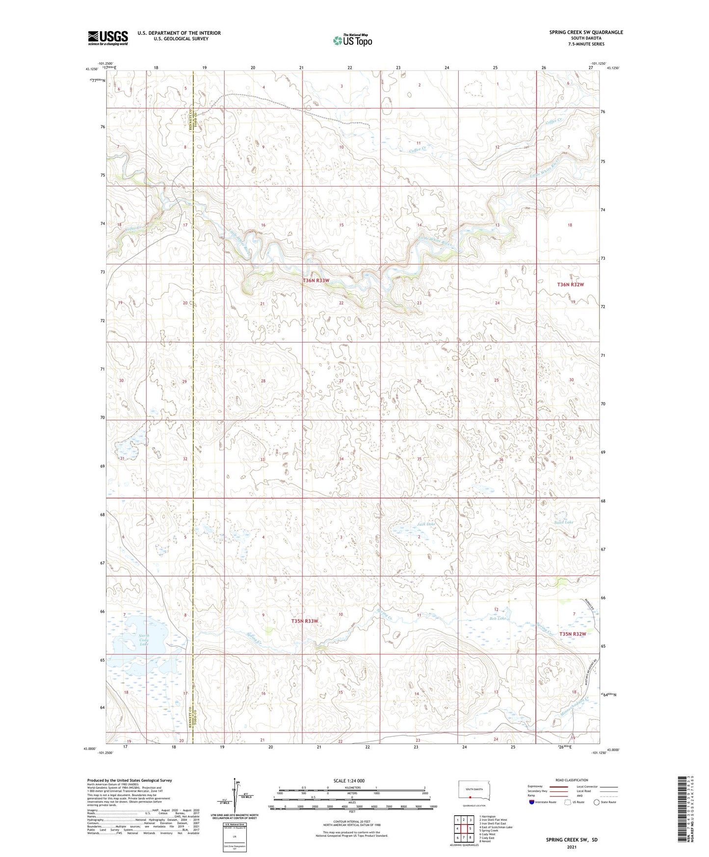
2021 topographic map quadrangle Spring Creek SW in the state of South Dakota. Scale: 1:24000. Based on the newly updated USGS 7.5' US Topo map series, this map is in the following counties: Todd, Bennett. The map contains contour data, water features, and other items you are used to seeing on USGS maps, but also has updated roads and other features. This is the next generation of topographic maps. Printed on high-quality waterproof paper with UV fade-resistant inks.
Quads adjacent to this one:
West: East of Scotchman Lake
Northwest: Harrington
North: Iron Shell Flat West
Northeast: Iron Shell Flat East
East: Spring Creek
Southeast: Nenzel
South: Cody East
Southwest: Cody West
This map covers the same area as the classic USGS quad with code o43101a2.
Contains the following named places: Barnes Ranch, Bob Lake, Cedar Creek, Jack Lake, North Cody Lake, Running Enemy Creek, Sand Lake