MyTopo
Springfield South Dakota US Topo Map
Couldn't load pickup availability
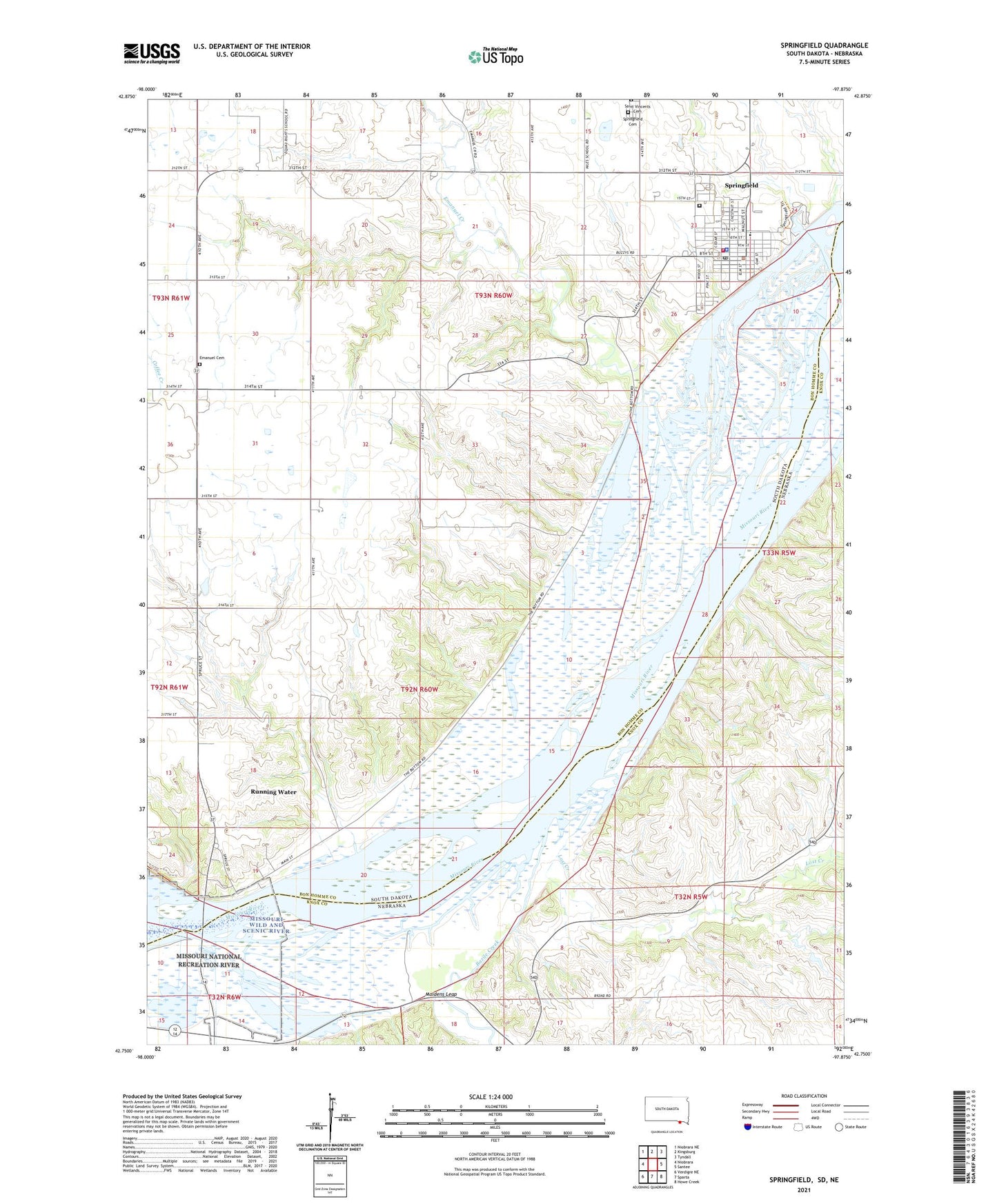
2021 topographic map quadrangle Springfield in the states of South Dakota, Nebraska. Scale: 1:24000. Based on the newly updated USGS 7.5' US Topo map series, this map is in the following counties: Bon Homme, Knox. The map contains contour data, water features, and other items you are used to seeing on USGS maps, but also has updated roads and other features. This is the next generation of topographic maps. Printed on high-quality waterproof paper with UV fade-resistant inks.
Quads adjacent to this one:
Northwest: Niobrara NE
North: Kingsburg
Northeast: Tyndall
East: Santee
Southeast: Howe Creek
South: Sparta
Southwest: Verdigre NE
Contains the following named places: Bazile Creek, Bazile Creek State Wildlife Management Area, Breckenridge Post Office, City of Springfield, Emanuel Cemetery, Emanuel Creek, Emanuel Creek Recreation Area, Evelyn Lang Public Library, KSTI-FM (Springfield), Lost Creek, Maidens Leap, Mike Durfee State Prison, Running Water, Running Water Census Designated Place, Saint Vincents Cemetery, School Number 37, School Number 38, School Number 39, School Number 6, Springfield, Springfield Ambulance Service, Springfield Cemetery, Springfield City Hall, Springfield College Museum, Springfield Elementary School, Springfield Fire Department, Springfield Historical Society Museum, Springfield Police Department, Springfield Post Office, Springfield Recreation Area, Township of Running Water, Township of Springfield, University of South Dakota at Springfield, ZIP Code: 57062