MyTopo
Tyndall South Dakota US Topo Map
Couldn't load pickup availability
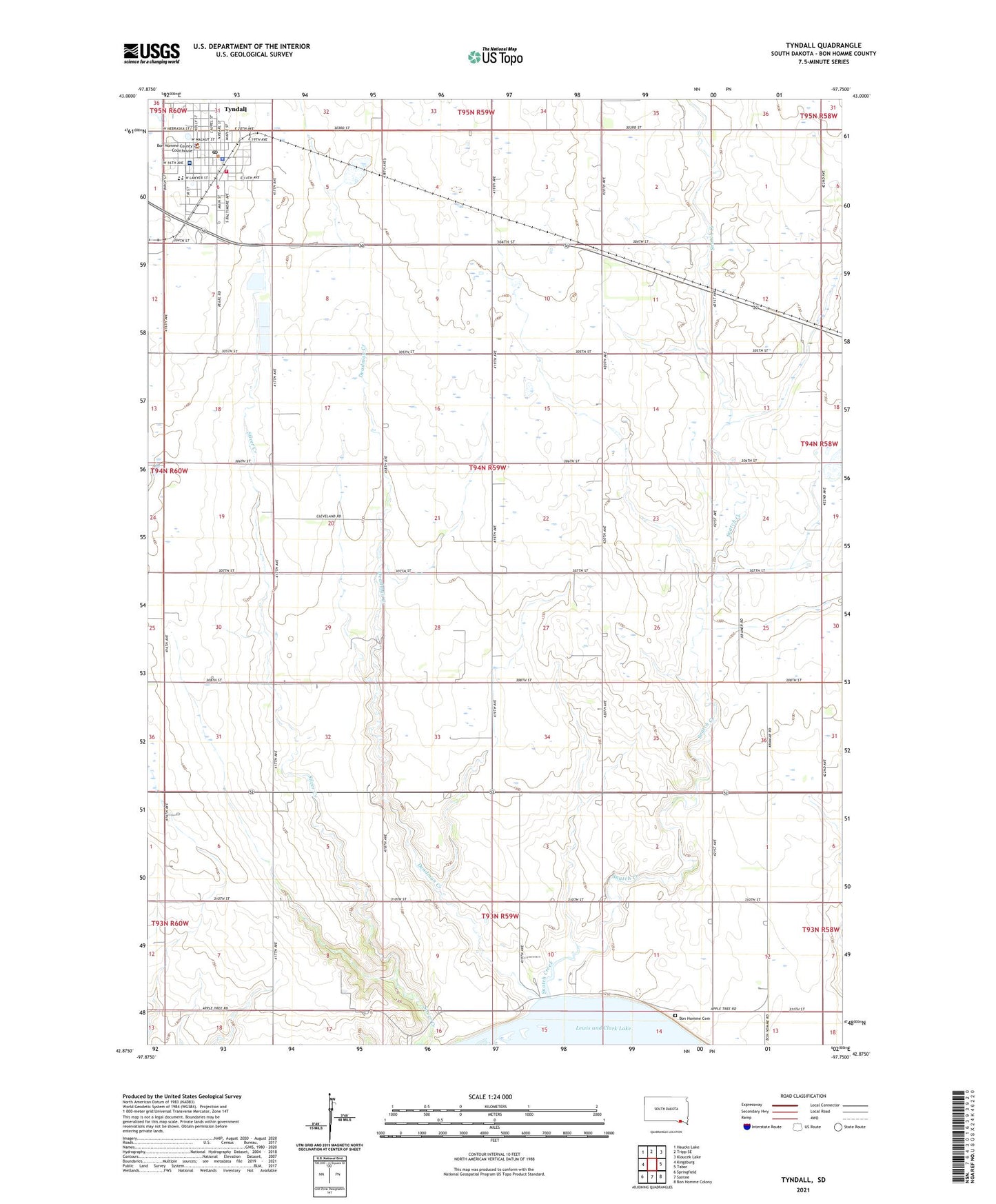
2021 topographic map quadrangle Tyndall in the state of South Dakota. Scale: 1:24000. Based on the newly updated USGS 7.5' US Topo map series, this map is in the following counties: Bon Homme. The map contains contour data, water features, and other items you are used to seeing on USGS maps, but also has updated roads and other features. This is the next generation of topographic maps. Printed on high-quality waterproof paper with UV fade-resistant inks.
Quads adjacent to this one:
West: Kingsburg
Northwest: Haucks Lake
North: Tripp SE
Northeast: Kloucek Lake
East: Tabor
Southeast: Bon Homme Colony
South: Santee
Southwest: Springfield
This map covers the same area as the classic USGS quad with code o42097h7.
Contains the following named places: Bon Homme Cemetery, Bon Homme Church, Bon Homme County Courthouse, Bon Homme County Jail, Bon Homme County Sheriff's Office, Bon Homme High School, Bon Homme Middle School, City of Tyndall, Cottonwood School, Deadman Creek, Saint Michaels Hospital, School Number 2, School Number 23, School Number 28, School Number 30, School Number 35, School Number 36, School Number 60, School Number 8, Snatch Creek, Snatch Creek Recreation Area, Township of Bon Homme, Township of Cleveland, Tyndall, Tyndall Ambulance Service, Tyndall City Hall, Tyndall Elementary School, Tyndall Fire Department, Tyndall Police Department, Tyndall Post Office, Tyndall Public Library, ZIP Code: 57066