MyTopo
Niobrara NE South Dakota US Topo Map
Couldn't load pickup availability
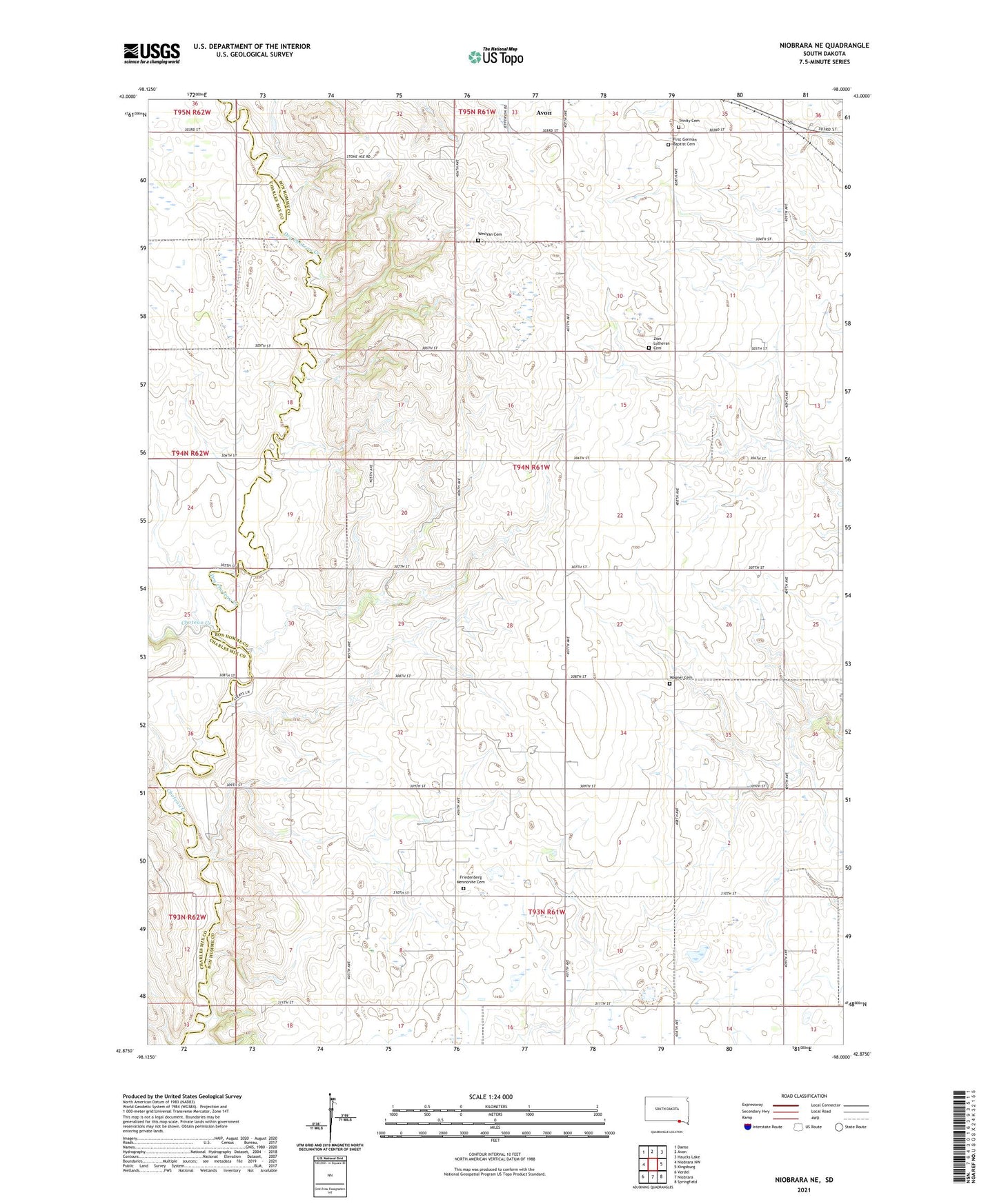
2021 topographic map quadrangle Niobrara NE in the state of South Dakota. Scale: 1:24000. Based on the newly updated USGS 7.5' US Topo map series, this map is in the following counties: Bon Homme, Charles Mix. The map contains contour data, water features, and other items you are used to seeing on USGS maps, but also has updated roads and other features. This is the next generation of topographic maps. Printed on high-quality waterproof paper with UV fade-resistant inks.
Quads adjacent to this one:
West: Niobrara NW
Northwest: Dante
North: Avon
Northeast: Haucks Lake
East: Kingsburg
Southeast: Springfield
Southwest: Verdel
This map covers the same area as the classic USGS quad with code o42098h1.
Contains the following named places: Andrus Post Office, Drake School, Dry Choteau Creek, First German Baptist Cemetery, Friedenberg Mennonite Cemetery, German Presbyterian Church, Lorettta Post Office, Mennonite Church, Mennonite School, Methodist Episcopal Church, School Number 40, School Number 42, School Number 52, School Number 53, School Number 54, Township of Hancock, Township of Jefferson, Trinity Cemetery, Trumbo School, Wagner Cemetery, Weslyan Cemetery, Zion Lutheran Cemetery, ZIP Code: 57315