
MyTopo
Stamford SE South Dakota US Topo Map
Couldn't load pickup availability
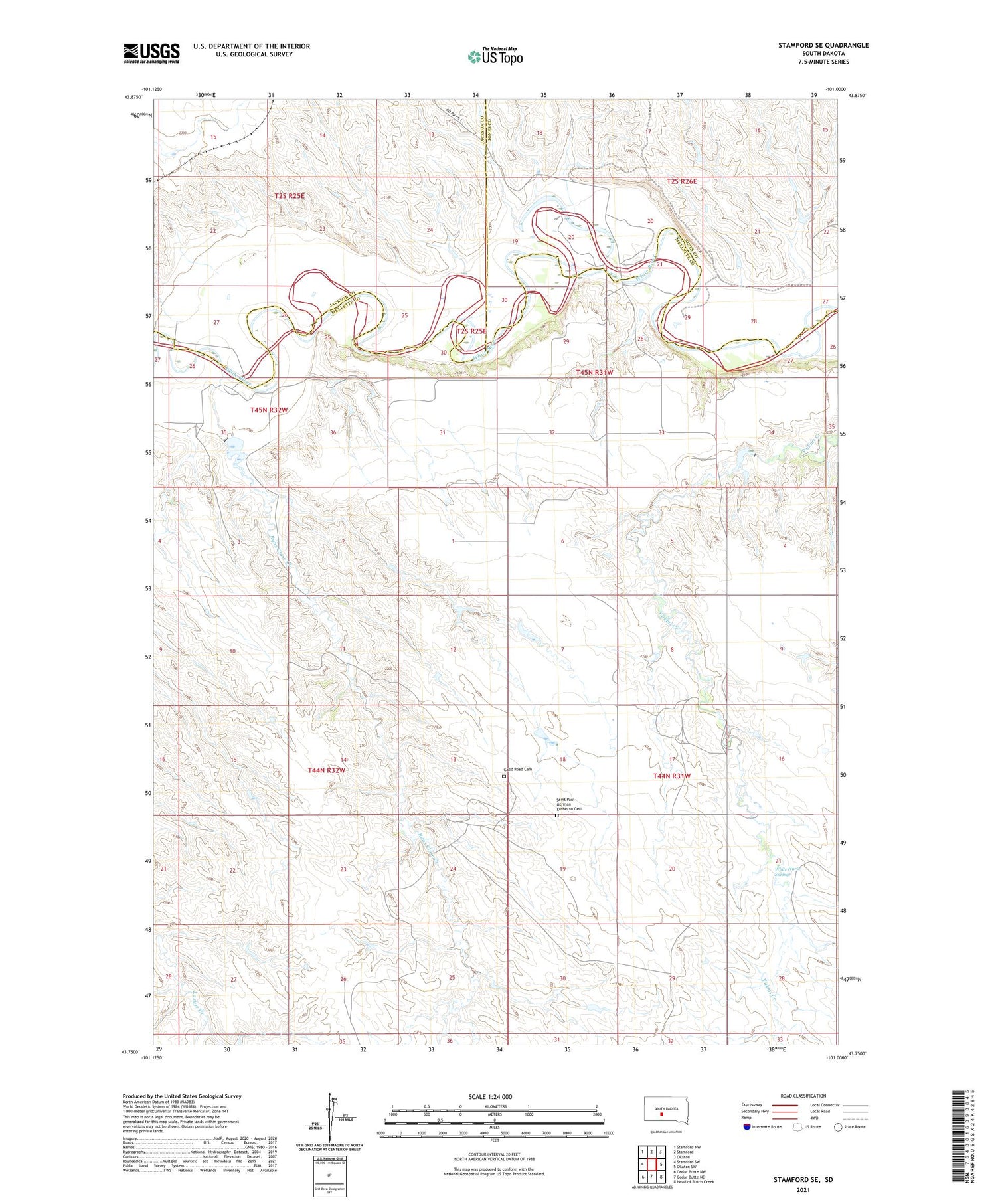
2021 topographic map quadrangle Stamford SE in the state of South Dakota. Scale: 1:24000. Based on the newly updated USGS 7.5' US Topo map series, this map is in the following counties: Mellette, Jackson, Jones. The map contains contour data, water features, and other items you are used to seeing on USGS maps, but also has updated roads and other features. This is the next generation of topographic maps. Printed on high-quality waterproof paper with UV fade-resistant inks.
Quads adjacent to this one:
West: Stamford SW
Northwest: Stamford NW
North: Stamford
Northeast: Okaton
East: Okaton SW
Southeast: Head of Butch Creek
South: Cedar Butte NE
Southwest: Cedar Butte NW
Contains the following named places: Bear Heels Ranch, Daum Brothers Number 1 Dam, Good Road Cemetery, Harmony School, Hathaway Ranch, Iwan Number 4 Dam, Iwan O M Number 1 Dam, Iwan O M Number 3 Dam, Iwan Ranch, Perault Number 1 Dam, Perault Number 4 Dam, Perault Number 5 Dam, Perault Number 6 Dam, Perault Number 7 Dam, Perault Ranch, Runs Close Creek, Saint Paul German Lutheran Cemetery, Schamber, Township of Red Fish, Vohr Ranch, White Horse Springs


