MyTopo
Okaton South Dakota US Topo Map
Couldn't load pickup availability
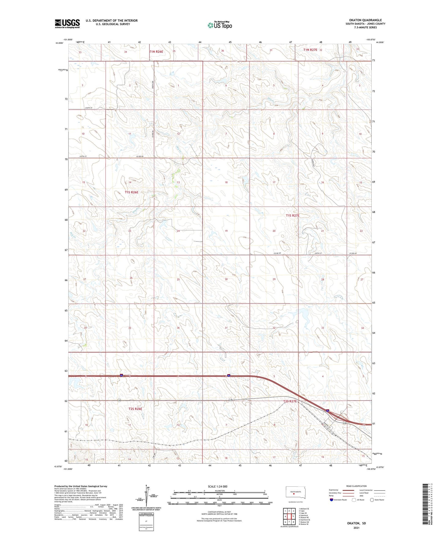
2021 topographic map quadrangle Okaton in the state of South Dakota. Scale: 1:24000. Based on the newly updated USGS 7.5' US Topo map series, this map is in the following counties: Jones. The map contains contour data, water features, and other items you are used to seeing on USGS maps, but also has updated roads and other features. This is the next generation of topographic maps. Printed on high-quality waterproof paper with UV fade-resistant inks.
Quads adjacent to this one:
West: Stamford
Northwest: Midland SE
North: Capa
Northeast: Capa SE
East: Okaton NE
Southeast: Okaton SE
South: Okaton SW
Southwest: Stamford SE
This map covers the same area as the classic USGS quad with code o43100h8.
Contains the following named places: Arp Number 1 Dam, Bork Number 2 Dam, Esmay and Sandy Number 2 Dam, Gothiermink Number 2 Dam, Highland, Hurst Number 1 Dam, Hurst Number 2 Dam, Hurst Number 3 Dam, Lyman Number 1 Dam, Lyman Number 2 Dam, Okaton, Okaton Post Office, Peters Number 1 Dam, Roghair Number 1 Dam, Sandy Number 2 Dam, Township of Morgan, Township of Scovil, ZIP Code: 57562