MyTopo
Freeman SE South Dakota US Topo Map
Couldn't load pickup availability
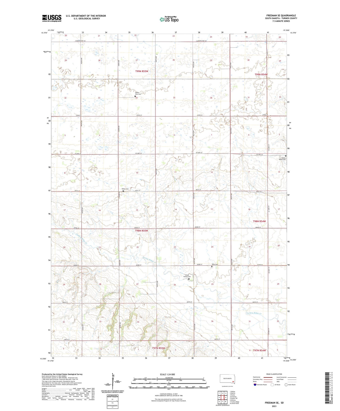
2021 topographic map quadrangle Freeman SE in the state of South Dakota. Scale: 1:24000. Based on the newly updated USGS 7.5' US Topo map series, this map is in the following counties: Turner. The map contains contour data, water features, and other items you are used to seeing on USGS maps, but also has updated roads and other features. This is the next generation of topographic maps. Printed on high-quality waterproof paper with UV fade-resistant inks.
Quads adjacent to this one:
West: Freeman
Northwest: Dolton
North: Marion
Northeast: Parker
East: Parker SW
Southeast: Center Point
South: Turkey Ridge
Southwest: Midway
This map covers the same area as the classic USGS quad with code o43097c3.
Contains the following named places: Childstown, Fairview School, German Evangelist Church, Hillside School, North Star School, Salem Cemetery, Salem Church, Salem Zion Cemetery, Salem Zion Church, Schlosser School, Spring Valley Post Office, Township of Childstown, Turkey Valley Cemetery, Unruh Family Cemetery, West Cemetery