MyTopo
Vale South Dakota US Topo Map
Couldn't load pickup availability
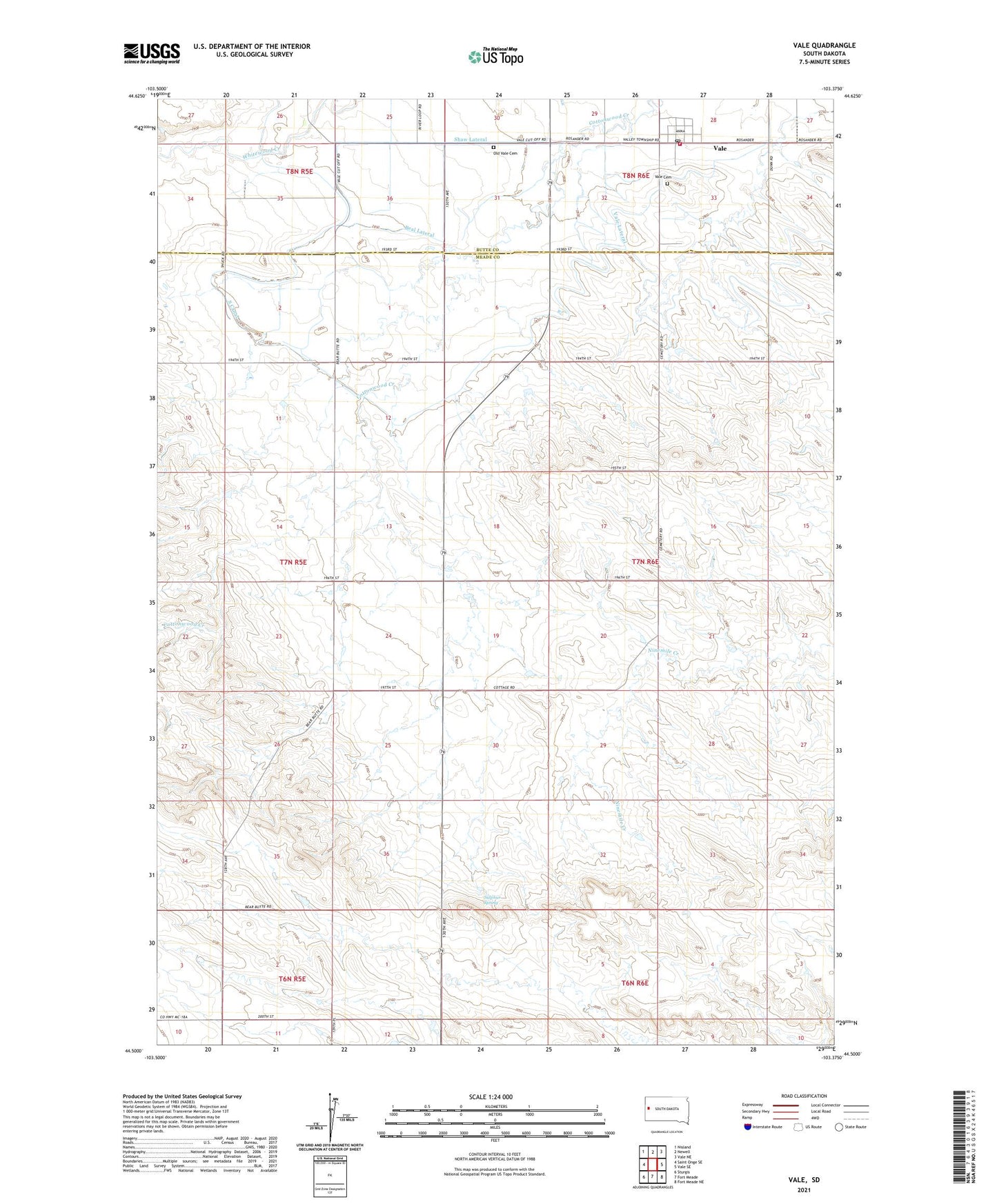
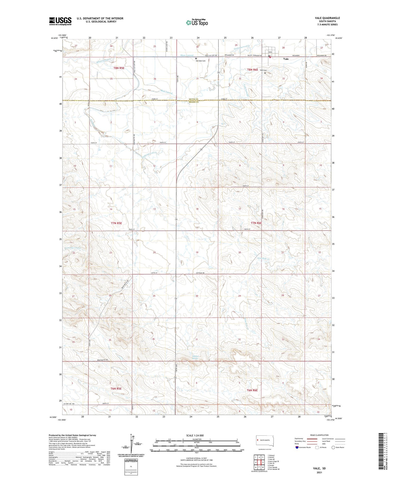
2021 topographic map quadrangle Vale in the state of South Dakota. Scale: 1:24000. Based on the newly updated USGS 7.5' US Topo map series, this map is in the following counties: Meade, Butte. The map contains contour data, water features, and other items you are used to seeing on USGS maps, but also has updated roads and other features. This is the next generation of topographic maps. Printed on high-quality waterproof paper with UV fade-resistant inks.
Quads adjacent to this one:
West: Saint Onge SE
Northwest: Nisland
North: Newell
Northeast: Vale NE
East: Vale SE
Southeast: Fort Meade NE
South: Fort Meade
Southwest: Sturgis
Contains the following named places: Beal Lateral, Cottonwood School, Farview School, Old Vale Cemetery, Riggs School, Shaw Lateral, Sulphur Spring, Township of Highland, Township of Vale, Vale, Vale Cemetery, Vale Census Designated Place, Vale Lateral, Vale Post Office, Vale Volunteer Fire Department, Wagner Historical Monument