MyTopo
White River SE South Dakota US Topo Map
Couldn't load pickup availability
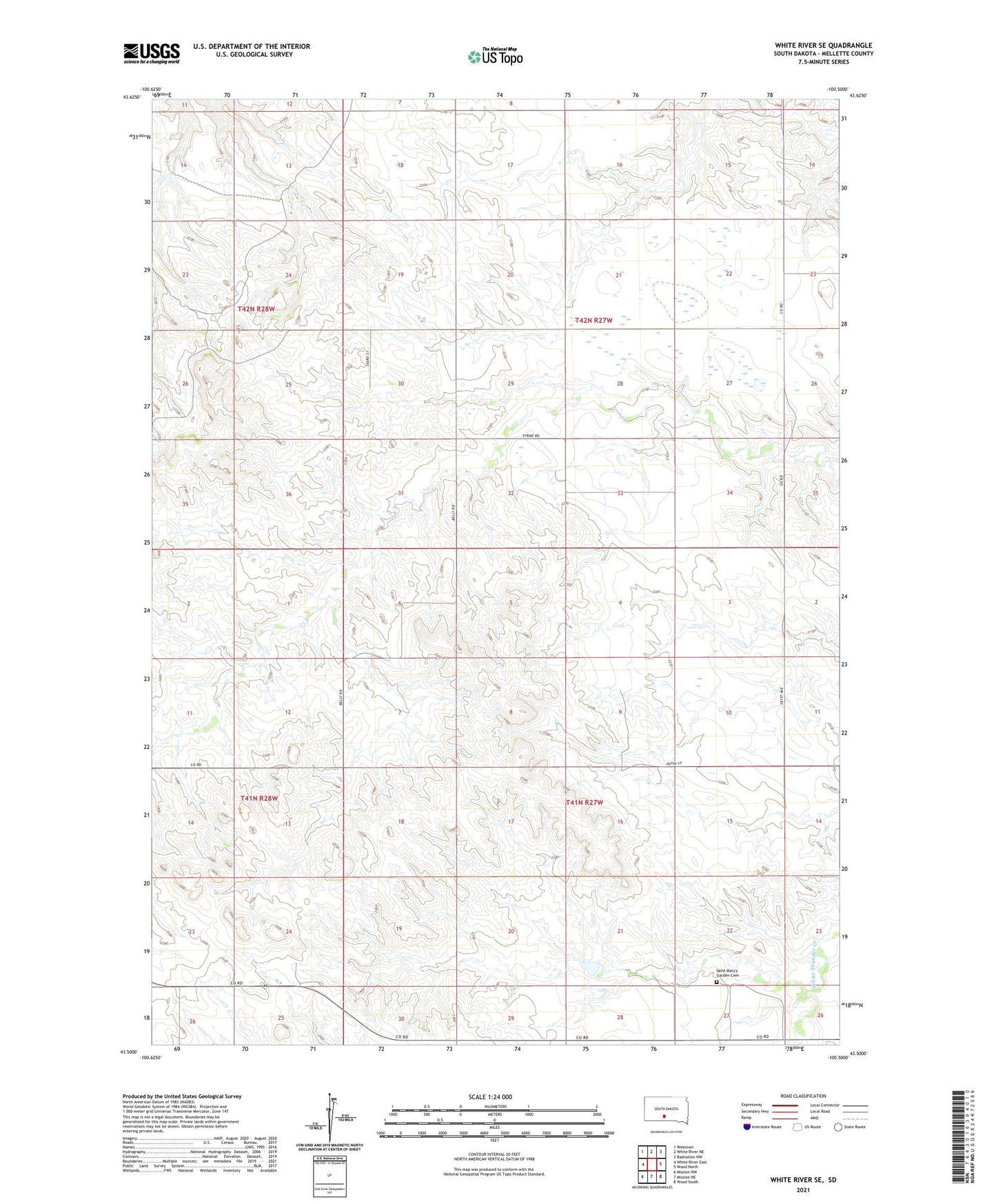
2021 topographic map quadrangle White River SE in the state of South Dakota. Scale: 1:24000. Based on the newly updated USGS 7.5' US Topo map series, this map is in the following counties: Mellette. The map contains contour data, water features, and other items you are used to seeing on USGS maps, but also has updated roads and other features. This is the next generation of topographic maps. Printed on high-quality waterproof paper with UV fade-resistant inks.
Quads adjacent to this one:
West: White River East
Northwest: Westover
North: White River NE
Northeast: Badnation NW
East: Wood North
Southeast: Wood South
South: Mission NE
Southwest: Mission NW
Contains the following named places: Bruning Number 1 Dam, Bruning Ranch, Chief Sitting Bulls Grave Monument, Derry Ranch, Egleston Ranch, Endes Ranch, Frank Krogman Ranch, Iverson Ranch, Jans 1 Dam, Kingsbury Ranch, Reutter Ranch, Roy Valburg Ranch, Ryno Number 1 Dam, Saint Mary's Garden Cemetery, Wheeler Ranch, William Krogman Ranch