MyTopo
Witten South Dakota US Topo Map
Couldn't load pickup availability
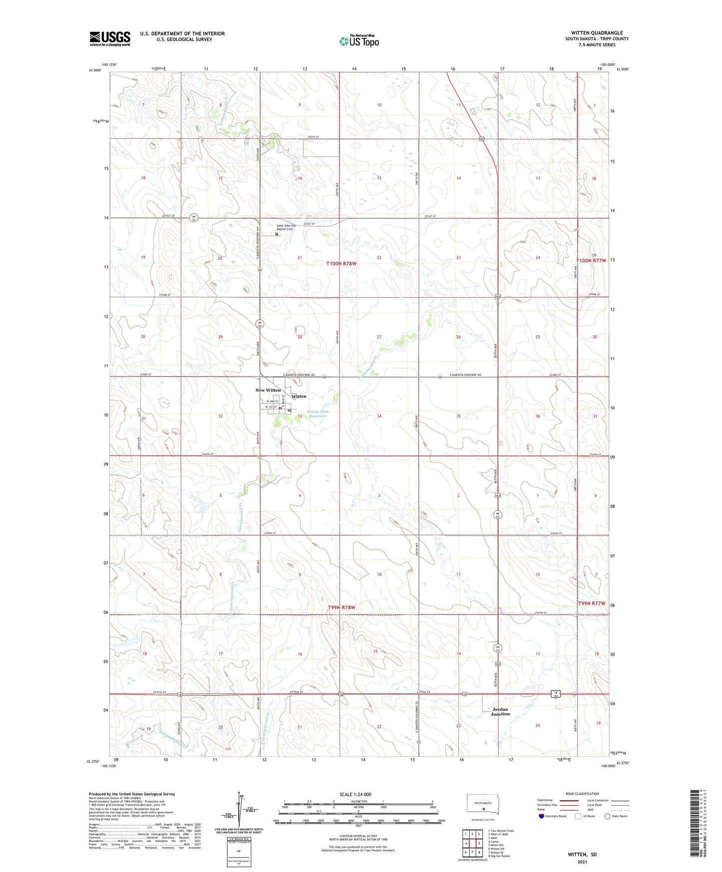
2021 topographic map quadrangle Witten in the state of South Dakota. Scale: 1:24000. Based on the newly updated USGS 7.5' US Topo map series, this map is in the following counties: Tripp. The map contains contour data, water features, and other items you are used to seeing on USGS maps, but also has updated roads and other features. This is the next generation of topographic maps. Printed on high-quality waterproof paper with UV fade-resistant inks.
Quads adjacent to this one:
West: Carter
Northwest: Two Nation Creek
North: West of Ideal
Northeast: Ideal
East: Miller Hill
Southeast: Dog Ear Buttes
South: Witten SE
Southwest: Witten SW
This map covers the same area as the classic USGS quad with code o43100d1.
Contains the following named places: Department of Game Fish Parks Dam, East Cottonwood Creek, Jordan Junction, Saint John the Baptist Cemetery, Town of New Witten, Township of Jordan, Township of Witten, West Cottonwood Creek, Witten, Witten Dam Reservoir, Witten Elementary School, Witten Fire Department, Witten Post Office