MyTopo
Ideal South Dakota US Topo Map
Couldn't load pickup availability
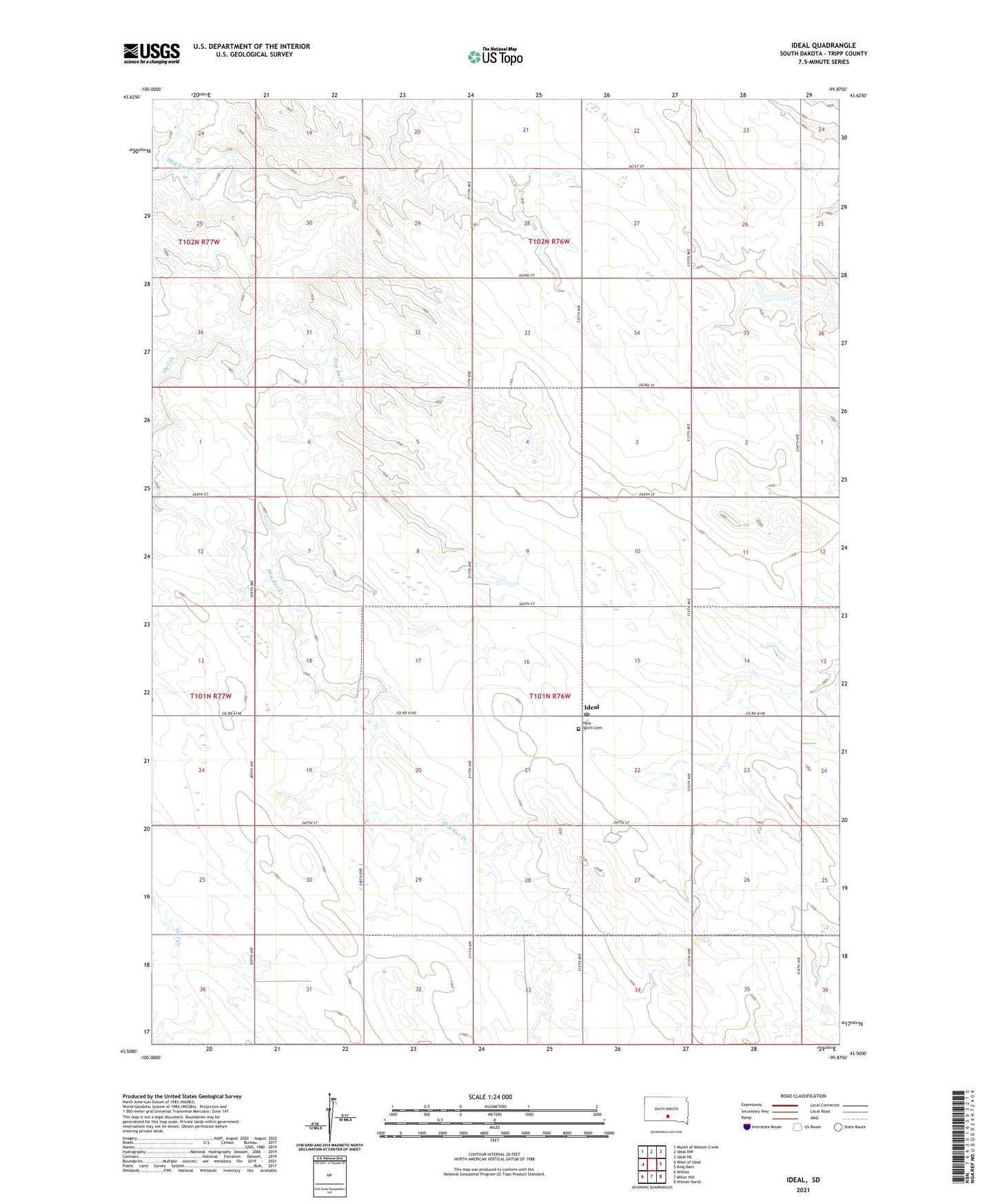
2021 topographic map quadrangle Ideal in the state of South Dakota. Scale: 1:24000. Based on the newly updated USGS 7.5' US Topo map series, this map is in the following counties: Tripp. The map contains contour data, water features, and other items you are used to seeing on USGS maps, but also has updated roads and other features. This is the next generation of topographic maps. Printed on high-quality waterproof paper with UV fade-resistant inks.
Quads adjacent to this one:
West: West of Ideal
Northwest: Mouth of Mission Creek
North: Ideal NW
Northeast: Ideal NE
East: King Dam
Southeast: Winner North
South: Miller Hill
Southwest: Witten
This map covers the same area as the classic USGS quad with code o43099e8.
Contains the following named places: Charles Heller Dam, Heller Landing Strip, Holy Spirit Cemetery, Ideal, Ideal Census Designated Place, Ideal Post Office, Owl Creek, Star Valley School, Township of Ideal, ZIP Code: 57541