MyTopo
Ashland City Tennessee US Topo Map
Couldn't load pickup availability
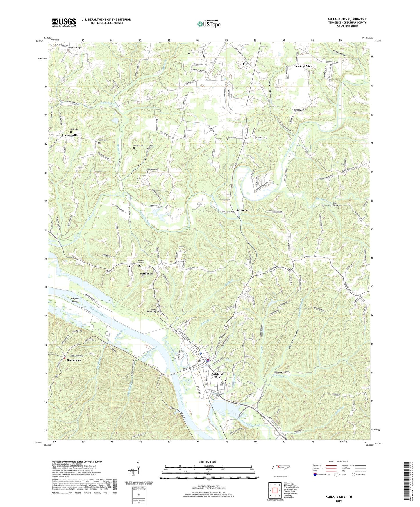
2019 topographic map quadrangle Ashland City in the state of Tennessee. Scale: 1:24000. Based on the newly updated USGS 7.5' US Topo map series, this map is in the following counties: Cheatham. The map contains contour data, water features, and other items you are used to seeing on USGS maps, but also has updated roads and other features. This is the next generation of topographic maps. Printed on high-quality waterproof paper with UV fade-resistant inks.
Quads adjacent to this one:
West: Cheatham Dam
Northwest: Henrietta
North: Pleasant View
Northeast: Springfield South
East: Forest Grove
Southeast: Scottsboro
South: Lillamay
Southwest: Harpeth Valley
Contains the following named places: Ashland City, Ashland City Division, Ashland City Dock, Ashland City Elementary School, Ashland City Fire Department Station 1, Ashland City First Baptist Church, Ashland City Police Department, Ashland City Post Office, Bearwallow Church, Bethlehem, Bethlehem Cemetery, Bethlehem Church, Big Bluff Creek, Big Bluff Creek Access Area, Binkley Cemetery, Blue Spring Cemetery, Blue Spring Creek, Boston Hollow, Boston Hollow Branch, Brinkley Branch, Central High School, Cheatham County, Cheatham County Courthouse, Cheatham County Emergency Management, Cheatham County Sheriff's Office, Cobb Hollow Creek, Cochran Community Center, Commissioner District 1, Crockets Landing, Dodge Landing, Dry Fork Creek, Felts Cemetery, Flax Patch Dam, Forest Hill Cemetery, Greenbrier, Greenbrier School, Happy Hollow, Harpeth Island, Harris Cemetery, Hudgens Cemetery, Hunt Cemetery, Lenox Branch, Little Bluff Creek, Lockertsville, Lockertsville Church, Marks Creek, Miles Landing, Pleasant View Division, Poplar Ridge, Slick Hollow, Spring Creek, Sugar Fork Creek, Sweet Home Community Center, Sycamore, Sycamore Chapel, Sycamore Middle School, Sycamore Powder Mill Landing, Teasley Cemetery, Teasley Hollow, Town of Ashland City, Triangle Community Center, TriStar Ashland City Medical Center, Turner - Pardue Cemetery, Two Rivers Volunteer Fire Department Station 1, Vick Branch, WAJN-AM (Ashland City), Walker Cemetery, West Cheatham Elementary School, Whisky Hill, Will Smith Cemetery, ZIP Code: 37015