MyTopo
Lillamay Tennessee US Topo Map
Couldn't load pickup availability
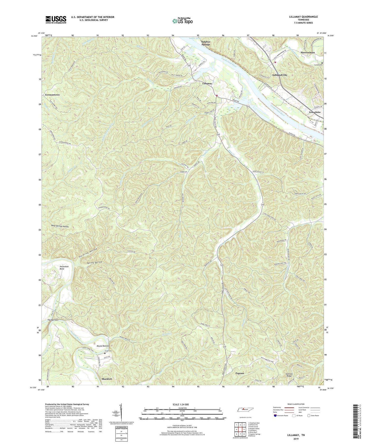
2022 topographic map quadrangle Lillamay in the state of Tennessee. Scale: 1:24000. Based on the newly updated USGS 7.5' US Topo map series, this map is in the following counties: Cheatham, Davidson. The map contains contour data, water features, and other items you are used to seeing on USGS maps, but also has updated roads and other features. This is the next generation of topographic maps. Printed on high-quality waterproof paper with UV fade-resistant inks.
Quads adjacent to this one:
West: Harpeth Valley
Northwest: Cheatham Dam
North: Ashland City
Northeast: Forest Grove
East: Scottsboro
Southeast: Bellevue
South: Kingston Springs
Southwest: White Bluff
This map covers the same area as the classic USGS quad with code o36087b1.
Contains the following named places: Ashland City Fire Department Station 2, Barton Landing, Blue Creek, Brush Creek, Brush Creek Access Area, Carney Cemetery, Cedar Hill School, Cheatham County Landfill, Cheatham County Poor House, Cheatham State Wildlife Management Area, Commissioner District 5, Dry Creek, Gardling Hollow, Gravelotte, Hoopers Landing, Horseshoe Bend, Knights Ferry, Lillamay, Lillamay School, Little Dry Creek, Little Marrowbone Creek, Marrowbone, Marrowbone Creek, Marrowbone School, Middle Fork Brush Creek, Mound Bottom, Mound Creek, Patterson Forge, Possumtrot Branch, Sams Creek, Sams Creek Church, Sams Creek School, Sandy Run, Scott Cemetery, Shearons Landing, Spring Hollow, Stillhouse Branch, Stumps Landing, Sulphur Spring, Sulphur Springs, Sulphur Springs Landing, The Narrows, Two Rivers Volunteer Fire Department Station 2, ZIP Code: 37143