MyTopo
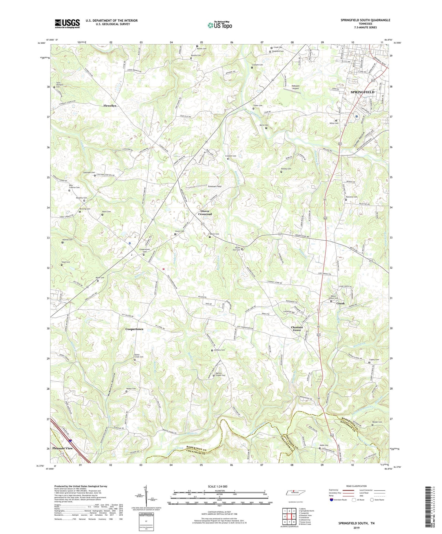
Springfield South Tennessee US Topo Map
Couldn't load pickup availability
2022 topographic map quadrangle Springfield South in the state of Tennessee. Scale: 1:24000. Based on the newly updated USGS 7.5' US Topo map series, this map is in the following counties: Robertson, Davidson, Cheatham. The map contains contour data, water features, and other items you are used to seeing on USGS maps, but also has updated roads and other features. This is the next generation of topographic maps. Printed on high-quality waterproof paper with UV fade-resistant inks.
Quads adjacent to this one:
West: Pleasant View
Northwest: Adams
North: Springfield North
Northeast: Youngville
East: Greenbrier
Southeast: Whites Creek
South: Forest Grove
Southwest: Ashland City
This map covers the same area as the classic USGS quad with code o36086d8.
Contains the following named places: Addie, Andersons Mill, Anthony Cemetery, Battle Creek, Battle Creek Cemetery, Battle Creek Church, Bednigo Branch, Billy Cothron Cemetery, Binkley Cemetery, Black Cemetery, Bransford High School, Browing Cemetery, Browns Fork, Brush Fork, Brushy Creek, Chestnut Grove, Chestnut Grove School, Chestnut Orchard, Commissioner District 10, Commissioner District 11, Commissioner District 12, Commissioner District 6, Cooperstown Cemetery, Cooperstown Church of Christ, Coopertown, Coopertown Elementary School, Coopertown Police Department, Coopertown School, Copley Cemetery, Crockett Cemetery, Crunk, Crunk Cemetery, Dry Fork, Fisher Cemetery, Flewellyn, Flewellyn Baptist Church, Foreman Field, Frierson Chapel, Glover Crossroad, Grace Baptist Church, Grange School, Greater South Baptist Church, Green Cemetery, Head Cemetery, Holmes Cemetery, Lipscomb Cemetery, Long Creek, Martin Cemetery, Martins Chapel, Martins Chapel Cemetery, McMahon Hollow, Miller Cemetery, Morris Cemetery, Mount Sharon Cemetery, Mount Sharon Cumberland Presbyterian Church, Mount Zion Cemetery, Mount Zion Church, Murphey Cemetery, Murphy Cemetery, New Chapel, New Chapel Church, New Chapel School, Nobuzzn Airport, Norris Mill, North Fork Sycamore Creek, Northcrest Medical Center, Palestine Cemetery, Palestine Church, Pleasant View Volunteer Fire Department Station 5, Poorhouse Branch, Powell Cemetery, Redding Branch, Reeder Cemetery, Reeves Branch, Robertson County Farm, Robertson County Landfill, Saint Michaels Cemetery, Saint Michaels Church, Sharon Church, Shepherd Cemetery, Sleepy Hollow, South Fork Sycamore Creek, Springfield Country Club, Springfield Special School, Town of Coopertown, Valley Grove School, Venters Branch, Walker Cemetery, WDBL-AM (Springfield), WDBL-FM (Springfield), Webb Cemetery, White Cemetery, Woodland Street School