MyTopo
Lee Valley Tennessee US Topo Map
Couldn't load pickup availability
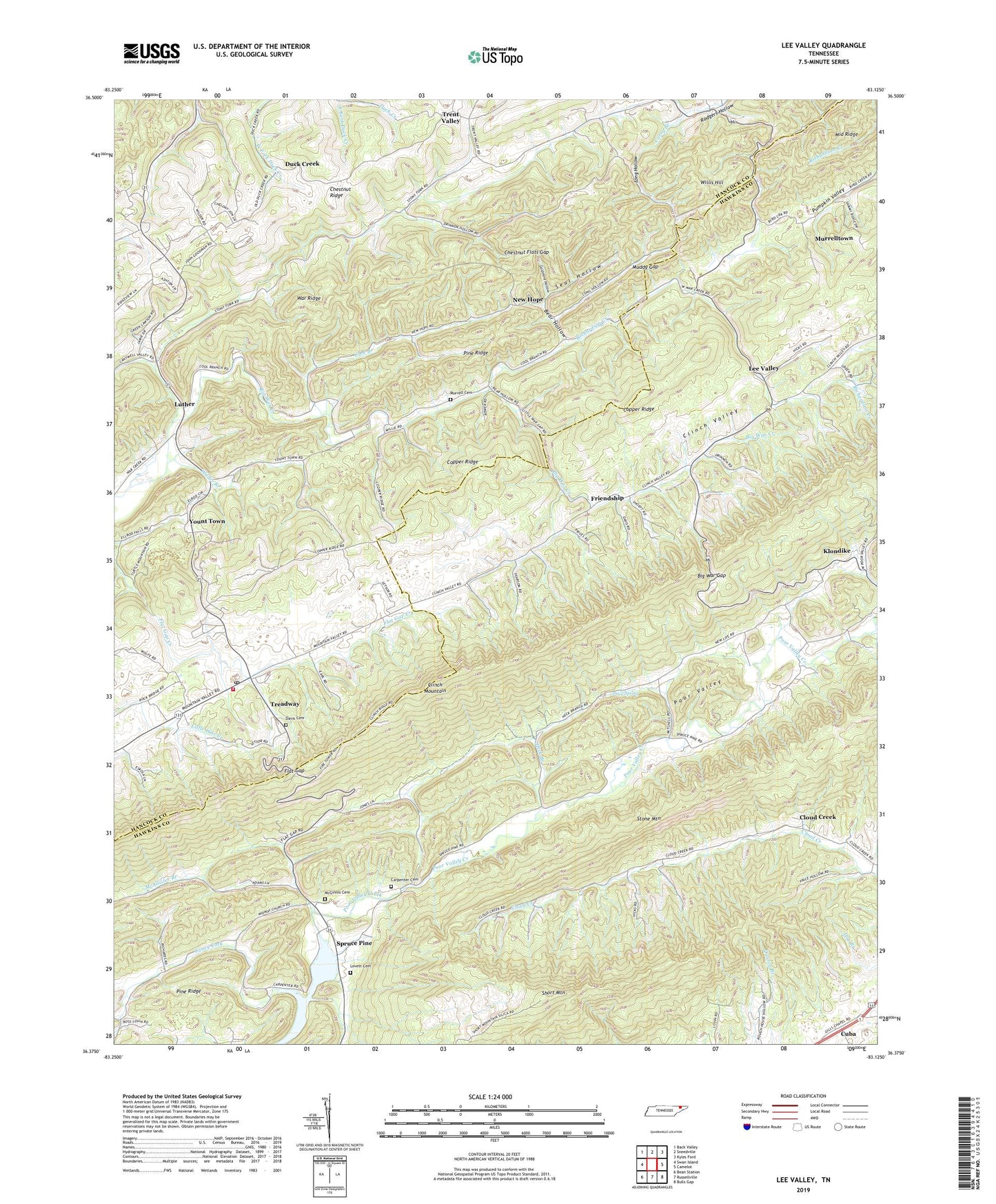
2022 topographic map quadrangle Lee Valley in the state of Tennessee. Scale: 1:24000. Based on the newly updated USGS 7.5' US Topo map series, this map is in the following counties: Hawkins, Hancock. The map contains contour data, water features, and other items you are used to seeing on USGS maps, but also has updated roads and other features. This is the next generation of topographic maps. Printed on high-quality waterproof paper with UV fade-resistant inks.
Quads adjacent to this one:
West: Swan Island
Northwest: Back Valley
North: Sneedville
Northeast: Kyles Ford
East: Camelot
Southeast: Bulls Gap
South: Russellville
Southwest: Bean Station
This map covers the same area as the classic USGS quad with code o36083d2.
Contains the following named places: Bear Hollow, Big War Creek Division, Big War Gap, Bond School, Caney Fork, Carpenter Cemetery, Chestnut Flats Gap, Chestnut Ridge, Clinch Mountain, Cloud Creek, Clouds Creek School, Commissioner District 2, Cool Branch, Cool Branch School, Cuba, Davis Cemetery, Duck Creek, Duck Creek Baptist Church, Duck Creek School, Fairmont School, Flat Gap, Flat Gap Elementary School, Friendship, Friendship School, Gills Chapel, Goldmine Hollow, Green Lawson School, Heck Branch, Klondike, Lee Valley, Lee Valley School, Long Hollow, Lovett Cemetery, Luther, McAllister Branch, McGinnis Cemetery, Middle Ridge, Midway Church, Muddy Gap, Murrell Cemetery, Murrelltown, New Hope, New Life Church, New Life School, Pine Ridge, Pleasant Hill Church, Price Quarry, Price Spring, Richardson Creek, Seal Hollow, Short Mountain, Spruce Pine, Spruce Pine Church, Spruce Pine School, Stony Fork, Treadway, Treadway Post Office, Treadway Volunteer Fire Department, Trent Valley, Trents Chapel School, War Creek Church, Wilder Branch, Willis Hill, WSJK-TV (Sneedville), Yount Town