MyTopo
Jearoldstown Tennessee US Topo Map
Couldn't load pickup availability
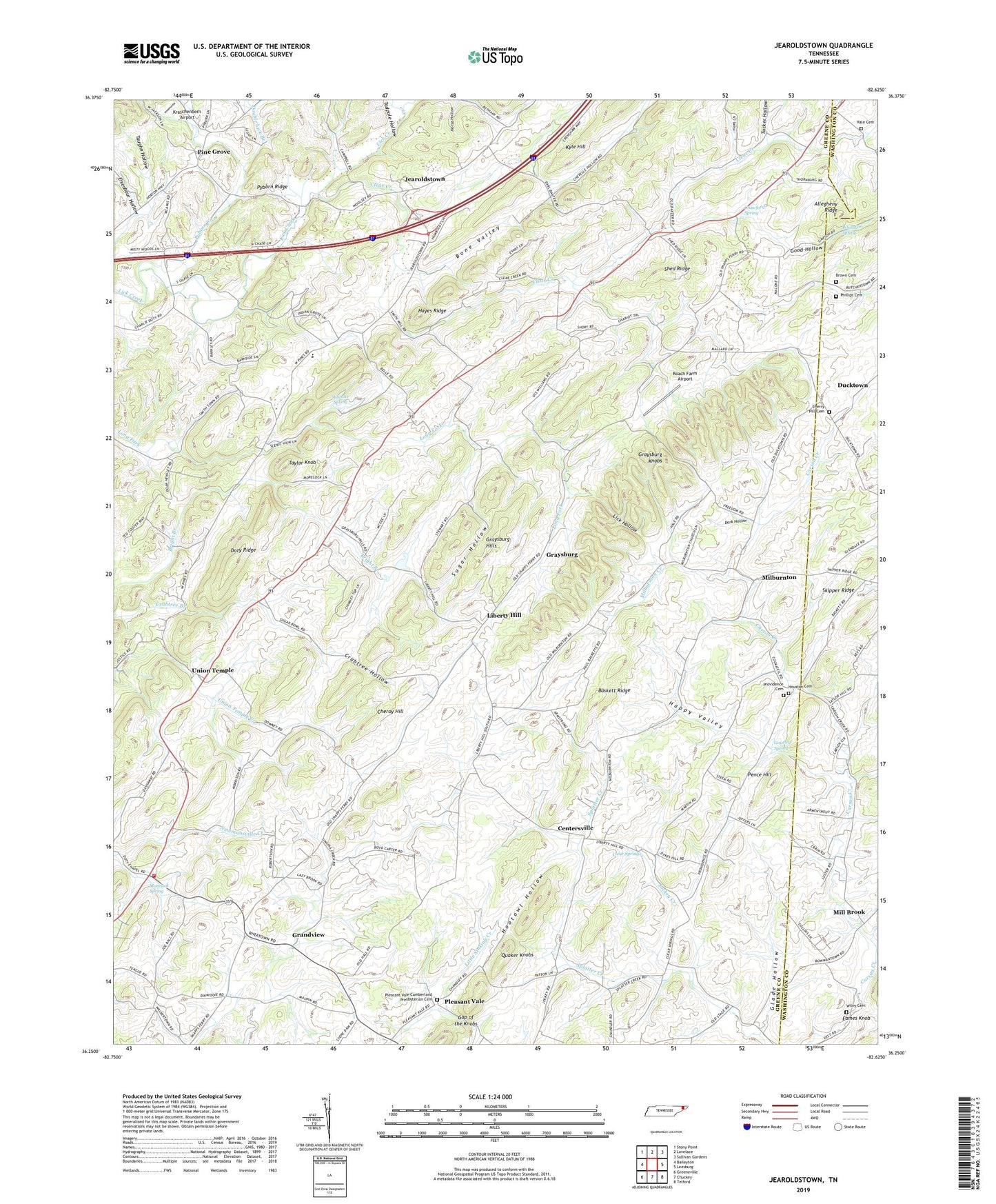
2022 topographic map quadrangle Jearoldstown in the state of Tennessee. Scale: 1:24000. Based on the newly updated USGS 7.5' US Topo map series, this map is in the following counties: Greene, Washington. The map contains contour data, water features, and other items you are used to seeing on USGS maps, but also has updated roads and other features. This is the next generation of topographic maps. Printed on high-quality waterproof paper with UV fade-resistant inks.
Quads adjacent to this one:
West: Baileyton
Northwest: Stony Point
North: Lovelace
Northeast: Sullivan Gardens
East: Leesburg
Southeast: Telford
South: Chuckey
Southwest: Greeneville
This map covers the same area as the classic USGS quad with code o36082c6.
Contains the following named places: Allegheny Ridge, Baskett Ridge, Bethesda Church, Bethesda School, Bone Valley, Brown Cemetery, Cedar Lane, Centersville, Cheroy Hill, Cherry Hill Cemetery, Cherry Hill Freewill Baptist Church, Clear Creek, Clear Creek Mill, Clear Springs, Crabtree Hollow, Crawford Spring, Dark Hollow, Dixon Chapel, Doty Ridge, Double Lick Branch, Ducktown, Eagle Mill, Eames Knob, Eisenhour Hollow, Gap of the Knobs, Glade Hollow, Good Hollow, Gourley Spring, Grandview, Graysburg, Graysburg Hills, Graysburg Knobs, Hale Cemetery, Happy Valley, Hayes Ridge, Hootowl Hollow, Houston Cemetery, Indian Grove School, Jearoldstown, Jearoldstown Division, Jearoldstown School, Jearoldstown United Methodist Church, Jockey, Kraschenbern Airport, Liberty Hill, Liberty Hill United Methodist Church, Lick Hollow, Maltsberger, Meadow View School, Milburnton, Milburnton Church, Milburnton Creek, Milburnton School, Mill Brook, Morelock Spring, Newmansville Elementary School, Newmansville Volunteer Fire Department, Oakdale Church, Pence Hill, Phillips Cemetery, Pine Grove, Pine Grove Church, Pleasant Hill Church, Pleasant Vale, Pleasant Vale Cumberland Presbyterian Cemetery, Pleasant Vale Cumberland Presbyterian Church, Providence Cemetery, Providence Church, Pyborn Creek, Pyborn Ridge, Roach Farm Airport, Shed Ridge, Skipper Ridge, Splatter Creek, Sugar Hollow, Swanay, Tadpole Hollow, Taughn Hollow, Taylor Knob, Tucker Hollow, Union Temple, Union Temple Church, Union Temple School, West Pines Elementary School, Wheeler Spring, Whitaker Spring, Wiley Cemetery