MyTopo
Lovelace Tennessee US Topo Map
Couldn't load pickup availability
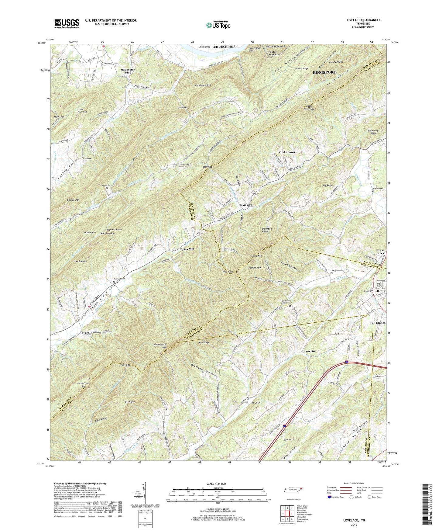
2022 topographic map quadrangle Lovelace in the state of Tennessee. Scale: 1:24000. Based on the newly updated USGS 7.5' US Topo map series, this map is in the following counties: Hawkins, Greene, Sullivan, Washington. The map contains contour data, water features, and other items you are used to seeing on USGS maps, but also has updated roads and other features. This is the next generation of topographic maps. Printed on high-quality waterproof paper with UV fade-resistant inks.
Quads adjacent to this one:
West: Stony Point
Northwest: Plum Grove
North: Church Hill
Northeast: Kingsport
East: Sullivan Gardens
Southeast: Leesburg
South: Jearoldstown
Southwest: Baileyton
This map covers the same area as the classic USGS quad with code o36082d6.
Contains the following named places: Back Hollow, Barrett Hollow, Bear Hollow, Beech Creek Church, Beech Grove Church, Bethany Church, Big Double Branch, Big Ridge, Blair Gap, Blair Gap Branch, Canebrake Mountain, Cedar Chapel, Chimneytop Mountain, Chimneytop School, Commissioner District 2, Conkintown, Crawford Hollow, Dark Hollow, Dixon Hollow, Dunkard Church, Dykes Mill, Fall Branch, Fall Branch Cemetery, Fall Branch United Methodist Church, Front Hollow, Goshen, Goshen Church, Goshen Mountain, Goshen Valley, Goshen Valley Volunteer Fire Department Station 1, Goshen Valley Volunteer Fire Department Station 2, Harbour, Hensley Hollow, Holiness Church, Horse Creek, Horse Hollow, Hunt Gap, Kate Hollow, Kiner Hollow, Kyle Hill, Laurel Run, Laurel Run Cliffs, Lickskillet Branch, Light Hollow, Light Mill, Limestone Branch, Little Horse Gap, Little Mountain, Little Pine Mountain, Lovelace, Lovelace Church, Lovelace School, Lynch Branch, McFerrin Church, McPheeter Bend, McPheeter Church, McPheeters Bend Elementary School, Morrison Cemetery, Mose Hollow, Mount Carmel Church, Mountain View School, Murrell Cemetery, Nathan Peak, Oak Glen School, Oak Glenn Cemetery, Oak Glenn Union Cemetery, Oak Glenn Union Church, Old Fall Branch-Hooper Cemetery, Onionbed Ridge, Pine Ridge, Pretty Ridge, Pyburn School, Simpsons School, Smith Gap, Smith Gap Creek, Solomons Temple Baptist Church, Solomons Temple School, Sugar Tree Hollow, Tennessee Highway Patrol District Five Headquarters, The Cliffs, The Doubles, Ugly Hollow, Upper Grassy Fork, Walker Fork Church, Wire Knob, Wolf Gap, Wolf Pen Gap, Yankee Cemetery, ZIP Code: 37656