MyTopo
Belfast Tennessee US Topo Map
Couldn't load pickup availability
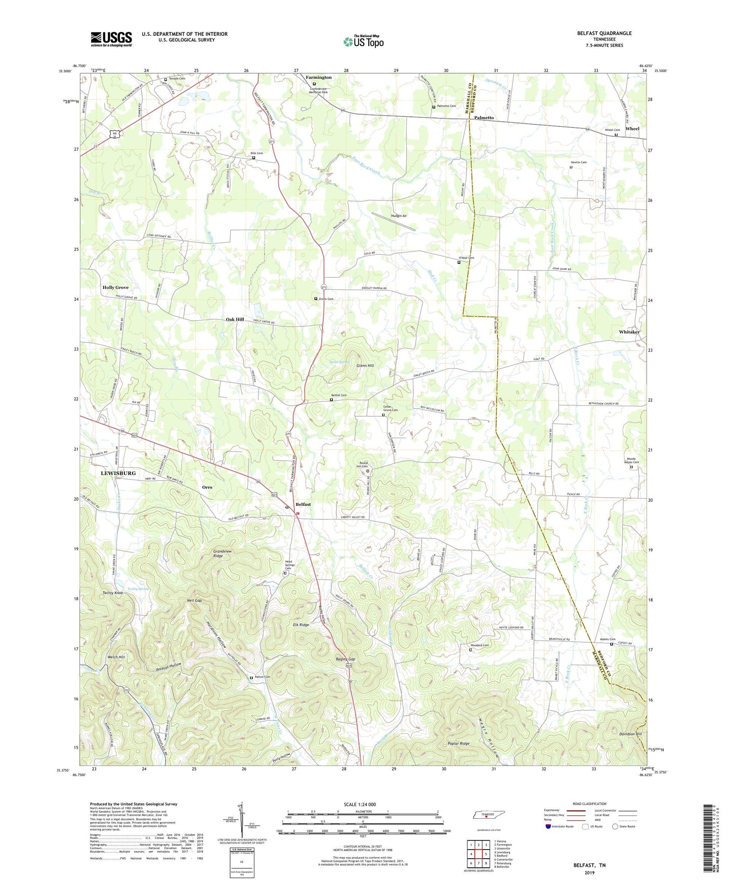
2022 topographic map quadrangle Belfast in the state of Tennessee. Scale: 1:24000. Based on the newly updated USGS 7.5' US Topo map series, this map is in the following counties: Marshall, Bedford. The map contains contour data, water features, and other items you are used to seeing on USGS maps, but also has updated roads and other features. This is the next generation of topographic maps. Printed on high-quality waterproof paper with UV fade-resistant inks.
Quads adjacent to this one:
West: Lewisburg
Northwest: Verona
North: Farmington
Northeast: Unionville
East: Bedford
Southeast: Belleville
South: Petersburg
Southwest: Cornersville
This map covers the same area as the classic USGS quad with code o35086d6.
Contains the following named places: Adams Cemetery, Bagley Gap, Bagley Hollow, Beech Hill Church, Belfast, Belfast Creek, Belfast Post Office, Belfast Rural Fire Department, Belfast School, Bethel Cemetery, Bills Cemetery, Blackwell Crossing, Cedar Grove Cemetery, Cedar Grove Church, Cedar Grove School, Commissioner District 3, Erwin Cemetery, Farmington Confederate Memorial Park, Farmington School, Glenn Hill, Grandview Ridge, Hardison Hollow, Head Springs Cemetery, Head Springs Church, Holly Grove, Holly Grove School, Hudgin Air, Ledford Branch, Leonard Church, Leonard School, Liberty Valley, Liberty Valley Church, Mud Creek, Negro Hollow, Neil Gap, Nowlin Cemetery, Oak Hill, O'Neal Cemetery, Orrs, Palmetto, Palmetto Cemetery, Patton Cemetery, Petty Hollow, Polecat Hollow, Poplar Ridge, Poplar Ridge School, Rocky Point Church, Round Hill Cemetery, Spout Spring, Temple Cemetery, Twitty Knob, Twitty Spring, Union School, Welch Hill, Wheel, Wheel Cemetery, Whitaker, Whitakers School, Woodard Cemetery, Woods-Mayes Cemetery, ZIP Code: 37019