MyTopo
Bedford Tennessee US Topo Map
Couldn't load pickup availability
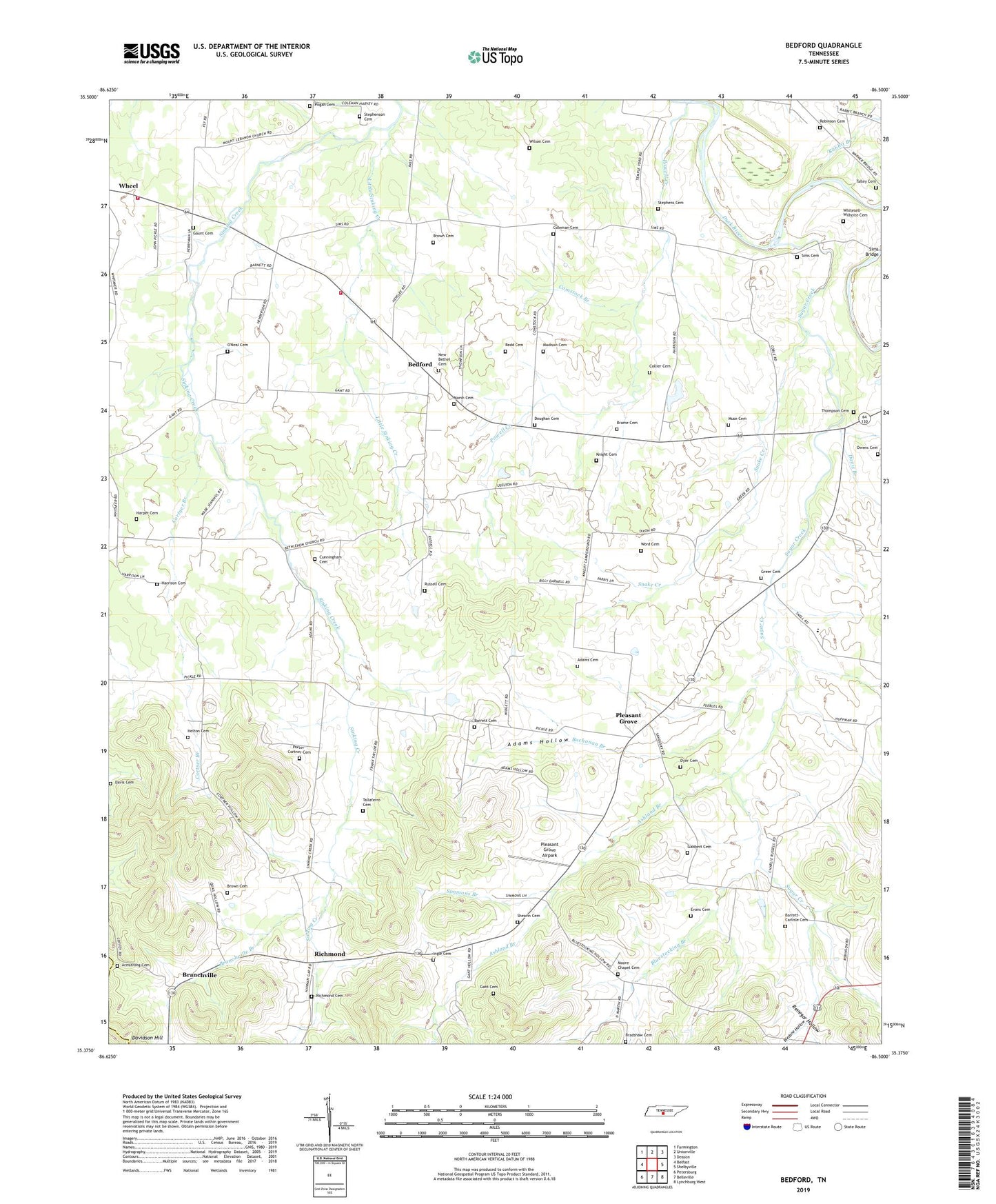
2022 topographic map quadrangle Bedford in the state of Tennessee. Scale: 1:24000. Based on the newly updated USGS 7.5' US Topo map series, this map is in the following counties: Bedford, Marshall. The map contains contour data, water features, and other items you are used to seeing on USGS maps, but also has updated roads and other features. This is the next generation of topographic maps. Printed on high-quality waterproof paper with UV fade-resistant inks.
Quads adjacent to this one:
West: Belfast
Northwest: Farmington
North: Unionville
Northeast: Deason
East: Shelbyville
Southeast: Lynchburg West
South: Belleville
Southwest: Petersburg
This map covers the same area as the classic USGS quad with code o35086d5.
Contains the following named places: Adams Cemetery, Adams Hollow, Armstrong Cemetery, Ashland Branch, Ashland School, Barrett Cemetery, Barrett-Carlisle Cemetery, Bedford, Bedford Church of Christ, Bedford County Fire Department / WBTS Volunteer Fire Department Station 3, Bedford Division, Bethlehem Church, Big Spring Church, Bledsoe Hollow, Bluestocking Branch, Bluestocking Hollow, Bradshaw Cemetery, Brame Cemetery, Branchville, Branchville Branch, Brown Cemetery, Buchanan Branch, Chanthaphone Farm, Coleman Cemetery, Collier Cemetery, Commissioner District 4, Comstock Branch, Cortner Branch, Cunningham Cemetery, Davis Branch, Davis Cemetery, Doughan Cemetery, Dyer Cemetery, Eastfield Farms, Evans Cemetery, Fairview School, Gabbert Cemetery, Gant Cemetery, Gaunt Cemetery, Greer Cemetery, Harper Cemetery, Harrison Cemetery, Helton Cemetery, Heltons Store, Ingle Cemetery, Knight Cemetery, Liberty Elementary School, Little Sinking Creek, Lone Oak Church of Christ, Madison Cemetery, Marsh Cemetery, Moore Chapel Cemetery, Moores Chapel, Muse Cemetery, New Bethel Baptist Church, New Bethel Cemetery, Oakland School, O'Neal Cemetery, Owens Cemetery, Pisgah Cemetery, Pleasant Grove, Pleasant Grove Airpark, Pleasant Grove School, Pleasant Grove United Methodist Church, Porter-Cortner Cemetery, Powell Creek, Powell Creek School, Rabbit Branch, Red Oak School, Redd Cemetery, Renegar Hollow, Richmond, Richmond Cemetery, Richmond Church, Richmond School, Rising Star Ranch, Robinson Cemetery, Russell Cemetery, Shearin Cemetery, Simmons Branch, Sims Cemetery, Snake Creek, Solomons Chapel, Stephens Cemetery, Stephenson Cemetery, Sugar Creek, Tallaferro Cemetery, Talley Cemetery, Temple Ford, Thompson Cemetery, Thompson Chapel, Thompson Grove School, Thompsons Mill, Thompsons Shop, Tucker Store, Volunteer Fire Services Station 8 / WBTS Volunteer Fire Department, Warners Mill, Wheel School, Whitesell-Wilhoite Cemetery, Wilson Cemetery, Woods School, Word Cemetery