MyTopo
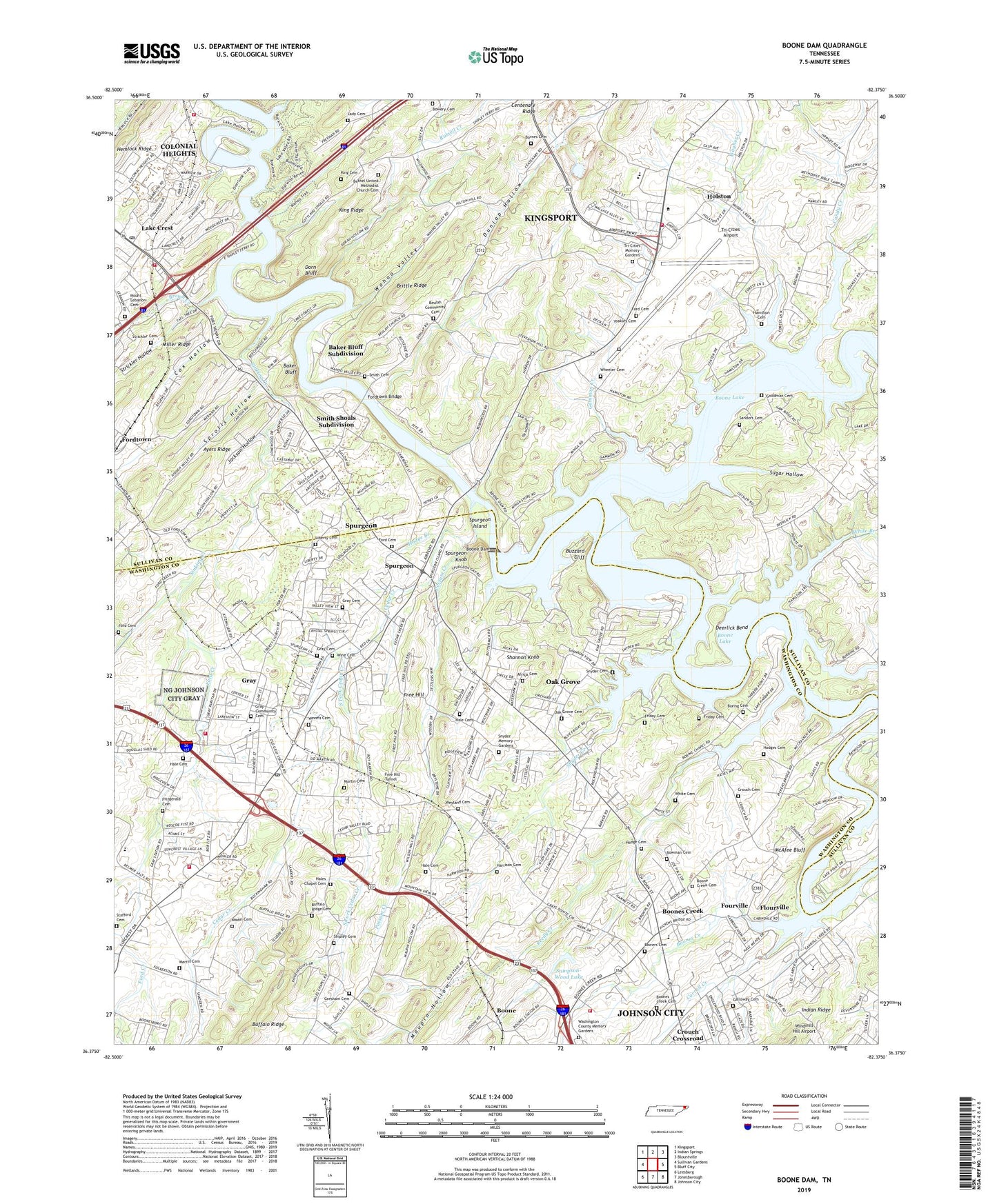
Boone Dam Tennessee US Topo Map
Couldn't load pickup availability
2022 topographic map quadrangle Boone Dam in the state of Tennessee. Scale: 1:24000. Based on the newly updated USGS 7.5' US Topo map series, this map is in the following counties: Sullivan, Washington. The map contains contour data, water features, and other items you are used to seeing on USGS maps, but also has updated roads and other features. This is the next generation of topographic maps. Printed on high-quality waterproof paper with UV fade-resistant inks.
Quads adjacent to this one:
West: Sullivan Gardens
Northwest: Kingsport
North: Indian Springs
Northeast: Blountville
East: Bluff City
Southeast: Johnson City
South: Jonesborough
Southwest: Leesburg
This map covers the same area as the classic USGS quad with code o36082d4.
Contains the following named places: Africa Cemetery, Ayers Ridge, Bachman Ford, Baker Bluff, Baker Bluff Subdivision, Barnes Cemetery, Berry Island, Bethany Church, Bethel Church, Bethel United Methodist Church Cemetery, Beulah Baptist Church, Beulah Community Cemetery, Boone, Boone Creek Cemetery, Boone Creek Mill, Boone Dam, Boones Creek, Boones Creek Bible Church, Boones Creek Cemetery, Boones Creek Church, Boones Creek Church of the Brethren, Boones Creek Dock, Boones Creek Middle School, Boring, Boring Cemetery, Boring Chapel, Boring Ford, Bowers Cemetery, Bowery Cemetery, Bowman Cemetery, Bowman Ford, Bowman Island, Brittle Ridge, Brown Creek, Brown Island, Buffalo Ridge, Buffalo Ridge Cemetery, Buffalo Ridge Church, Buzzard Cliff, Candy Creek, Candy Creek Dock, Carroll Creek, Cedar Creek, Cedar Creek Church, Centenary Church, Centenary Ridge, Colby, Colonial Heights Census Designated Place, Colonial Heights Church, Colonial Heights Post Office, Commissioner District 1, Commissioner District 7, Cox Hollow, Crouch Cemetery, Crouch Crossroad, Darr Creek, Deck Cemetery, Deer Lick School, Deerlick Bend, Deerlick Church, District 11, District 12, Doran Hollow, Dorn Bluff, Dunlap Hollow, Dunlap School, Edwards Airport, El Rancho, Englewood, Fall Creek, Fitzgerald Cemetery, Flourville, Ford Cemetery, Ford Creek, Fordtown Bridge, Fordtown Church, Fourville, Free Hill, Free Hill Tunnel, Friday Cemetery, Galloway Cemetery, Gammon Creek, Goodman Cemetery, Gray, Gray Baptist Church, Gray Cemetery, Gray Census Designated Place, Gray Community Cemetery, Gray Elementary School, Gray Post Office, Gray Volunteer Fire Department, Green Vale Church, Gresham Cemetery, Hale Cemetery, Hales Chapel, Hales Chapel Cemetery, Hall Ford, Hall Ridge Church, Hall Ridge Dock, Halls Mill, Halls Mill Pond, Halls School, Hamilton Cemetery, Harrison Cemetery, Hemlock Ridge, Hicks Bend, Hilton, Hodge Branch, Hodge Cemetery, Hodge School, Hodges Cemetery, Holston, Holston Elementary School, Holston Middle School, Holston School, Jackson Hollow, Johnson City Fire Department Station 6, Johnson City Fire Department Station 8, King Cemetery, King Ridge, Kingsport Fire Department Station 6, Kitzmiller, Ladies Academy, Lady Cemetery, Lake Crest, Lakeside Dock, Liberty Cemetery, Liberty Church, Madin Cemetery, Martin Cemetery, Maupin Hollow, McAfee Bluff, Mount Lebanon Cemetery, Northeast State Community College, Oak Grove, Oak Grove Baptist Church, Oak Grove Cemetery, Oak Grove Census Designated Place, Oak Grove School, Oak Grove Village Mobile Home Park, Pickens Bend, Possum Creek, Reedy Creek, Royal Pines, Russell Creek, Sampson-Wood Lake, Sampson-Wood Lake Dam, Samuel, Sanders Cemetery, Shannon Knob, Shipley Cemetery, Shirley Ferry, Sinking Creek, Slaughter Island, Smith Cemetery, Smith Shoals Subdivision, Snyder Cemetery, Snyder Creek, Snyder Memory Gardens, South Fork Cedar Creek, Sprolls Hollow, Spurgeon, Spurgeon Census Designated Place, Spurgeon Island, Spurgeon Knob, Stafford Cemetery, Strickler Cemetery, Strickler Hollow, Sugar Hollow, Sunrise School, Talley Island, Tennessee Department of Agriculture Division of Forestry Sullivan, Tri - Cities Regional Airport Public Safety Fire Department, Tri-Cities Airport, Tri-Cities Memory Gardens, Tri-City Airport Church, Wagner Creek, Wahoo, Wahoo Valley, Warriors Path State Park, Washington County Fairgrounds, Washington County Memory Gardens, Watauga River, Weems Cemetery, Weyland Cemetery, Weyland Missionary Baptist Church, Wheeler Cemetery, Wheeler Chapel, Wheeler Church, White Branch, White Cemetery, Wine Cemetery, WJCW-AM (Johnson City), Yoakley Cemetery, Yoakley Ferry, ZIP Codes: 37615, 37663


