MyTopo
Kingsport Tennessee US Topo Map
Couldn't load pickup availability
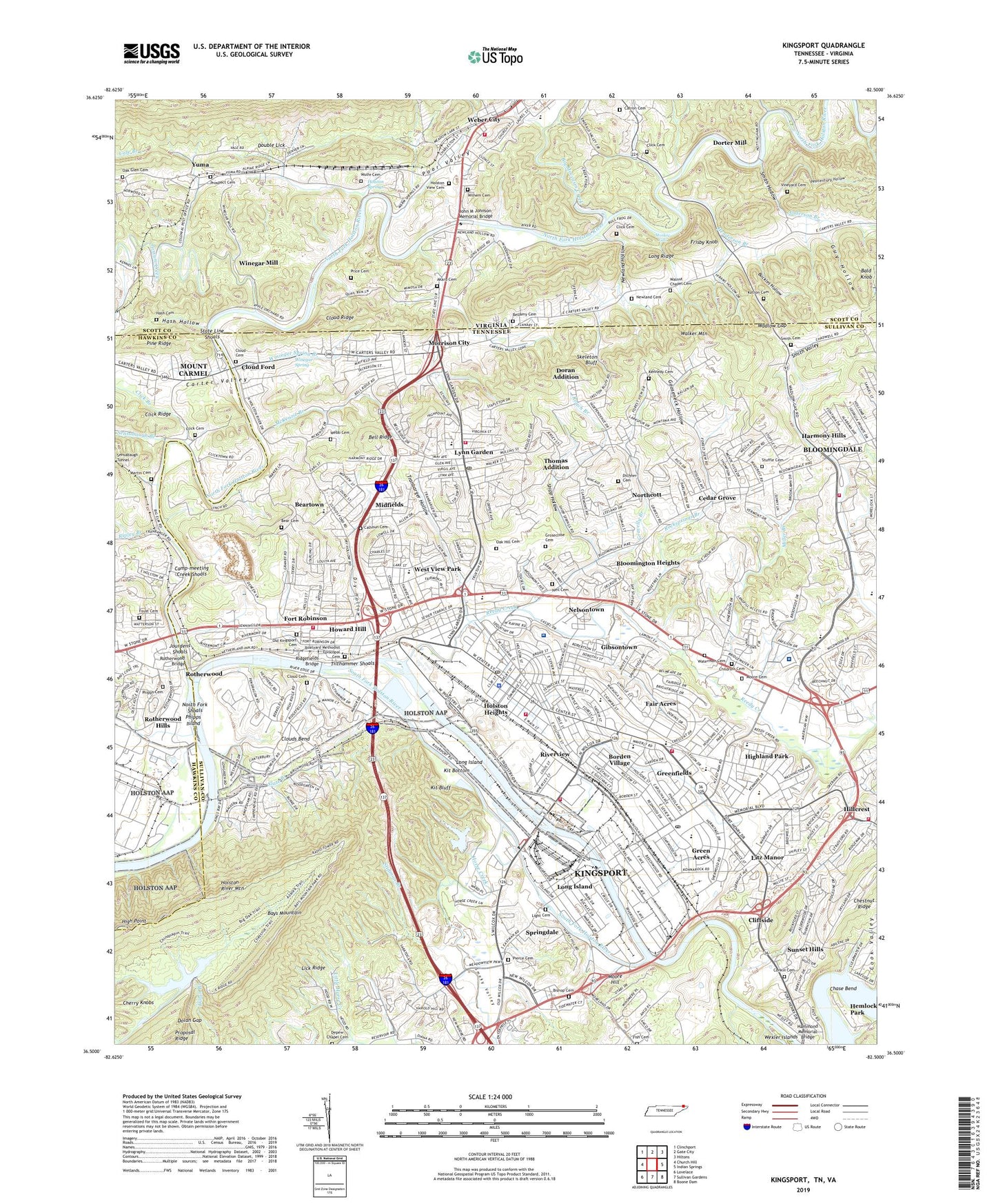
2022 topographic map quadrangle Kingsport in the states of Tennessee, Virginia. Scale: 1:24000. Based on the newly updated USGS 7.5' US Topo map series, this map is in the following counties: Sullivan, Scott, Hawkins. The map contains contour data, water features, and other items you are used to seeing on USGS maps, but also has updated roads and other features. This is the next generation of topographic maps. Printed on high-quality waterproof paper with UV fade-resistant inks.
Quads adjacent to this one:
West: Church Hill
Northwest: Clinchport
North: Gate City
Northeast: Hiltons
East: Indian Springs
Southeast: Boone Dam
South: Sullivan Gardens
Southwest: Lovelace
Contains the following named places: Abraham Lincoln Elementary School, Akard Cemetery, Allandale Market Place Shopping Center, Amersham, Anderson Block House Monument, Anderson Branch, Andrew Jackson Elementary School, Andrew Johnson School, Bald Knob, Bays Mountain Dam, Bays Mountain Park, Bays Mountain Reservoir, Bear Cemetery, Beartown, Beechwood Village, Bell Ridge, Bell Ridge School, Bellamy Cemetery, Big Moccasin Creek, Bishop Cemetery, Bloomingdale Census Designated Place, Bloomington Heights, Boatyard Methodist Episcopal Cemetery, Borden Village, Brookside Elementary School, Buckles Hollow, Calhoun Cemetery, Camp-meeting Creek, Camp-meeting Creek Shoals, Catron Cemetery, Cedar Grove, Cedar Grove Elementary School, Centennial Boat Yard Park, Chase Bend, Cherokee Village, Childress Cemetery, Church Circle, City of Kingsport, Civilian Conservation Corps Camp Number 2427, Click Branch, Click Cemetery, Cliffside, Cloud Cemetery, Cloud Ford, Cloud Park, Cloud Ridge, Clouds Bend, Commissioner District 10, Commissioner District 11, Commissioner District 9, Conkin Cemetery, Crown Point Shopping Center, Darlington Heights, Depew Chapel Cemetery, Dichner Cemetery, Dickson Elementary School, Dobyns-Bennett High School, Dolan Gap, Doran Addition, Dorter Mill, Double Lick, Douglas High School, Dry Hollow, East Kingsport, Eastman Recreation Area, Eden Ridge, Fair Acres, Fish Cemetery, Fort Henry Mall Shopping Center, Fort Robinson, Foust Cemetery, Fox Run, Frisby Knob, Garden Mountain Lookout Tower, George Washington Elementary School, Gibsontown, Gooseneck Hollow, Gravelly Branch, Green Acres, Green Acres Shopping Center, Greenfields, Greenvale, Greenvale School, Groseclose Cemetery, Guy Hollow, Harmony Hills, Hash Cemetery, Hash Hollow, Hemlock Park, Henderson Branch, Hiara Heights, High Point, Highland Park, Holston Heights, Holston Hills, Holston Springs, Holston Valley Medical Center, Holston View Cemetery, Horace, Horse Creek, Howard Hill, Huntington Hills, Indian Path Medical Center, Indian Path Pavilion, J Fred Johnson Park, James Madison Elementary School, John M Johnson Memorial Bridge, John Sevier Junior High School, Jourdens Mill, Jourdens Shoals, Katron Cemetery, Kennedy Cemetery, Kings Giant Plaza Shopping Center, Kings Mill, Kingsport, Kingsport City Landfill, Kingsport Division, Kingsport Health Center, Kingsport Mall Shopping Center, Kingsport Reservoir, Kingsport Rifle Range, Kingsport Wastewater Treatment Plant, Kit Bluff, Kit Bottom, Larkspur, Lick Ridge, Light Cemetery, Little Horse Creek, Litz Manor, Long Island, Long Ridge, Lynn Garden, Lynn Garden Elementary School, Lynn View High School, Martin Cemetery, McKenzie Branch, Meadow View Golf Course, Midfields, Midtown Shopping Center, Miller Branch, Monkey Falls, Moore Cemetery, Moore Hill, Morrison City, Neil Cemetery, Nelsontown, Newland Cemetery, Newland Hollow, North Fork Holston River, North Fork Shoals, Northcott, Oak Glen Cemetery, Oak Hill Cemetery, Old Kingsport Presbyterian Church Cemetery, Palmer Memorial Center for Crippled Children, Parker Chapel School, Parkway Plaza Shopping Center, Penitentiary Hollow, Petlier, Phipps Cemetery, Phipps Island, Pierce Cemetery, Pine Ridge, Possum Creek, Preston Forest, Price Cemetery, Proposal Ridge, Prospect Cemetery, Reedy Creek, Reservoir Road Area, Ridgefields, Ridgefields Bridge, Ridgefields Golf and Country Club, Ripley Branch, Riverfront Park, Riverview, Roach Branch, Robert E Lee School, Rock Springs Branch, Rocksprings Branch, Ross N Robinson Junior High School, Rotherwood, Rotherwood Bridge, Rotherwood Heights, Rotherwood Hills, Saint Dominics School, Sensabaugh Branch, Sensabaugh Tunnel, Sevier Terrace, Shipp Hollow, Skeleton Bluff, Skyview Estates, Slate Branch, Smith Cemetery, Smith Hollow, Smith Valley, Smoky Valley, South Fork Holston River, Southland Shopping Center, Springdale, State Line Shoals, Stidman Branch, Stuffle Cemetery, Sullivan North High School, Sunset Hills, Thomas Addition, Tilthammer Shoals, Town of Weber City, Tranbarger Hollow, Vineyard Cemetery, Wadlow Gap, Walker Mountain, Walnut Chapel Cemetery, Waterman Cemetery, WCSK-FM (Kingsport), Webb Cemetery, Weber City, West View Elementary School, West View Park, Wexler Islands, Whitesburg School, Wilhem Cemetery, Windmere, Winegar Mill, Winegar Mill Dam, Winegar Spring, Wininger Spring Branch, WKIN-AM (Kingsport), WKPT-AM (Kingsport), Wolfe Cemetery, WTFM-FM (Kingsport), Yuma, ZIP Codes: 24290, 37660, 37665


