MyTopo
Brick Church Tennessee US Topo Map
Couldn't load pickup availability
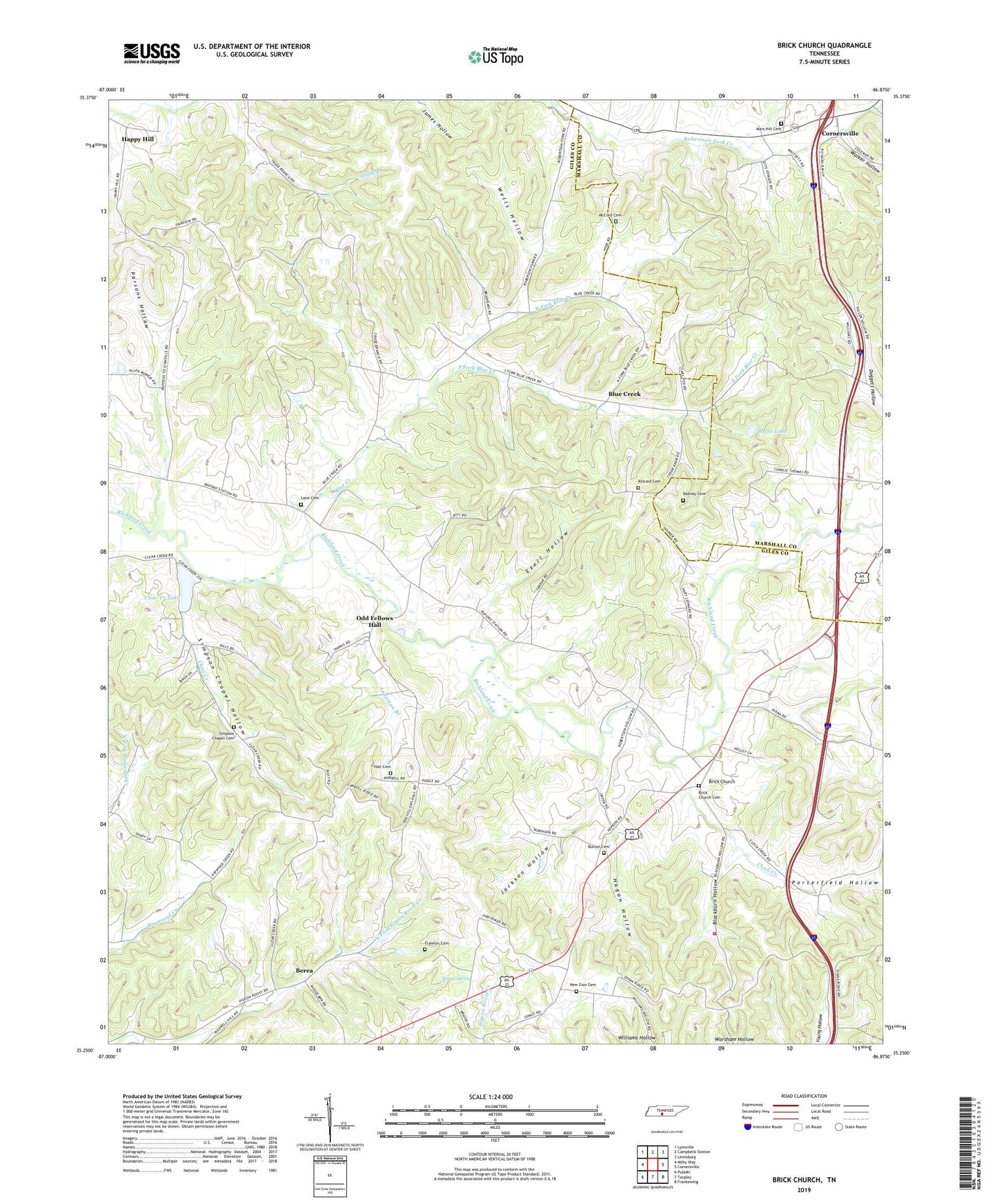
2022 topographic map quadrangle Brick Church in the state of Tennessee. Scale: 1:24000. Based on the newly updated USGS 7.5' US Topo map series, this map is in the following counties: Giles, Marshall. The map contains contour data, water features, and other items you are used to seeing on USGS maps, but also has updated roads and other features. This is the next generation of topographic maps. Printed on high-quality waterproof paper with UV fade-resistant inks.
Quads adjacent to this one:
West: Milky Way
Northwest: Lynnville
North: Campbells Station
Northeast: Lewisburg
East: Cornersville
Southeast: Frankewing
South: Tarpley
Southwest: Pulaski
This map covers the same area as the classic USGS quad with code o35086c8.
Contains the following named places: Anderson Branch, Berea, Blackburn Hollow, Blue Creek, Blue Creek School, Brick Church, Brick Church Cemetery, Brick Church School, Burns Lake, Burns Lake Dam, Burton Cemetery, Clear Creek, Clear Creek Lake, Clear Creek Lake Dam, Clock Creek, Commissioner District 4, Dabney Cemetery, Ezell Hollow, Fairview School, Forest Hill, Franklin Cemetery, Giles County Fire and Rescue Department - Brick Church, Hagan Hollow, Hall Cemetery, Happy Hill, Hope Chapel, Jackson Hollow, Kincaid Cemetery, Krapp Spring, Lane Cemetery, Lowranch Hollow, Mars Hill, Mars Hill Cemetery, Mars Hill Presbyterian Church, McCord Cemetery, New Zion Baptist Church, New Zion Cemetery, North Fork Blue Creek, North Robertson Fork Creek, Odd Fellows Hall, Parsons Hollow, Porterfield Hollow, Richland, Robertson Fork, Robertson Fork Church, Simpson Chapel Cemetery, Simpson Chapel Hollow, South Fork Blue Creek, Taylor School, Walker Hollow, Wells Hollow, Woodlawn School