MyTopo
Brighton Tennessee US Topo Map
Couldn't load pickup availability
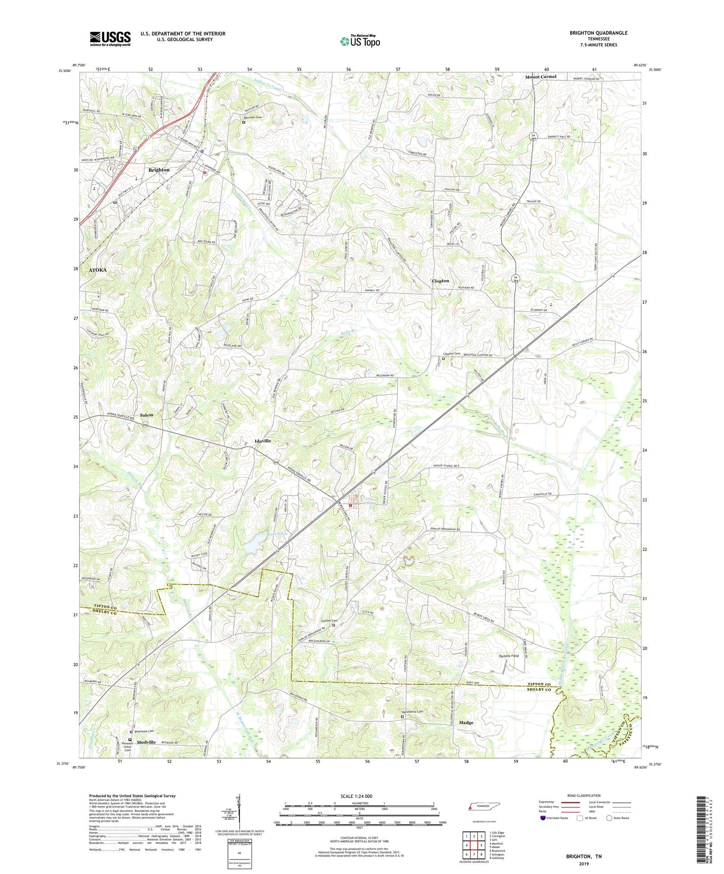
2022 topographic map quadrangle Brighton in the state of Tennessee. Scale: 1:24000. Based on the newly updated USGS 7.5' US Topo map series, this map is in the following counties: Tipton, Shelby, Fayette. The map contains contour data, water features, and other items you are used to seeing on USGS maps, but also has updated roads and other features. This is the next generation of topographic maps. Printed on high-quality waterproof paper with UV fade-resistant inks.
Quads adjacent to this one:
West: Munford
Northwest: Gilt Edge
North: Covington
Northeast: Gift
East: Mason
Southeast: Gallaway
South: Arlington
Southwest: Brunswick
This map covers the same area as the classic USGS quad with code o35089d6.
Contains the following named places: Anthony School, Bloomington School, Brighton, Brighton Baptist Church, Brighton City Hall, Brighton Community Center, Brighton Division, Brighton Elementary School, Brighton Fire Department, Brighton Police Department, Brighton Post Office, Brighton School, Center School, Clopton, Clopton Cemetery, Clopton Church, Commissioner District 9, Dixon School, Dunlap Orphanage, Elmoro School, Galilee Cemetery, Galilee Church, Hatchel Creek, Hebron Branch, Idaville, Kelly Branch, Lake Ellen, Lake Ellen Dam, Macedonia Church, Macedonia United Methodist Church Cemetery, Madge, Morrison Cemetery, Mount Carmel, Mount Carmel Presbyterian Church, Mount Carmel School, Mount Tipton Christian Methodist Episcopal Church, Mudville, Parsons Field, Pleasant Grove Baptist Church, Pleasant Union Church, Pleasant Union Cumberland Presbyterian Cemetery, Rosemark Cemetery, Salem, Salem Associated Reformed Presbyterian Church, Salem School, Sharon Church, Sharon School, Shiloh Church, Smith Branch, Three Star Volunteer Fire Department, Town of Brighton, Wrights Church, ZIP Code: 38011