MyTopo
Burrville Tennessee US Topo Map
Couldn't load pickup availability
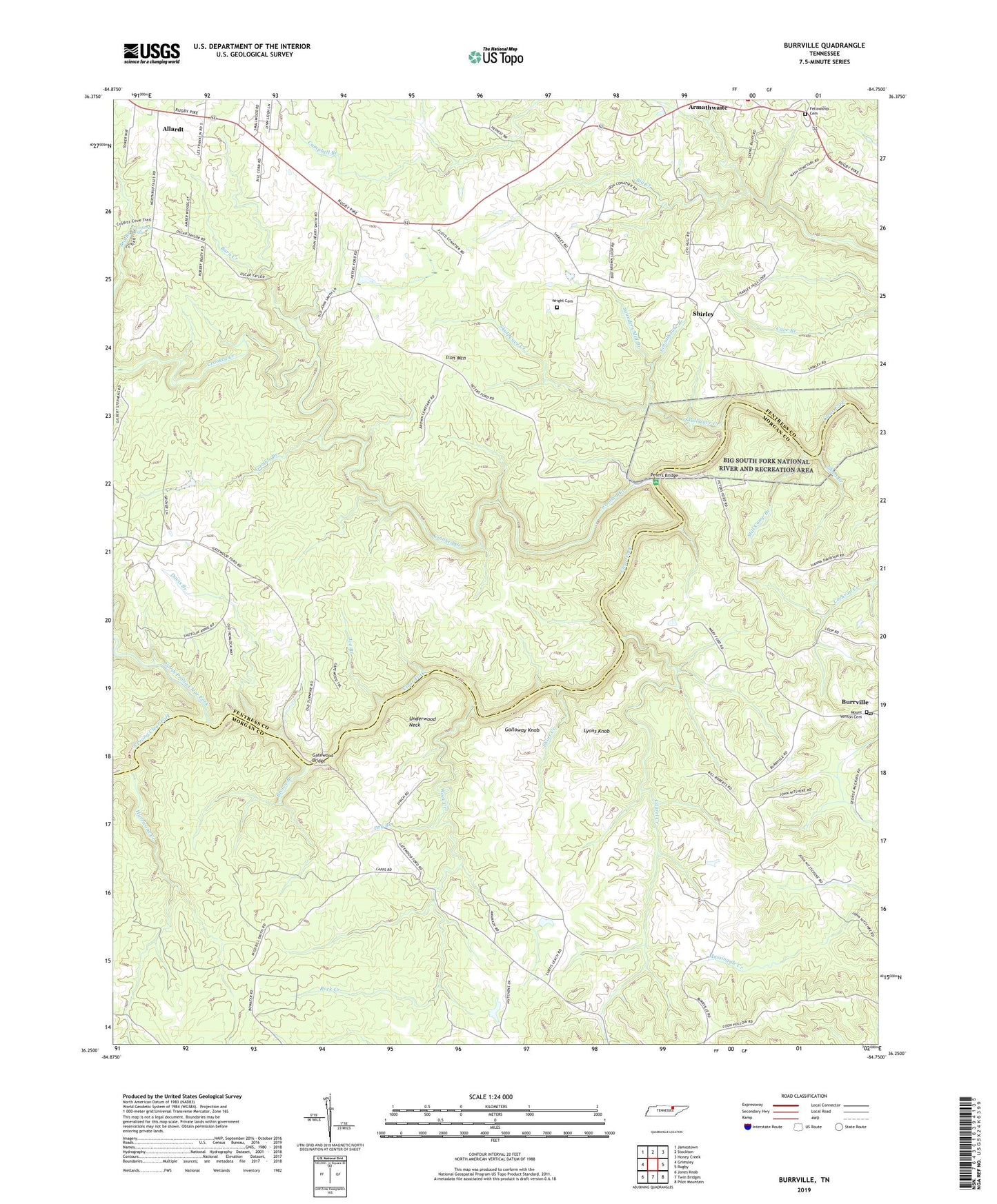
2019 topographic map quadrangle Burrville in the state of Tennessee. Scale: 1:24000. Based on the newly updated USGS 7.5' US Topo map series, this map is in the following counties: Fentress, Morgan. The map contains contour data, water features, and other items you are used to seeing on USGS maps, but also has updated roads and other features. This is the next generation of topographic maps. Printed on high-quality waterproof paper with UV fade-resistant inks.
Quads adjacent to this one:
West: Grimsley
Northwest: Jamestown
North: Stockton
Northeast: Honey Creek
East: Rugby
Southeast: Pilot Mountain
South: Twin Bridges
Southwest: Jones Knob
Contains the following named places: Armathwaite, Barger Branch, Barn Creek, Big Branch, Boiling, Brown Branch, Burrville, Burrville Post Office, Center Belle Church, Crooked Creek, Davis Branch, Dry Branch, Fellowship Cemetery, Fellowship Church, Galloway Knob, Gamble Branch, Gatewood Bridge, Gatewood School, Howard Ford, Hurricane Creek, Iron Mountain, Joe Branch, Key Ford, Laurel Creek, Lyons Knob, Mount Vernon Cemetery, Mount Vernon Methodist Church, North Prong Clear Fork, Northrup Falls, Peters Bridge, Pleasant View Church, Rock Creek, Saunders Mill Branch, Schoolhouse Branch, Shadeland Church, Shirley, Shirley United Baptist Church, Short Creek, Silver Pine School, Skull Cave Creek, Smith Dairy Farm, South Prong Clear Fork, Still Camp Branch, Underwood Neck, Union Grove Church, Wright Cemetery