MyTopo
Cardiff Tennessee US Topo Map
Couldn't load pickup availability
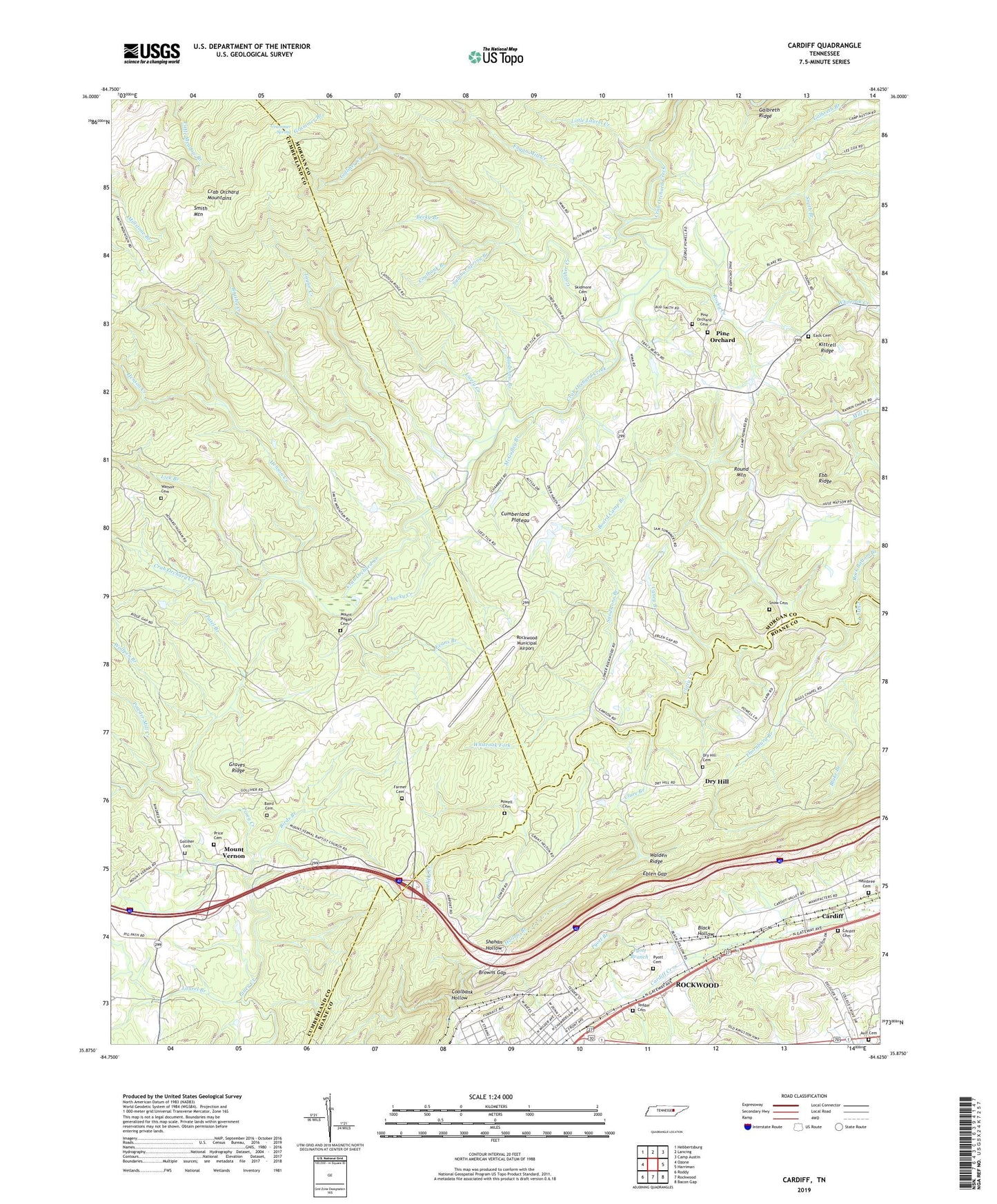
2022 topographic map quadrangle Cardiff in the state of Tennessee. Scale: 1:24000. Based on the newly updated USGS 7.5' US Topo map series, this map is in the following counties: Cumberland, Morgan, Roane. The map contains contour data, water features, and other items you are used to seeing on USGS maps, but also has updated roads and other features. This is the next generation of topographic maps. Printed on high-quality waterproof paper with UV fade-resistant inks.
Quads adjacent to this one:
West: Ozone
Northwest: Hebbertsburg
North: Lancing
Northeast: Camp Austin
East: Harriman
Southeast: Bacon Gap
South: Rockwood
Southwest: Roddy
This map covers the same area as the classic USGS quad with code o35084h6.
Contains the following named places: Ault Cemetery, Baird Cemetery, Becky Branch, Birds Branch, Black Hollow, Bladshaw Branch, Board Camp Branch, Browns Gap, Brushy Creek, Burning Springs Well, Camp Howard, Caney Branch, Cardiff, Cardiff Cemetery, Cardiff Mine, Chucky Creek, Clure Branch, Coalbank Branch, Coalbank Hollow, Cumberland Plateau, Deerwood, Dry Hill, Dry Hill Cemetery, Dry Hill Church, Dry Hill School, Eads Cemetery, Eblen Gap, Evans Branch, Fagan Mill Creek, Farmer Cemetery, Flat Rock Ford, Galbreth Ridge, Golliher Cemetery, Golliher Creek, Grammer Spring, Graves Ridge, Hembree Cemetery, Henson Creek, Hollow Branch, Kittrell Ridge, Laurel Branch, Lick Branch, Little Laurel Creek, Lively Creek, McGuffey Branch, Moulders School, Mount Pisgah, Mount Pisgah Cemetery, Mount Pisgah Church, Mount Pisgah School, Mount Teman Church, Mount Vernal Church, Mount Vernon, North Rockwood Church, Patel Branch, Patton Mine, Pine Orchard, Pine Orchard Baptist Church, Pine Orchard Cemetery, Pine Orchard School, Powder Mill Creek, Powell Cemetery, Price Cemetery, Pyott Branch, Pyott Cemetery, Roane County Industrial Park, Roane Memorial Gardens, Roane State Community College, Rock Bottom Branch, Rockwood Mine, Rockwood Municipal Airport, Rocky Creek, Round Mountain, Sandstone Branch, Shahan Hollow, Skidmore Cemetery, Smith Mountain, Snow Cemetery, Sulphur Spring Branch, Taylor Creek, Tedder Cemetery, Thornburg Branch, Victory Church, Warner Mine, Watson Cemetery, Westel Community Center, Whiteoak Fork, Wolfpen Branch, ZIP Code: 37854