MyTopo
Chewalla Tennessee US Topo Map
Couldn't load pickup availability
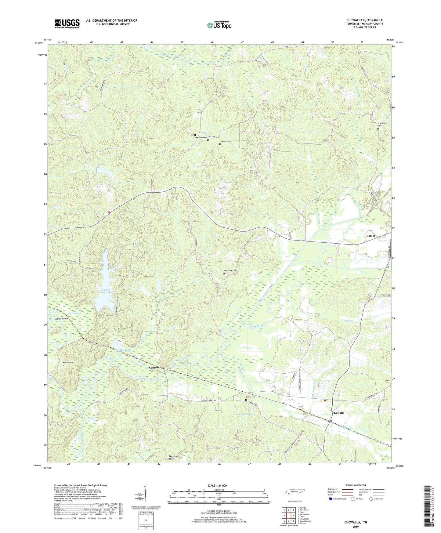
2019 topographic map quadrangle Chewalla in the state of Tennessee. Scale: 1:24000. Based on the newly updated USGS 7.5' US Topo map series, this map is in the following counties: McNairy. The map contains contour data, water features, and other items you are used to seeing on USGS maps, but also has updated roads and other features. This is the next generation of topographic maps. Printed on high-quality waterproof paper with UV fade-resistant inks.
Quads adjacent to this one:
West: Pocahontas
Northwest: Hornsby
North: Rose Creek
Northeast: Purdy
East: Guys
Southeast: Corinth
South: Kossuth North
Southwest: Chalybeate
Contains the following named places: Allen Branch, Antioch Church, Big Hill Pond, Big Hill Pond Lake, Big Hill Pond Lake Dam, Big Hill Pond State Park, Boles Branch, Butlers Chapel, Caney Creek, Carr Cemetery, Chewalla, Chewalla Baptist Church, Chewalla Census Designated Place, Chewalla Post Office, Chewalla School, Coleman Cemetery, Commissioner District 5, Cypress, Cypress Creek, Cypress Creek Ditch, Dismal Branch, Dismal Swamp, Dry Branch, Friendship Baptist Church, Friendship Cemetery, Hurley School, Indian Creek, Indian Creek Cemetery, Jimmies Branch, Kings Mountain School, Little Indian Creek, McNairy County Fire Department Station 31 Chewalla Fire Department, McNairy County Fire Department Station 33 Big Hill Pond Fire Department, Muddy Creek, Neatherly Branch, Neatherly Cemetery, Otterville Church, Ramer Branch, Reed School, Reedy Branch, Tan Yard Bend, Turner Cemetery, Turner Lake, Tuscumbia River Canal, Union Chapel School, White Oak Cemetery, Wooten Cemetery