MyTopo
Clarkrange Tennessee US Topo Map
Couldn't load pickup availability
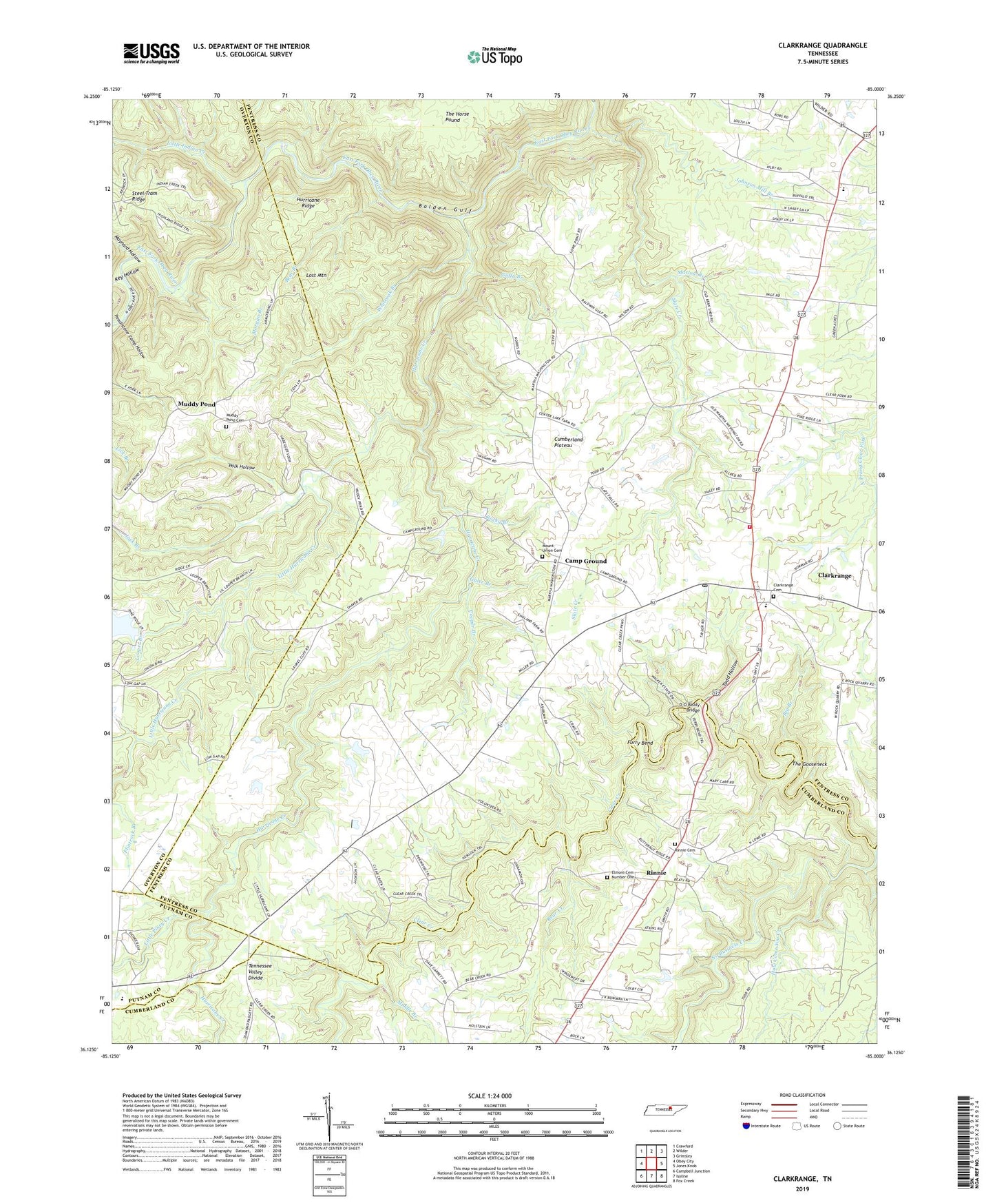
2019 topographic map quadrangle Clarkrange in the state of Tennessee. Scale: 1:24000. Based on the newly updated USGS 7.5' US Topo map series, this map is in the following counties: Fentress, Overton, Cumberland, Putnam. The map contains contour data, water features, and other items you are used to seeing on USGS maps, but also has updated roads and other features. This is the next generation of topographic maps. Printed on high-quality waterproof paper with UV fade-resistant inks.
Quads adjacent to this one:
West: Obey City
Northwest: Crawford
North: Wilder
Northeast: Grimsley
East: Jones Knob
Southeast: Fox Creek
South: Isoline
Southwest: Campbell Junction
Contains the following named places: Balden Gulf, Bear Branch, Bear Creek, Big Branch, Camp Ground, Clarkrange, Clarkrange Baptist Church, Clarkrange Cemetery, Clarkrange Census Designated Place, Clarkrange Church, Clarkrange Elementary School, Clarkrange High School, Clarkrange Post Office, Clarkrange United Methodist Church, Commissioner District 4, Cooper Branch, D O Beaty Bridge, Elmore Cemetery Number One, Fentress County Volunteer Fire Department Station 7 Clarkrange, Flintrock Branch, Fond Branch, Furry Bend, Galer Branch, Guffy Branch, Hickory Corner, How Come You Creek, Hudsonburg, Hurricane Creek, Hurricane Ridge, Jack Branch, Johnson Mill Branch, Key Hollow, Little Hurricane Creek, Little Indian Creek, Little Piney Creek, Looper Branch, Lost Mountain, Marlow Branch, Martha Washington School, Maynard Hollow, Middle Branch, Morgan Branch, Mount Union Cemetery, Mount Union Church, Muddy Pond, Muddy Pond Cemetery, Muddy Pond School, No Business Creek, North Cumberland Elementary School, Peachstone Camp Hollow, Pine Ridge Lake Dam, Polk Hollow, Rinnie, Rinnie Cemetery, Rinnie Freewill Baptist Church, Rocky Branch, Slate Creek, Steel Tram Ridge, The Gooseneck, Todd Hollow, Union B School, Union Grove School, Whiteoak Branch, ZIP Code: 38553