MyTopo
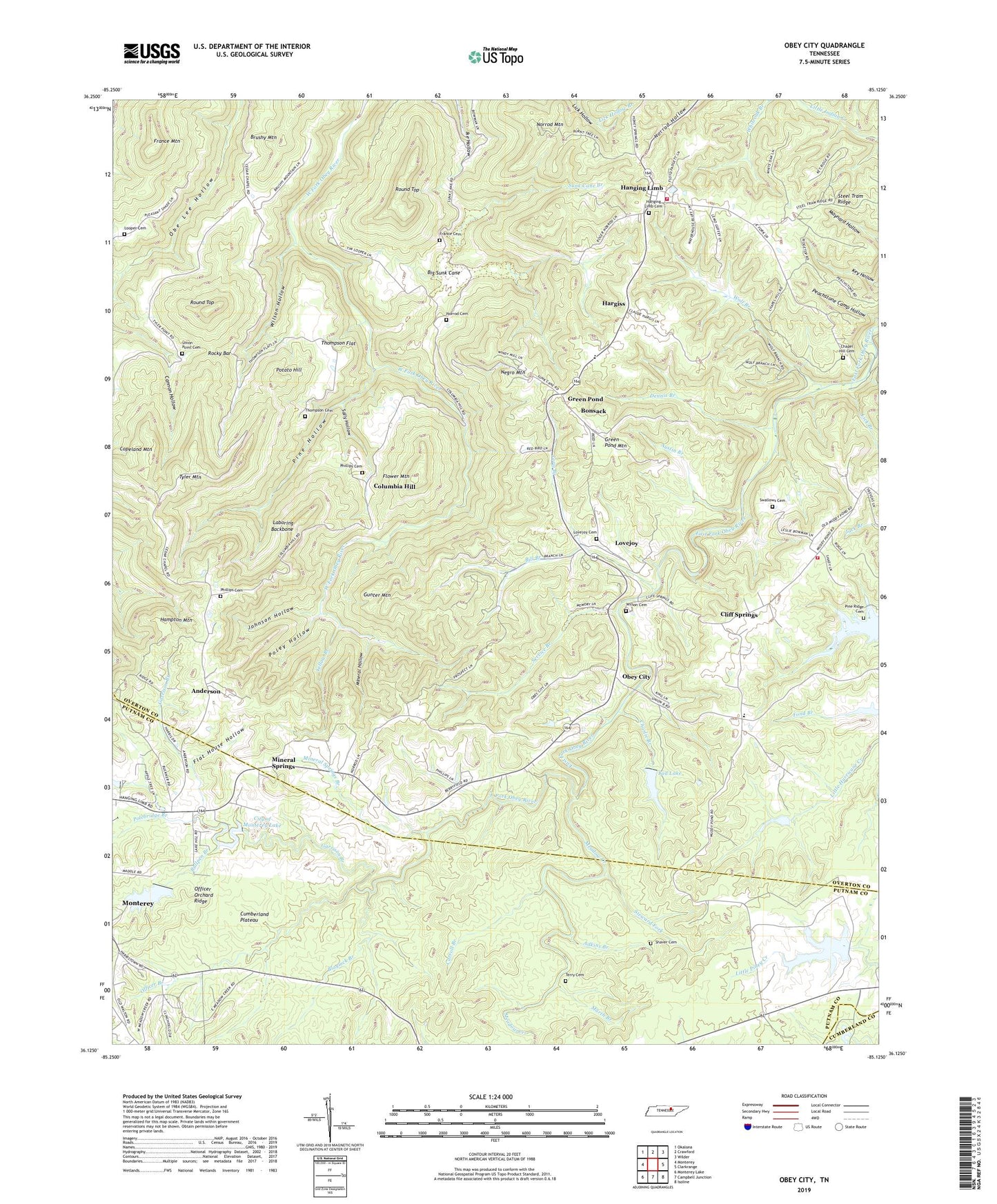
Obey City Tennessee US Topo Map
Couldn't load pickup availability
2022 topographic map quadrangle Obey City in the state of Tennessee. Scale: 1:24000. Based on the newly updated USGS 7.5' US Topo map series, this map is in the following counties: Overton, Putnam, Cumberland. The map contains contour data, water features, and other items you are used to seeing on USGS maps, but also has updated roads and other features. This is the next generation of topographic maps. Printed on high-quality waterproof paper with UV fade-resistant inks.
Quads adjacent to this one:
West: Monterey
Northwest: Okalona
North: Crawford
Northeast: Wilder
East: Clarkrange
Southeast: Isoline
South: Campbell Junction
Southwest: Monterey Lake
This map covers the same area as the classic USGS quad with code o36085b2.
Contains the following named places: Adkins Branch, Anderson, Anderson School, Austin Branch, Big Sunk Cane, Bill Branch, Blaylock Branch, Bonsack, Brushy Mountain, Buckner Chapel, Bullpen Branch, Camp Monterey Lake, Camp Monterey Lake Dam, Carroll Branch, Chapel Hill Cemetery, Charlie Branch, City of Monterey Lake, City of Monterey Water Supply Dam, Cliff Springs, Columbia Hill, Columbia Hill Church, Copeland Mountain, Crawford Division, Dennis Branch, Doubling Spur, Flat House Hollow, Flower Mountain, France Cemetery, France Mountain, Garrison Branch, Green Pond, Green Pond Mountain, Gunter Mountain, Hampton Mountain, Hanging Limb, Hanging Limb Baptist Church, Hanging Limb Cemetery, Hanging Limb School, Hargiss, Honeycutt Estates, J E Walker Lake, J E Walker Lake Dam, Johnson Hollow, Laboring Backbone, Lad Lake, Lad Lake Dam, Lick Branch, Long Branch, Looper Cemetery, Lovejoy, Lovejoy Cemetery, Marth Branch, Meadow Creek, Mineral Hollow, Mineral Springs, Mineral Springs Branch, Mineral Springs First Baptist Church, Mountain Volunteer Fire and Rescue, Muddy Pond Volunteer Fire Department, Negro Mountain, Norrod Cemetery, Norrod Mountain, Obey City, Officer Branch, Officer Orchard Ridge, Phillips Cemetery, Phillips Ford, Pine Hollow, Pine Ridge Cemetery, Pine Ridge Church, Pine Ridge Lake, Polebridge Branch, Poley Hollow, Potato Hill, Rocky Bar, Round Top, Sally Hollow, Service Branch, Shaver Cemetery, Steward Fork, Sunk Cane Branch, Swallows Cemetery, Terry Cemetery, Thompson Cemetery, Thompson Flat, Tyler Mountain, Union Grove Church, Union Point Cemetery, Union Point Church, Whiteoak Branch, Wilson Cemetery, Wilson Elementary School, Wilson Hollow, Wolf Branch, Yellow Branch, ZIP Codes: 38554, 38574