MyTopo
Campbell Junction Tennessee US Topo Map
Couldn't load pickup availability
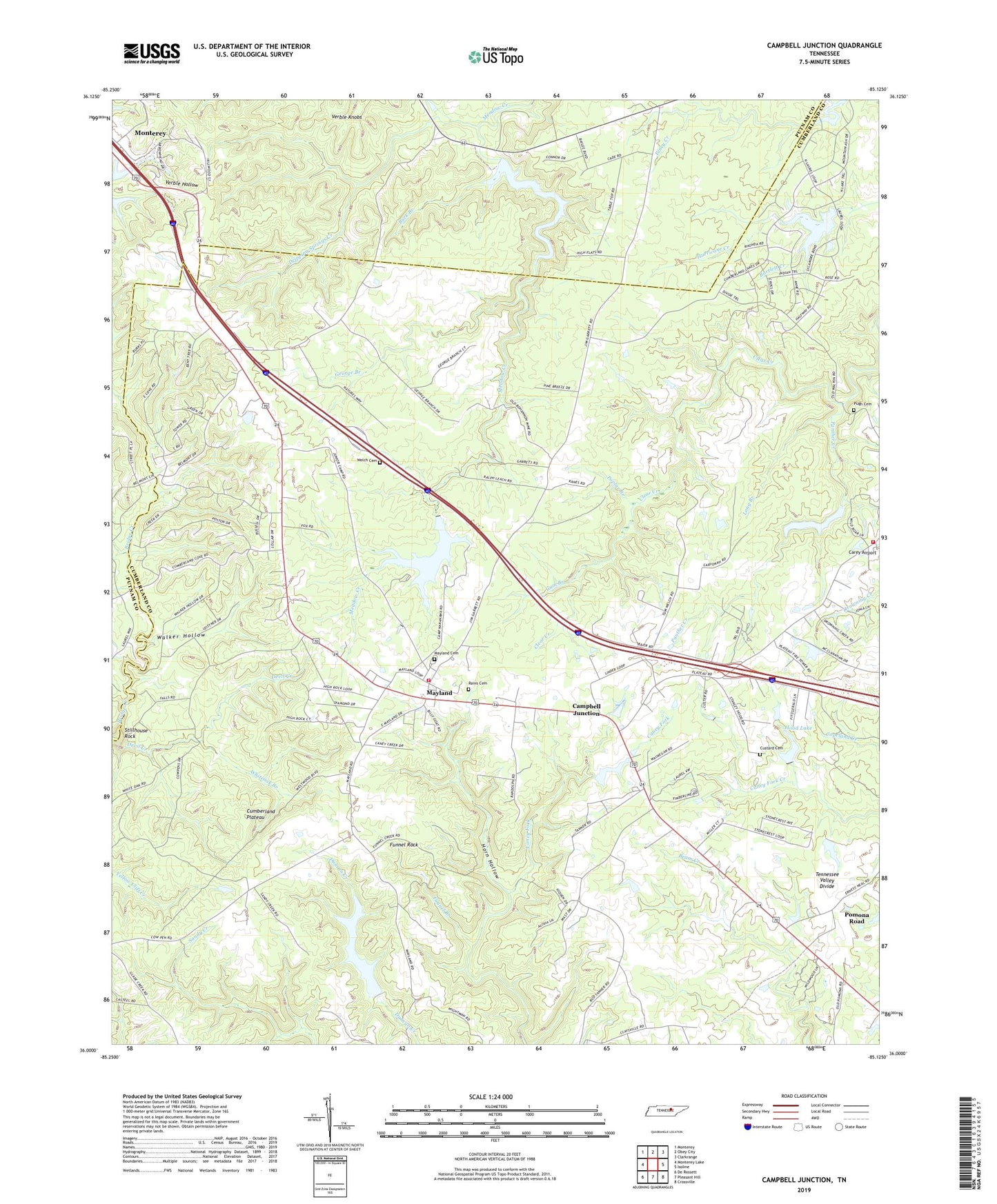
2022 topographic map quadrangle Campbell Junction in the state of Tennessee. Scale: 1:24000. Based on the newly updated USGS 7.5' US Topo map series, this map is in the following counties: Cumberland, Putnam. The map contains contour data, water features, and other items you are used to seeing on USGS maps, but also has updated roads and other features. This is the next generation of topographic maps. Printed on high-quality waterproof paper with UV fade-resistant inks.
Quads adjacent to this one:
West: Monterey Lake
Northwest: Monterey
North: Obey City
Northeast: Clarkrange
East: Isoline
Southeast: Crossville
South: Pleasant Hill
Southwest: De Rossett
This map covers the same area as the classic USGS quad with code o36085a2.
Contains the following named places: Bartlett Creek, Buck Branch, Camp Nakanawa, Campbell Junction, Cumberland County Fire Department Station 7, Cumberland County Fire Department Station 7 - 2, Custard Cemetery, Devil Creek, Dripping Springs, Dripping Springs Creek, Drowning Creek, Flat Rock Siding, Funnel Branch, Funnel Rock, George Branch, Gum Branch, Hillwood Estates, Hood Lake, Hood Lake Dam, Horn Hollow, Long Branch, Mayland, Mayland Baptist Church, Mayland Cemetery, Mayland Census Designated Place, Mayland Lake, Mayland Lake Dam, Mayland School, Mayland Town Hall, Panther Creek, Pomana Road, Pomona Road, Poplar Branch, Pugh Cemetery, Rains Cemetery, Stillhouse Rock, The Cowpens, Verble Hollow, Verble Knobs, Walker Hollow, Welch, Welch Cemetery, Whiteoak Branch