MyTopo
Herbert Domain Tennessee US Topo Map
Couldn't load pickup availability
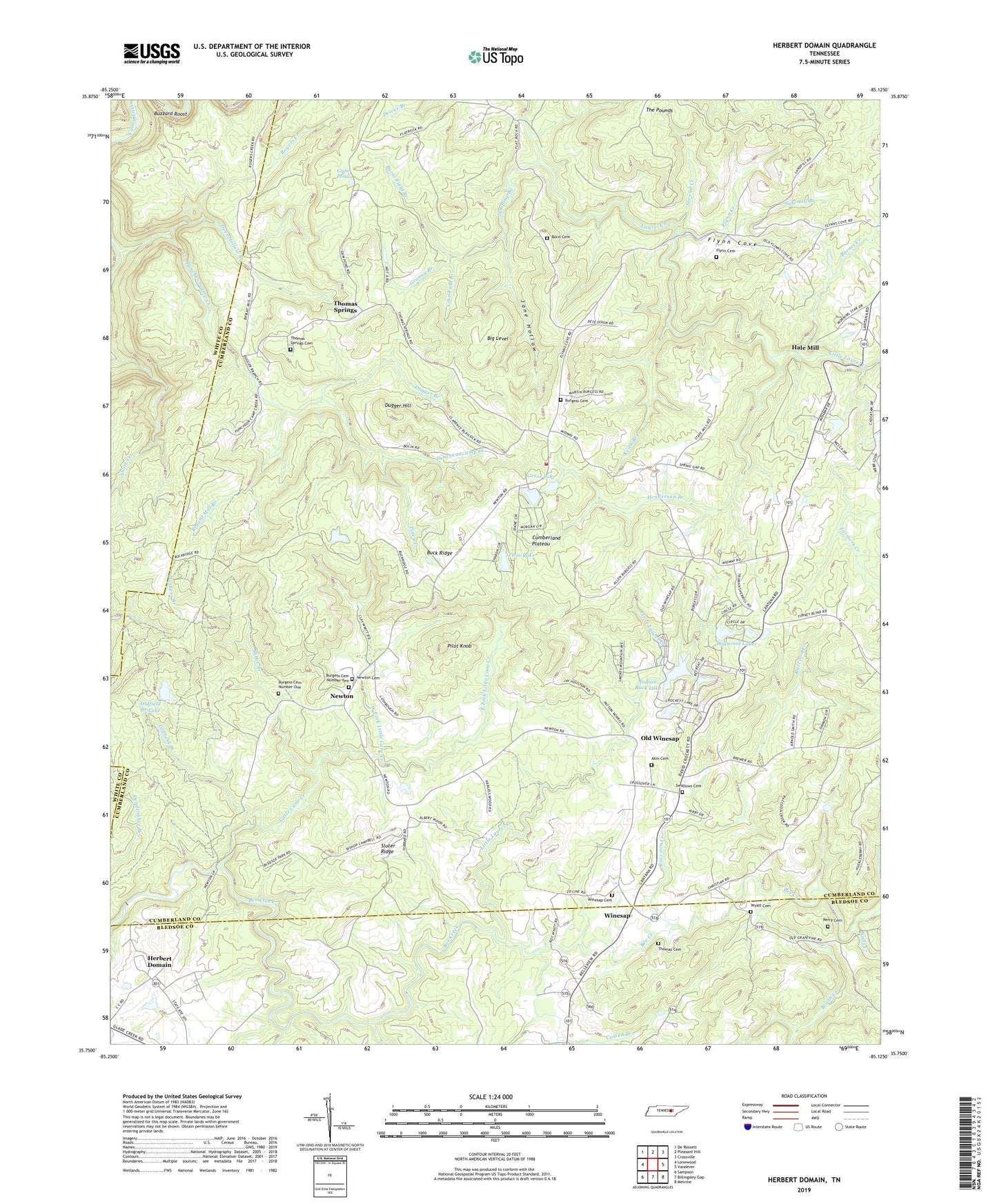
2022 topographic map quadrangle Herbert Domain in the state of Tennessee. Scale: 1:24000. Based on the newly updated USGS 7.5' US Topo map series, this map is in the following counties: Cumberland, Bledsoe, White. The map contains contour data, water features, and other items you are used to seeing on USGS maps, but also has updated roads and other features. This is the next generation of topographic maps. Printed on high-quality waterproof paper with UV fade-resistant inks.
Quads adjacent to this one:
West: Lonewood
Northwest: De Rossett
North: Pleasant Hill
Northeast: Crossville
East: Vandever
Southeast: Melvine
South: Billingsley Gap
Southwest: Sampson
This map covers the same area as the classic USGS quad with code o35085g2.
Contains the following named places: Akin Cemetery, Barnes Creek, Beaverdam Creek, Big Level, Bolin Cemetery, Brown Gap, Brush Creek, Bryant Mill Branch, Buck Ridge, Burgess Cemetery, Burgess Cemetery Number One, Burgess Cemetery Number Two, Burgess School, Burgesstown, Burnt Field Branch, Buzzard Roost, Cove Field Branch, Cowen Branch, Cumberland County Fire Department Station 5 - 1, Cumberland County Landfill, Cumberland Mountain Retreat, Deadtimber Branch, Deer Hollow Branch, Dogwood Lakes, Dugger Branch, Dugger Hill, East Fork Little Cane Creek, Farmers Creek, Flatrock, Flatrock School, Flynn Cemetery, Flynn Cove, Flynn Creek, Flynn School, Granny Branch, Grapevine, Grapevine School, Gross Lake, Gum Pond, Hale Mill, Henderson Branch, Herbert Domain, Indian Rock Lake, J P Wyatt Dam, J P Wyatt Lake, Jane Hollow, Jumping Branch, Keith Branch, Lake Park, Little Cane Creek, Little Laurel Creek, Midway, Midway School, Miller Branch, Mount Gilead, Mount Union School, Nails Creek, Newton, Newton Cemetery, Newton School, Old Rocky Ford, Old Winesap, Oldfield Branch, Oldfield Branch Dam, Oldfield Branch Lake, Perry Cemetery, Pilot Knob, Piney Creek, Puncheoncamp Creek, Raccoon Creek, Rogers Creek, Sawmill Branch, Second Creek, Short Creek, Sluter Ridge, Spring Lake, Spring Lake Dam, State of Tennessee Dam, State of Tennessee Reservoir, Swallows Cemetery, Taft Youth Center, The Pounds, Thomas Cemetery, Thomas Springs, Thomas Springs Cemetery, Thomas Springs School, Twin Lake, Twin Lake Dam, West Fork Little Cane Creek, Winesap, Winesap Cemetery, Winesap Freewill Baptist Church, Wyatt Cemetery, Zion Church, Zion Hill Church, ZIP Code: 38572