MyTopo
Ellis Mills Tennessee US Topo Map
Couldn't load pickup availability
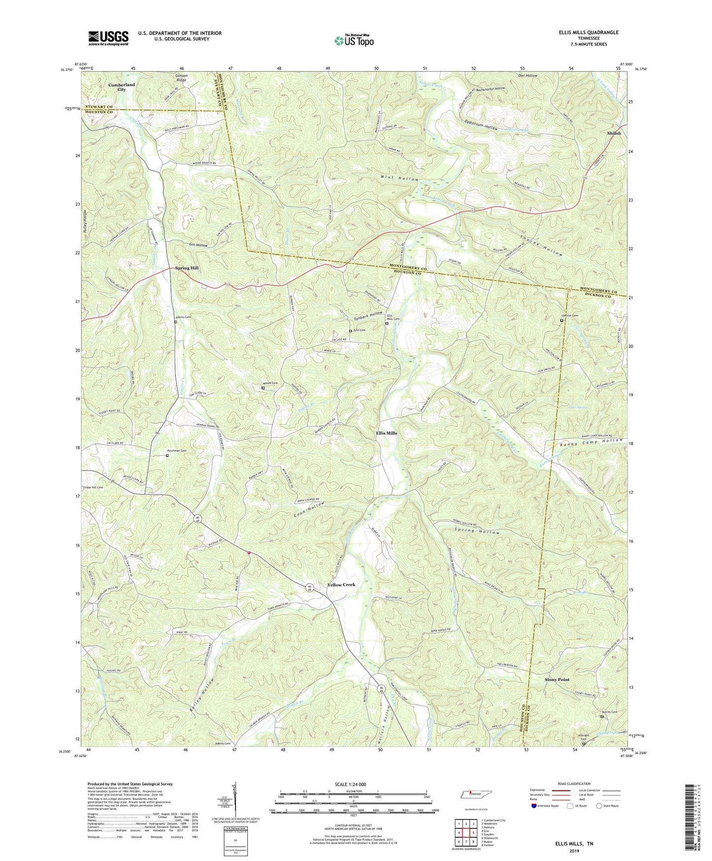
2019 topographic map quadrangle Ellis Mills in the state of Tennessee. Scale: 1:24000. Based on the newly updated USGS 7.5' US Topo map series, this map is in the following counties: Houston, Montgomery, Dickson, Stewart. The map contains contour data, water features, and other items you are used to seeing on USGS maps, but also has updated roads and other features. This is the next generation of topographic maps. Printed on high-quality waterproof paper with UV fade-resistant inks.
Quads adjacent to this one:
West: Erin
Northwest: Cumberland City
North: Needmore
Northeast: Palmyra
East: Slayden
Southeast: Vanleer
South: Ruskin
Southwest: Woolworth
Contains the following named places: Adkins Branch, Albright Cemetery, Averitt Cemetery, Baggett Branch, Bailey Hollow, Beech Grove Church, Boaz Branch, Bushwhacker Hollow, Cave Spring, Cave Spring Branch, Cave Spring School, Commissioner District 7, Coon Hollow, Crossroad Church, District 20, Dortch Chapel, Dry Branch, Dunbar School, Ellis Mills, Ellis Mills Cemetery, Ellis Mills Church, Gin Hollow, Griffin Chapel, Houston County Fire Department Erin Station, Indian Branch, Leatherwood Creek, Lyle Cemetery, Mint Hollow, Moore Branch, Moore Cemetery, Opossum Branch, Oppossum Hollow, Parchman Cemetery, Patterson Chapel, Raney Camp Branch, Raney Camp Hollow, Rye Cemetery, Sailors Rest, Sailors Rest Furnace, Salmon Branch, Shelton Cemetery, Shiloh, Shiloh School, Spring Hill, Spring Hill Church, Spring Hollow, Stony Point, Stony Point School, Story Point Church, Sullivan Branch, Tanbark Hollow, Thorne Hollow, Town Branch, Wallace Hollow, Williamson Branch, Yellow Creek, Yellow Creek High School