MyTopo
Slayden Tennessee US Topo Map
Couldn't load pickup availability
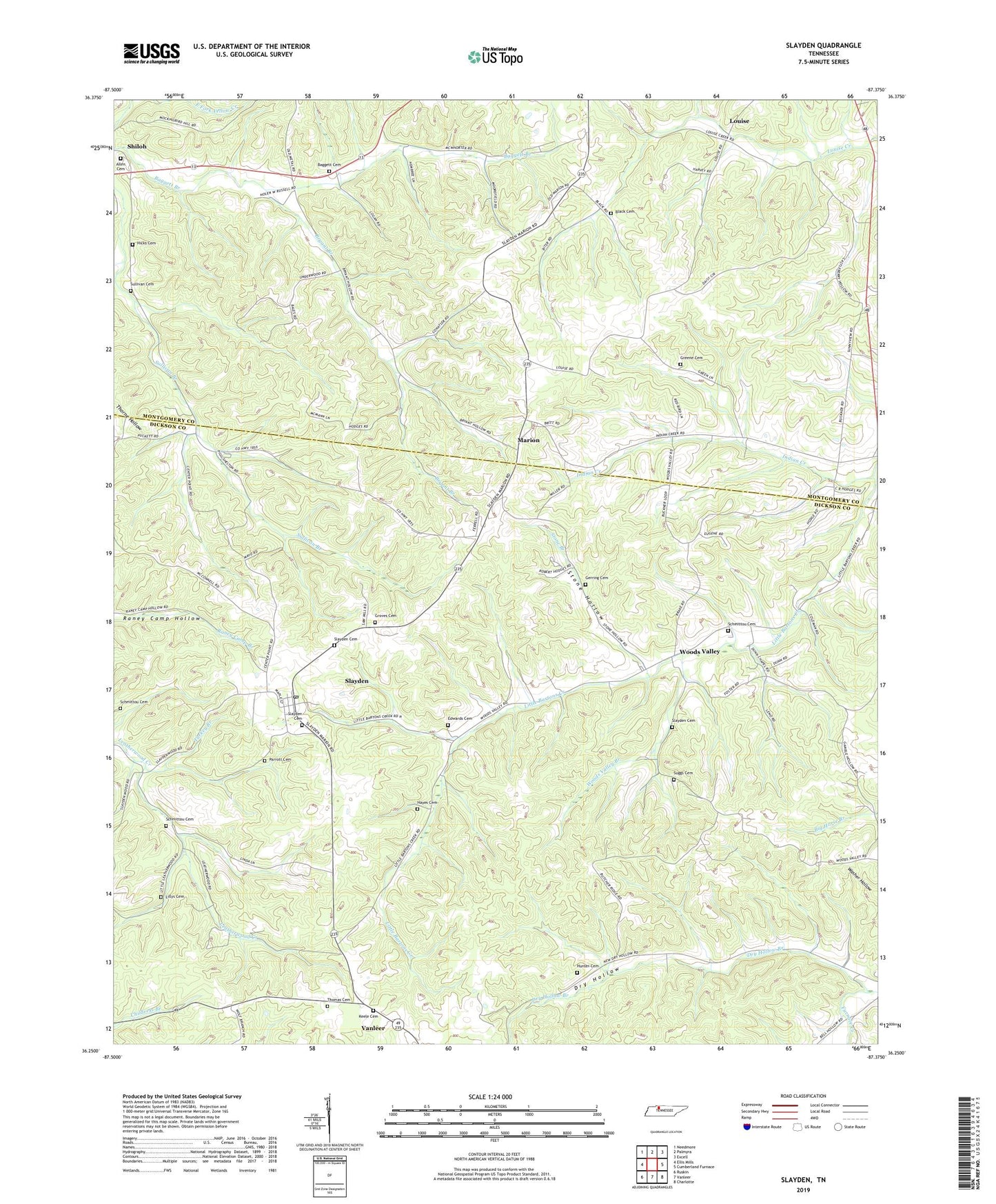
2022 topographic map quadrangle Slayden in the state of Tennessee. Scale: 1:24000. Based on the newly updated USGS 7.5' US Topo map series, this map is in the following counties: Dickson, Montgomery. The map contains contour data, water features, and other items you are used to seeing on USGS maps, but also has updated roads and other features. This is the next generation of topographic maps. Printed on high-quality waterproof paper with UV fade-resistant inks.
Quads adjacent to this one:
West: Ellis Mills
Northwest: Needmore
North: Palmyra
Northeast: Excell
East: Cumberland Furnace
Southeast: Charlotte
South: Vanleer
Southwest: Ruskin
This map covers the same area as the classic USGS quad with code o36087c4.
Contains the following named places: Allen Cemetery, Baggett Cemetery, Black Cemetery, Bryant Branch, District 22, Dry Hollow, Dry Hollow Branch, Dry Hollow School, Dunn Chapel, Dunns Chapel, Edwards Cemetery, Foster Cemetery, Geneva Church, Geneva School, Gerring Cemetery, Greene Cemetery, Groves Cemetery, Gum Springs Church, Hayes Cemetery, Hicks Cemetery, Hunter Cemetery, Keele Cemetery, Lillys Cemetery, Louise, Louise Furnace, Louise United Methodist Church, Marion, Marion United Methodist Church, Mount Zion Church, O K Furnace, Parrott Cemetery, Plainview Cemetery, Pleasant View Church, Potts School, Primitive Church, Rockdale School, Schmittou Cemetery, Schmittou Foster Cemetery, Slayden, Slayden Cemetery, Slayden Church of Christ, Slayden Church of God Cemetery, Slayden Missionary Baptist Church, Slayden Post Office, Slayden Presbyterian Church, Slayden School, Slaydens Mill, Stone Branch, Stone Hollow, Suggs Cemetery, Sullivan Cemetery, Thomas Cemetery, Town of Slayden, Turkey Branch, Vanleer Division, Wood Valley School, Woods Valley, Woods Valley Branch, Woods Valley United Methodist Church, ZIP Codes: 37051, 37165