MyTopo
Fairview Tennessee US Topo Map
Couldn't load pickup availability
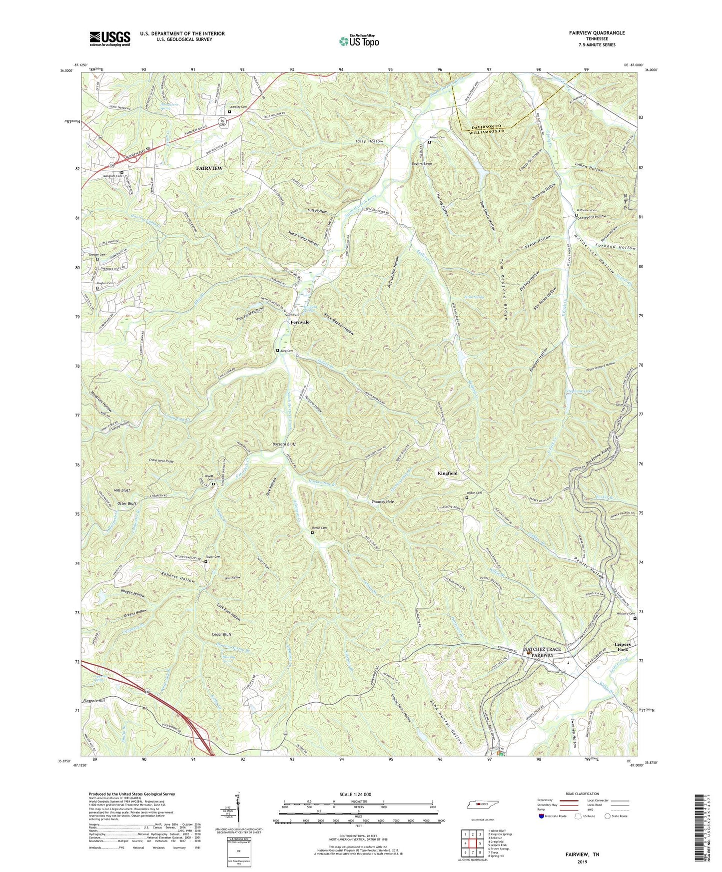
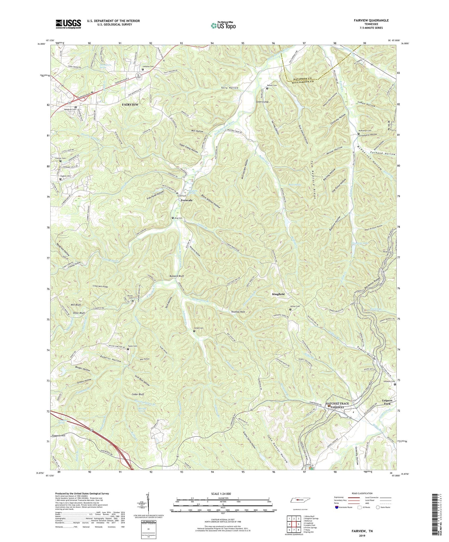
2019 topographic map quadrangle Fairview in the state of Tennessee. Scale: 1:24000. Based on the newly updated USGS 7.5' US Topo map series, this map is in the following counties: Williamson, Davidson. The map contains contour data, water features, and other items you are used to seeing on USGS maps, but also has updated roads and other features. This is the next generation of topographic maps. Printed on high-quality waterproof paper with UV fade-resistant inks.
Quads adjacent to this one:
West: Craigfield
Northwest: White Bluff
North: Kingston Springs
Northeast: Bellevue
East: Leipers Fork
Southeast: Spring Hill
South: Theta
Southwest: Primm Springs
Contains the following named places: Allen Branch, Arkansas Creek, Baptizing Hole, Basin Spring, Bear Hollow, Beasley Church, Bedford Creek, Big Ivey Hollow, Black Sulphur Hollow, Blowing Spring, Blowing Spring Branch, Booger Hollow, Buzzard Bluff, Caney Fork Creek, Cedar Bluff, Chester Cemetery, Chester Estates, Childress Hollow, Coldwater Branch, Coldwater School, Coleman Branch, Commissioner District 1, Copperas Branch, Copperas Spring, Crane Neck Ridge, Cross Paths, Fairview, Fairview Division, Fairview Post Office, Fernvale, Fernvale Church of Christ, Fernvale Dam, Fernvale Lake, Fernvale School, Fernvale Springs, Fish Pond Hollow, Flagpole Hill, Forhand Hollow, Grammer Estates, Graveyard Hollow, Greens Hollow, Hargrove Hollow, Harpendene Branch, Harpeth Furnace, Haskell School, Hillsboro Cemetery, Horntavern Spring, Hughes Cemetery, Hunting Camp Creek, Ike Ivey Hollow, Inman Branch, Inman Cemetery, Inman Hollow, Kelley Creek, King Cemetery, Kingfield, Lakeview Estates, Lampley Cemetery, Little East Fork, Lone Oak, Lovers Leap, Mangrum Cemetery, Mangrum Hollow, Mayfield Spring, McCrutchen Hollow, McPherson Cemetery, McPherson Hollow, Mill Bluff, Mill Hollow, Oak Tree, Otter Bluff, Peach Orchard Hollow, Pewitt Cemetery, Pewitt Chapel, Pinewood Branch, Pond Church, Redford Hollow, Reese Hollow, Roberts Hollow, Rolling Acres, Rotary Club Dam, Russell Cemetery, Shelton Hollow, Slat Fence Hollow, Sleepy Hollow, Slick Rock Hollow, Smith Cemetery, South Harpeth Creek, Stephens Lake, Stevens Creek, Stovall Branch, Sugar Camp Hollow, Susan Hollow, Sweeney Hollow, Tally Hollow, Taylor Cemetery, Tennessee Industrial School Camp, Tobacco Patch Hollow, Tom Redford Ridge, Tom Smith Hollow, Twomey Hole, Twomey Hole Branch, White Oak Branch, Wilkie Branch, Williamson County Landfill, Wilson Cemetery, York Hollow