MyTopo
Primm Springs Tennessee US Topo Map
Couldn't load pickup availability
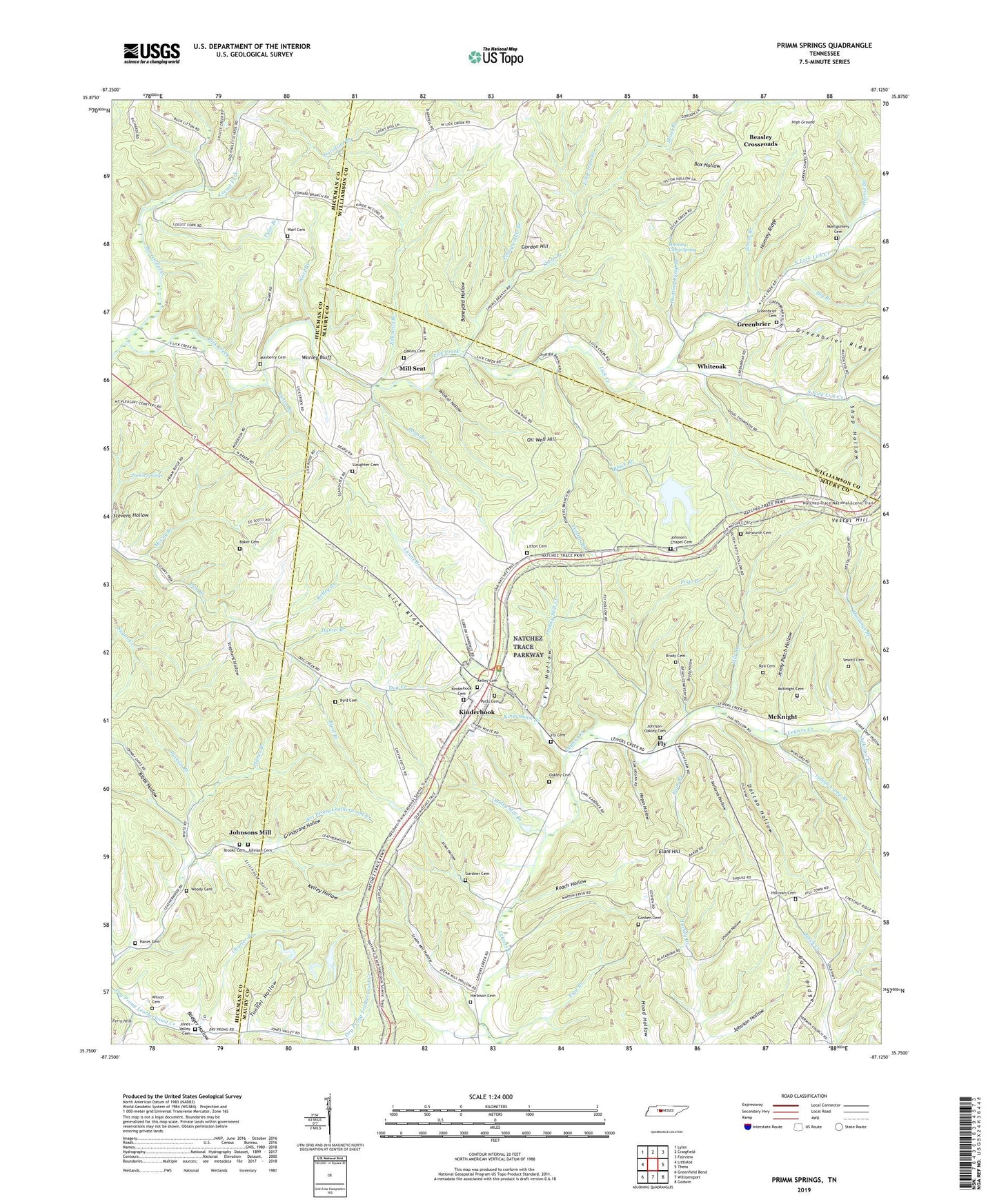
2022 topographic map quadrangle Primm Springs in the state of Tennessee. Scale: 1:24000. Based on the newly updated USGS 7.5' US Topo map series, this map is in the following counties: Maury, Hickman, Williamson. The map contains contour data, water features, and other items you are used to seeing on USGS maps, but also has updated roads and other features. This is the next generation of topographic maps. Printed on high-quality waterproof paper with UV fade-resistant inks.
Quads adjacent to this one:
West: Littlelot
Northwest: Lyles
North: Craigfield
Northeast: Fairview
East: Theta
Southeast: Godwin
South: Williamsport
Southwest: Greenfield Bend
This map covers the same area as the classic USGS quad with code o35087g2.
Contains the following named places: Adkison Branch, Ashworth Cemetery, Badger Hollow, Baker Cemetery, Barren Fork, Beasley Church, Beasley Crossroads, Bibbs Hollow, Big Branch, Black Branch, Boneyard Hollow, Box Hollow, Brady Cemetery, Brady Hollow, Brooks Cemetery, Burr Ridge, Byrd Branch, Byrd Cemetery, Charter Branch, Corner School, Daniel Branch, Davidson Branch, District 1, Dorton Hollow, Edwards Branch, Elam Branch, Elam Hill, Ellmore School, Elmo School, Fly, Fly Cemetery, Fly Church, Fly Hollow, Forked Deer Hollow, Gardner Cemetery, Gordon Hill, Goshen Cemetery, Goshen Church, Greenbrier, Greenbrier Cemetery, Greenbrier School, Greenbrier United Methodist Church, Grindstone Hollow, Hanes Branch, Hanes Cemetery, Harbison Cemetery, Harris Branch, Hastings Branch, High Ground, Hill Branch, Hill Town, Hill Town Church, Hilltown Cemetery, Hogan Hollow, Hominy Ridge, Hunting Camp Branch, Hunting Camp Spring, Indian Camp Branch, Jenny Patch Hollow, Johnson Cemetery, Johnson Chapel, Johnson Hollow, Johnson School, Johnson-Oakley Cemetery, Johnsons Chapel Cemetery, Johnsons Mill, Jones Hollow, Jones Valley Cemetery, Kelley Branch, Kelley Cemetery, Kelley Hollow, Kinderhook, Kinderhook Branch, Kinderhook Cemetery, Leatherwood, Lick Creek, Lick Ridge, Little Dam Branch, Litton Cemetery, Locust Fork, Lucketts Chapel, Lunns Branch, Mayberry, Mayberry Cemetery, McCoy Branch, McKnight, McKnight Cemetery, Mill Seat, Montgomery Cemetery, Mount La View School, Nellums Hollow, New Flys Village, North Fork Lick Creek, Oakley Cemetery, Oakley Mill Branch, Oakley Mill Creek, Oil Well Hill, Page Branch, Parham Chapel, Pennywinkle Branch, Piner Ford, Porters Branch, Potts Branch, Potts Cemetery, Primm Springs, Puckett Branch, Rail Cemetery, Roach Hollow, Santa Fe Division, Sewell Cemetery, Shoal Branch, Shoals Branch School, Shop Hollow, Shouse Hollow, Simon Branch, Slaughter Cemetery, South Fork Lick Creek, Steam Mill Hollow, Stephens Hollow, Stillhouse Hollow, Sylvan Heights School, Tunnel Hollow, Tyler Branch, Vestal Hill, Warf Branch, Warf Cemetery, Whiteoak, Wildcat Hollow, Wilson Cemetery, Woody Cemetery, Worley Bluff, ZIP Codes: 38476, 38482