MyTopo
Spring Hill Tennessee US Topo Map
Couldn't load pickup availability
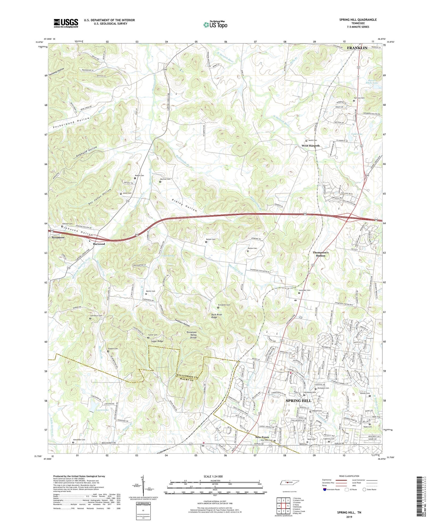
2022 topographic map quadrangle Spring Hill in the state of Tennessee. Scale: 1:24000. Based on the newly updated USGS 7.5' US Topo map series, this map is in the following counties: Williamson, Maury. The map contains contour data, water features, and other items you are used to seeing on USGS maps, but also has updated roads and other features. This is the next generation of topographic maps. Printed on high-quality waterproof paper with UV fade-resistant inks.
Quads adjacent to this one:
West: Theta
Northwest: Fairview
North: Leipers Fork
Northeast: Franklin
East: Bethesda
Southeast: Rally Hill
South: Carters Creek
Southwest: Godwin
This map covers the same area as the classic USGS quad with code o35086g8.
Contains the following named places: Alexander Cemetery, Barker Cemetery, Bear Creek, Bethel Church, Burwood, Calvary Church, Caperton Cemetery, Carter Cemetery, Cayce Branch, Cayce Spring, Cheatham, Commissioner District 3, Connection Hill Church, Country Haven Estates, Doc Jones Hollow, Dodson Cemetery, Dogwood Hollow, Evergreen Cemetery, Evergreen Church, Fedco Siding, Forest Hill Church, Forest Hill School, Gary Lake, Harrison Cemetery, Homestead Manor Plantation, Johnson Cemetery, Johnson Hollow, Jones Cemetery, Kelly Branch, Laura Lake, Laura Lake Dam, Laurel Hill Plantation, Lavender Cemetery, Lawrence Cemetery, Lawrence Grove Church, Lea Farm Plantation, Leipers Fork Church, Little Carters Creek, Martin Cemetery, Mayberry, McCormack Crossing, McKee Cemetery, McMeen Branch, Morganville, Mount Lavergne Church, Mount Lavergne School, Murfree Cemetery, New Town, New Town Cemetery, Nicholson Cemetery, North Cemetery, Patton Cemetery, Peckerwood Hollow, Perkins Church, Pleasantdale Church, Pointer Cemetery, Rattlesnake Branch, Ridley Hollow, Roderick Plantation, Russel White Dam, Russel White Lake, Satterfield, Sherwood Mansion, Spring Green Farm, Spring Hill, Spring Hill Elementary School, Spring Hill Fire Department Station 1, Spring Hill Fire Department Station 3, Spring Hill High School, Spring Hill Post Office, Spring Hill Station, Sugar Ridge, Swanson Hollow, Sycamore, Sycamore Cree, Thompson's Station, Thompsons Station Post Office, Todd Lake, Todd Lake Dam, Town of Thompson's Station, Wade Cemetery, Walton Cemetery, Warioto Farms, Wells Cemetery, West Harpeth, West Harpeth Church, West Harpeth School, West Prong Murfrees Fork, Westend Church, Wilkes, ZIP Code: 37179