MyTopo
Theta Tennessee US Topo Map
Couldn't load pickup availability
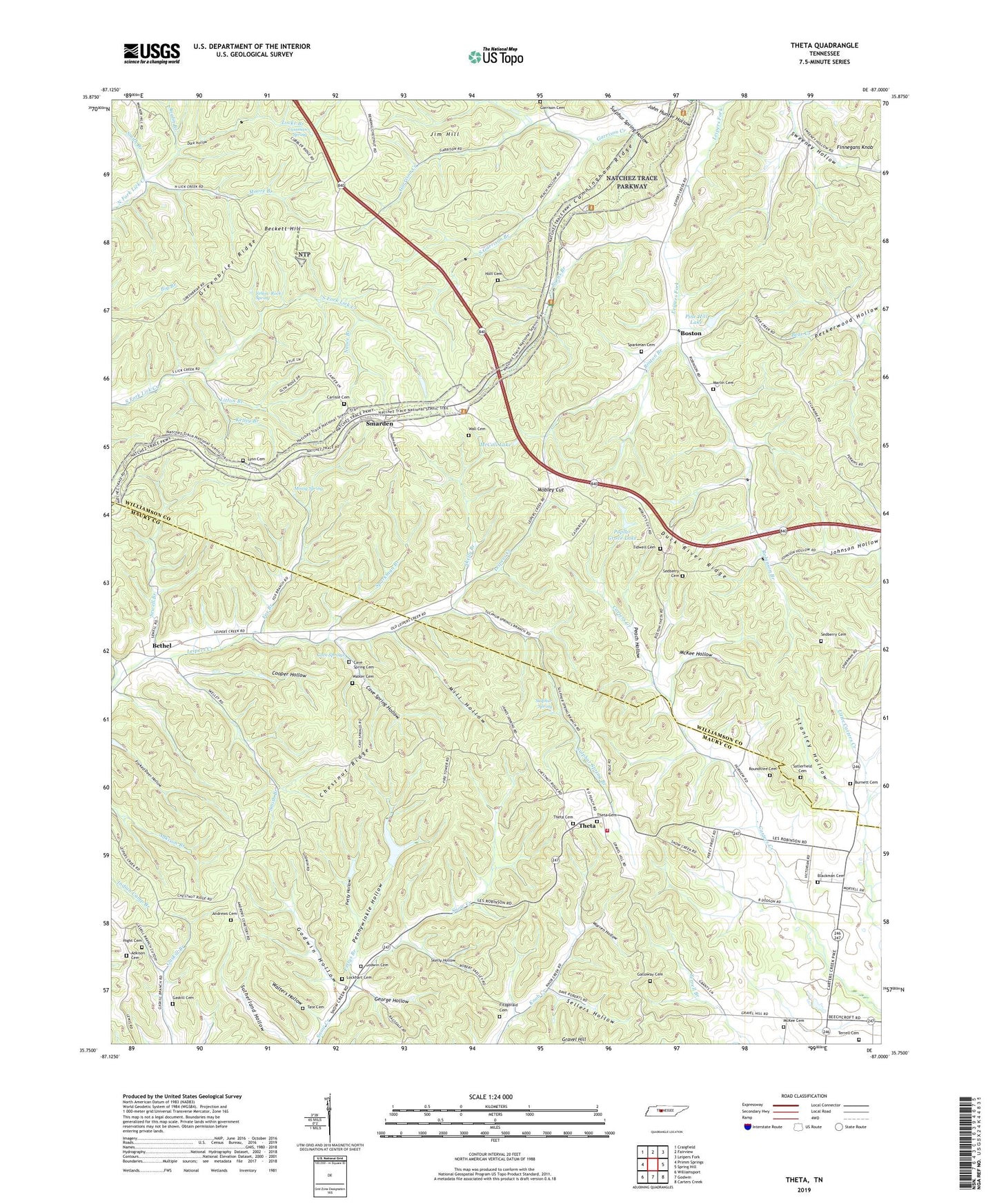
2022 topographic map quadrangle Theta in the state of Tennessee. Scale: 1:24000. Based on the newly updated USGS 7.5' US Topo map series, this map is in the following counties: Williamson, Maury. The map contains contour data, water features, and other items you are used to seeing on USGS maps, but also has updated roads and other features. This is the next generation of topographic maps. Printed on high-quality waterproof paper with UV fade-resistant inks.
Quads adjacent to this one:
West: Primm Springs
Northwest: Craigfield
North: Fairview
Northeast: Leipers Fork
East: Spring Hill
Southeast: Carters Creek
South: Godwin
Southwest: Williamsport
This map covers the same area as the classic USGS quad with code o35087g1.
Contains the following named places: Adkison Cemetery, Andrews Cemetery, Anglin Branch, Beckett Hill, Bending Chestnut, Bethel, Bethel Methodist Church, Bethel School, Blackburns Mill, Blackman Cemetery, Boston, Boston Branch, Boston Division, Burnett Cemetery, Burns Branch, Carlisle Cemetery, Cassman Spring, Cave Spring Cemetery, Cave Spring Church, Cave Spring Hollow, Cave Springs, Cave Springs School, Cedar Grove Church, Chestnut Ridge, Chestnut Ridge Church, Commissioner District 6, Cooper Hollow, Cunningham Ridge, Dark Hollow, District 19, Fairview Church, Finnegans Knob, Fitzgerald Cemetery, Fox Branch, Galloway Cemetery, Garrison Cemetery, Garrison Church, Garrison Creek, Gaskill Cemetery, George Hollow, Godwin Cemetery, Godwin Hollow, Gravel Hill, Greenbrier Ridge, Hatcher Mine, Hight Cemetery, Holt Cemetery, Holts Chapel, Jameson, Jim Hill, John Hunter Hollow, Kelley Branch, Litton Branch, Locke Branch, Lockhart Cemetery, Loco, Lost Acres Dam, Lost Acres Lake, Lynn Cemetery, Marlin Cemetery, Maury County Fire Department Station 9 Theta, McCall Lake, McCall Lake Dam, McKee Cemetery, McKee Hollow, Mill Hollow, Mobley Cut, Moore Branch, Mossy Spring, Mossy Spring School, Mount Bethel Church, Nance Branch, Parham School, Peach Hollow, Pennywinkle Hollow, Petty Hollow, Pettys Branch, Pine Hill Dam, Pine Hill Lake, Poplar Grove Dam Number One, Poplar Grove Lake, Robinson Branch, Roundtree Cemetery, Satlerfield Cemetery, Sedberry Cemetery, Sellers Hollow, Sewell Branch, Skelly Branch, Skelly Hollow, Smarden, Smith Branch, South Garrison Branch, Sparkman Branch, Sparkman Cemetery, Stanley Hollow, Sulphur Spring, Sulphur Spring Branch, Sulphur Spring Hollow, Sulphur Springs, Tate Cemetery, Taylor Chapel, Terrell Cemetery, Theta, Theta Baptist Church, Theta Cemetery, Theta Church of Christ, Theta Community Center, Theta School, Theta United Methodist Church, Tidwell Cemetery, Union Church, Union School, Walker Cemetery, Wall Cemetery, Walters Hollow, Warren Hollow, Yellow Rock Spring