MyTopo
Gallaway Tennessee US Topo Map
Couldn't load pickup availability
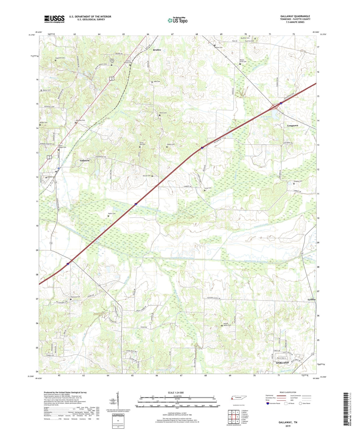
2019 topographic map quadrangle Gallaway in the state of Tennessee. Scale: 1:24000. Based on the newly updated USGS 7.5' US Topo map series, this map is in the following counties: Fayette. The map contains contour data, water features, and other items you are used to seeing on USGS maps, but also has updated roads and other features. This is the next generation of topographic maps. Printed on high-quality waterproof paper with UV fade-resistant inks.
Quads adjacent to this one:
West: Arlington
Northwest: Brighton
North: Mason
Northeast: Stanton
East: Lambert
Southeast: Macon
South: Oakland
Southwest: Eads
Contains the following named places: Beaver Cemetery, Black Ankle Creek, Braden City Hall, Braden Division, Cane Creek, Center Point, City of Gallaway, Clifton Summit Cemetery, Douglas Cemetery, Fields School, Flournoy Cemetery, Gallaway, Gallaway Cemetery, Gallaway City Hall, Gallaway Community Center, Gallaway First Baptist Church, Gallaway Police Department, Gallaway Post Office, Greshams Dam, Greshams Lake, Griffen, Griffin School, Harris Cemetery, Herron Cemetery, Hick Thomas School, Hickory Withe Fire Department, Hillard Nolley Cemetery, Hopewell Cemetery, Layton Cemetery, Little Cypress Creek Canal, Longtown, Longtown School, Loosahatchie River Canal, Lucas Cemetery, Melton Cemetery, Mount Sinai Cemetery, Mount Sinai Church, New Prospect Church, Nolley Chapel, OKelly Cemetery, Pipkin Cemetery, Pleasant Hill Church, Poplar Springs Cemetery, Poplar Springs Church, Prospect Church, R E Williams School, Rosser Cemetery, Scotts Chapel Cemetery, Stevens Store, Town of Braden, Treadville Creek, Tucker Temple, Union Hill Cemetery, Union Hill Church, Union Hill School, W W Wilder Dam, W W Wilder Lake, Wall Cemetery, Waymond Cemetery, Weber Branch, Wilder Creek, Wirt School