MyTopo
Gobey Tennessee US Topo Map
Couldn't load pickup availability
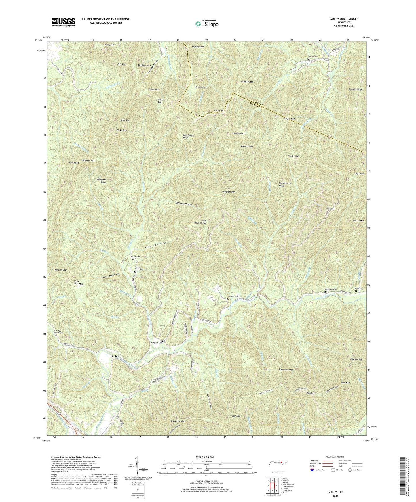
2022 topographic map quadrangle Gobey in the state of Tennessee. Scale: 1:24000. Based on the newly updated USGS 7.5' US Topo map series, this map is in the following counties: Morgan, Scott. The map contains contour data, water features, and other items you are used to seeing on USGS maps, but also has updated roads and other features. This is the next generation of topographic maps. Printed on high-quality waterproof paper with UV fade-resistant inks.
Quads adjacent to this one:
West: Pilot Mountain
Northwest: Rugby
North: Robbins
Northeast: Norma
East: Fork Mountain
Southeast: Petros
South: Camp Austin
Southwest: Lancing
This map covers the same area as the classic USGS quad with code o36084b5.
Contains the following named places: Bear Bench Ridge, Beech Branch, Big Lick Gap, Cane Branch, Cane Branch Church, Caney Branch Cemetery, Dry Branch, Edmund Branch, Elizabeth, Elizabeth Cemetery, Elizabeth Church, Elizabeth School, Emory, Emory River Church, England Mountain, Fall Hollow, Fork Mountain, Freels Mountain, Gladey Branch, Gobey, Gobey School, Gosnell Branch, Gosnell Ridge, Grapevine Gap, Greasy Creek, Greasy Creek Cemetery, Griffith Mountain, Griffith School, Grimes Branch, Hall Branch, Hamby Cemetery, Hamby Gap, Hangover Ridge, Harriman Red Ash Mine, High Knob, Holloway Hollow, Huckleberry Ridge, Jeff Gap, Jim Branch, Joe Creek, Judge Branch, Justice Mountain, Knolling Knob, Landrom Mountain, Laurel Branch, Laurel Fork, Little Creek, Little Pilot Mountain, Low Gap, Macedonia Cemetery, Macedonia Church, Maden Branch, McCartt Cemetery, McCartt Gap, Melrose, Middle Branch, Mike Hollow, Mill Branch, North Prong Flat Fork, Oak Hill, Oak Hill School, Peaky Mountain, Phillips Creek, Pleas McCartt Mountain, Polly Gap, Pond Knob, Potato Knob, Rhoda Creek, Richland Mountain, Rock Creek, Rocky Hollow, Ross Gap, Sang Branch, Service Flat, Sexton Cemetery, Spruce Lick Creek, Stillhouse Branch, Sugarcamp Hollow, Thompson Mountain, Tom Branch, Webb Gap, Whiteoak Creek, Whiteoak Gap, Wilson Pewee Mine, Wright Mountain, Young Creek, Young Mountain