MyTopo
Huntsville Tennessee US Topo Map
Couldn't load pickup availability
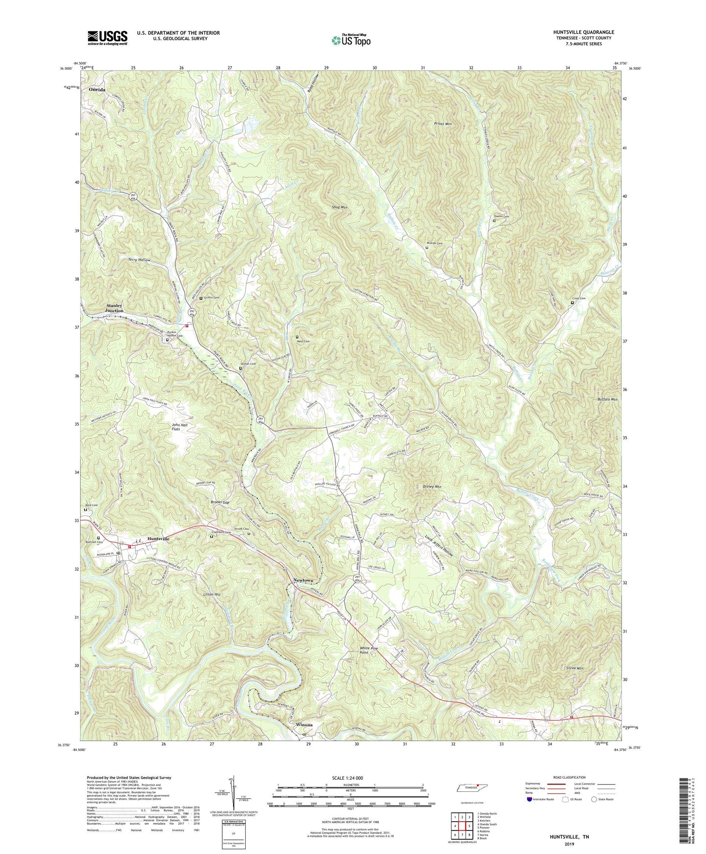
2019 topographic map quadrangle Huntsville in the state of Tennessee. Scale: 1:24000. Based on the newly updated USGS 7.5' US Topo map series, this map is in the following counties: Scott. The map contains contour data, water features, and other items you are used to seeing on USGS maps, but also has updated roads and other features. This is the next generation of topographic maps. Printed on high-quality waterproof paper with UV fade-resistant inks.
Quads adjacent to this one:
West: Oneida South
Northwest: Oneida North
North: Winfield
Northeast: Ketchen
East: Pioneer
Southeast: Block
South: Norma
Southwest: Robbins
Contains the following named places: Acres School, Allen Creek, Almy School, Anadell Church, Bowl, Brooks Gap, Browns Branch, Brushy Branch, Buffalo Bridge Church, Buffalo Bridge School, Buffalo School, Buttram Cemetery, Byrd Cemetery, Capitol Hill School, Cave Branch, Chambers Cemetery, Commissioner District 3, Cordell Creek, Cross Cemetery, Ditney Mountain, Doctors, East 63 Volunteer Fire Department, Fairview Church, Fairview Elementary School, Five Black Gum Church, Flat Creek, Griffin Cemetery, Huntsville, Huntsville Elementary School, Huntsville Fire Department, Huntsville First Baptist Church, Huntsville High School, Huntsville Middle School, Huntsville Post Office, John Hall Flats, Laurel Branch, Little Creek, Litton Hill, Louis Jeffers Hollow, Marcum Creek, Mount Zion Baptist Church, New Salem Church, Newtown, Newtown Church, Owens Cemetery, Paint Rock Church, Paint Rock Creek, Paint Rock Volunteer Fire Department, Phillips Branch, Phillips Cemetery, Phillips Creek, Posey School, Privet Mountain, Punkin Hollow Cemetery, Reed Hollow, Rockhouse Fork, Scott County Home, Sexton Cemetery, Shug Mountain, Silcox Mountain, Slick Rock Branch, Smith Creek, Stanley Creek, Stanley Junction, Strunk Cemetery, Sugar Grove Church, Terry Hollow, Trammel Branch, West Cemetery, West Creek, White Pine Point, White Rock Church, Winona, Winona Post Office, Winona School