MyTopo
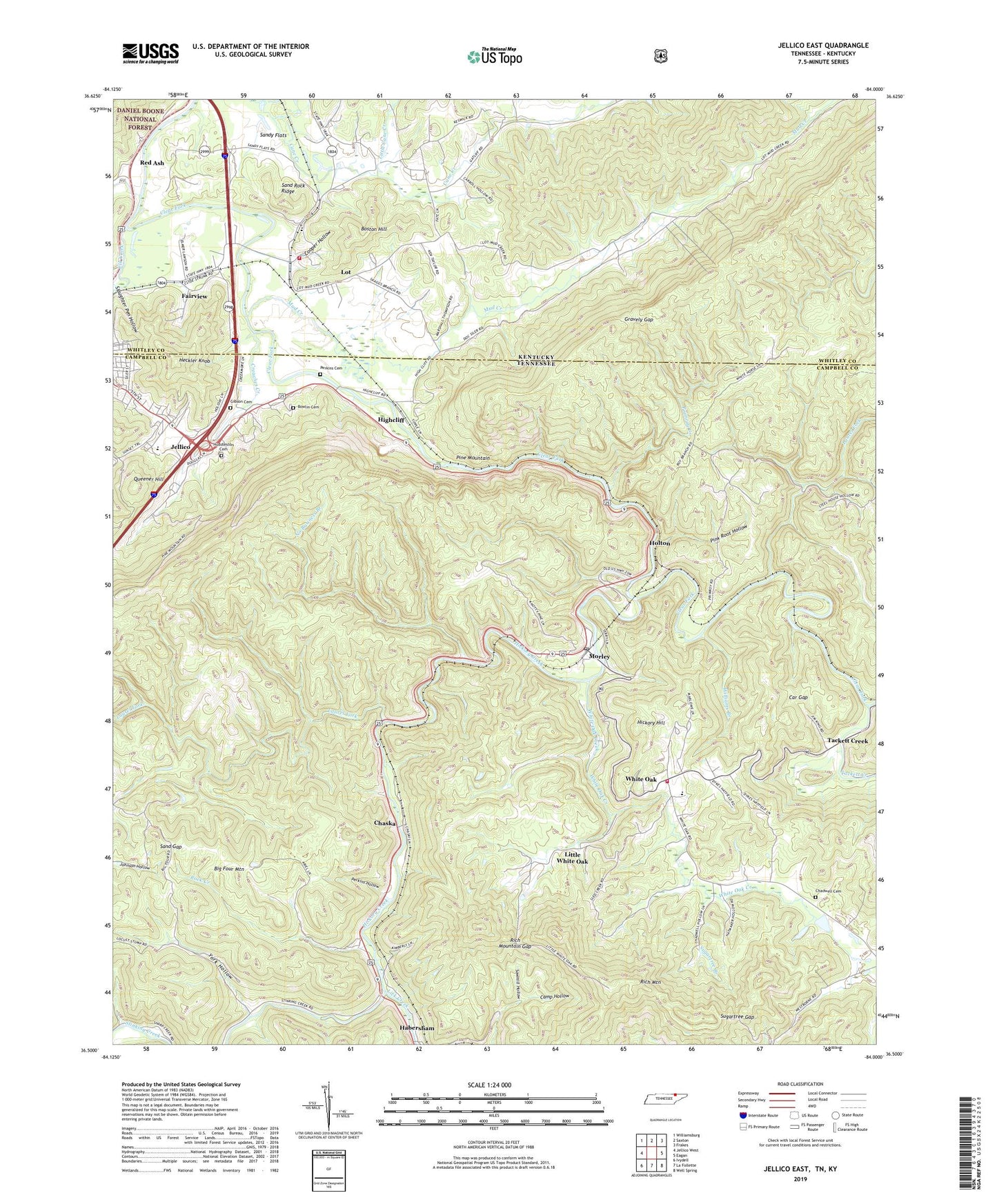
Jellico East Tennessee US Topo Map
Couldn't load pickup availability
Also explore the Jellico East Forest Service Topo of this same quad for updated USFS data
2022 topographic map quadrangle Jellico East in the states of Tennessee, Kentucky. Scale: 1:24000. Based on the newly updated USGS 7.5' US Topo map series, this map is in the following counties: Campbell, Whitley, Claiborne. The map contains contour data, water features, and other items you are used to seeing on USGS maps, but also has updated roads and other features. This is the next generation of topographic maps. Printed on high-quality waterproof paper with UV fade-resistant inks.
Quads adjacent to this one:
West: Jellico West
Northwest: Williamsburg
North: Saxton
Northeast: Frakes
East: Eagan
Southeast: Well Spring
South: La Follette
Southwest: Ivydell
This map covers the same area as the classic USGS quad with code o36084e1.
Contains the following named places: Big Four Mountain, Blue Rose Mine, Boston Church, Boston Hill, Boston School, Bowlin Cemetery, Brooks Graham Mine, Burke Hollow Railroad Station, Camp Hollow, Cane Creek Church, Car Gap, Carl Duncan Mine, Chadwell Cemetery, Chaska, Clear Fork Church, Cooper Hollow, Crouches Creek, Crouches Creek Baptist Church, Elk Creek, Ewing School, Fairview, Gibson Cemetery, Gravely Gap, Habersham Division, Heckler Knob, Hickory Creek, Hickory Hill, High Cliff Missionary Baptist Church, Highcliff, Holton, Huddleston Cemetery, Jellico High School, Keswick Railroad Station, Laurel Fork, Lick Creek, Little Cane Creek, Little White Oak, Little White Oak Independent Missionary Baptist Church, Lot, Morley, Morley Baptist Church, Morley Post Office, Mud Creek, No Business Branch, Perkins Cemetery, Perkins Hollow, Pigeon Roost Creek, Pink Root Hollow, Primroy Church, Primroy Creek, Queener Hill, Red Ash, Rich Mountain, Rich Mountain Gap, Rock Creek, Sand Gap, Sand Rock Ridge, Sandy Flats, Sawmill Hollow, Slaughter Pen Hollow, South Whitley Volunteer Fire Department, Stateline Railroad Station, Sugartree Branch, Sugartree Gap, Sulphur Spring Church, Tackett Creek, Walnut Grove Church, Wesleyan Church, White Oak, White Oak Church of Christ, White Oak Creek, White Oak Elementary School, White Oak Missionary Baptist Church, White Oak Volunteer Fire Department, Williams Branch, York Hollow, ZIP Code: 37729