MyTopo
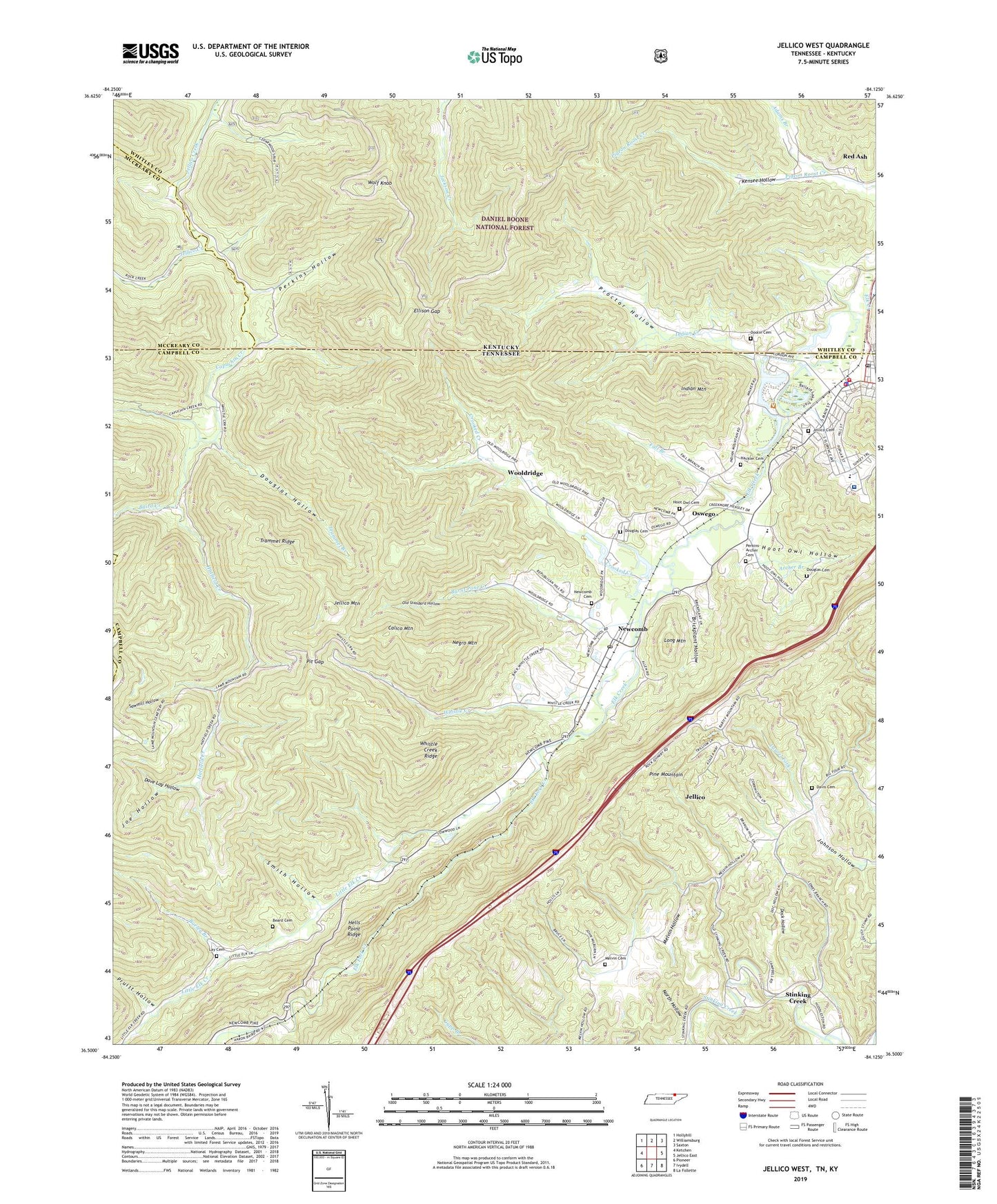
Jellico West Tennessee US Topo Map
Couldn't load pickup availability
Also explore the Jellico West Forest Service Topo of this same quad for updated USFS data
2022 topographic map quadrangle Jellico West in the states of Tennessee, Kentucky. Scale: 1:24000. Based on the newly updated USGS 7.5' US Topo map series, this map is in the following counties: Campbell, Whitley, McCreary, Scott. The map contains contour data, water features, and other items you are used to seeing on USGS maps, but also has updated roads and other features. This is the next generation of topographic maps. Printed on high-quality waterproof paper with UV fade-resistant inks.
Quads adjacent to this one:
West: Ketchen
Northwest: Hollyhill
North: Williamsburg
Northeast: Saxton
East: Jellico East
Southeast: La Follette
South: Ivydell
Southwest: Pioneer
This map covers the same area as the classic USGS quad with code o36084e2.
Contains the following named places: Adams Branch, Archer Branch, Baird Creek, Bairds Chapel, Barley Branch, Beard Cemetery, Black Oak Church, Black Oak School, Brickplant Hollow, Brickplant Hollow Church, Burnt Pone Creek, Calico Mountain, Capuchin Creek, City of Jellico, Coal Mine, Crooked Creek, Dave Lay Hollow, Davis Cemetery, Dock Hollow, Doolin Cemetery, Douglas Cemetery, Douglas Hollow, Elk Fork Creek, Elk Valley Division, Ellison Gap, Fall Branch, First Baptist Church, Good Hope United Baptist Church, Hackler Cemetery, Hatfield Creek, Hells Point Ridge, Hoot Owl Cemetery, Hoot Owl Hollow, Indian Creek, Indian Mountain, Indian Mountain State Forest, Indian Mountain State Park, Jackson Creek, Jeff Hollow, Jellico, Jellico Cemetery, Jellico Church of God, Jellico Community Hospital, Jellico Elementary School, Jellico Fire Department, Jellico Life Saving and Rescue Squad, Jellico Mountain, Jellico Police Department, Jellico Post Office, Jellico United Methodist Church, Jellico Water Treatment Plant, Joe Hollow, Johnson Hollow, Kelsey Switch, Kensee Church, Kensee Coal Mine, Kensee Hollow, Kensee Railroad Station, Lay Cemetery, Little Elk Creek, Little Elk School, Little Elk United Baptist Church, Long Mountain, Melvin Cemetery, Melvin Hollow, Negro Mountain, Newcomb, Newcomb Baptist Church, Newcomb Cemetery, Newcomb Elementary School, Newcomb Post Office, North Hollow, North Regional Emergency Medical Services, Old Standard Hollow, Oswego, Oswego Industrial Park, Oswego Missionary Baptist Church, Oswego School, Perkins Hollow, Perkins-Archer Cemetery, Perry Branch, Pit Gap, Proctor Hollow, Pruitt Hollow, Red Ash Coal Camp, Rodeheaver Church, Sawmill Hollow, Smith Hollow, Stanville Church, Stinking Creek, Stinking Creek Elementary School, Tannery Hollow Missionary Baptist Church, Trammel Branch, Trammel Ridge, Whistle Creek, Whistle Creek Mine, Whistle Creek Ridge, WJJT-AM (Jellico), Wolf Knob, Wooldridge, Woolridge School, Zion Hill School, ZIP Codes: 37762, 37819