MyTopo
La Follette Tennessee US Topo Map
Couldn't load pickup availability
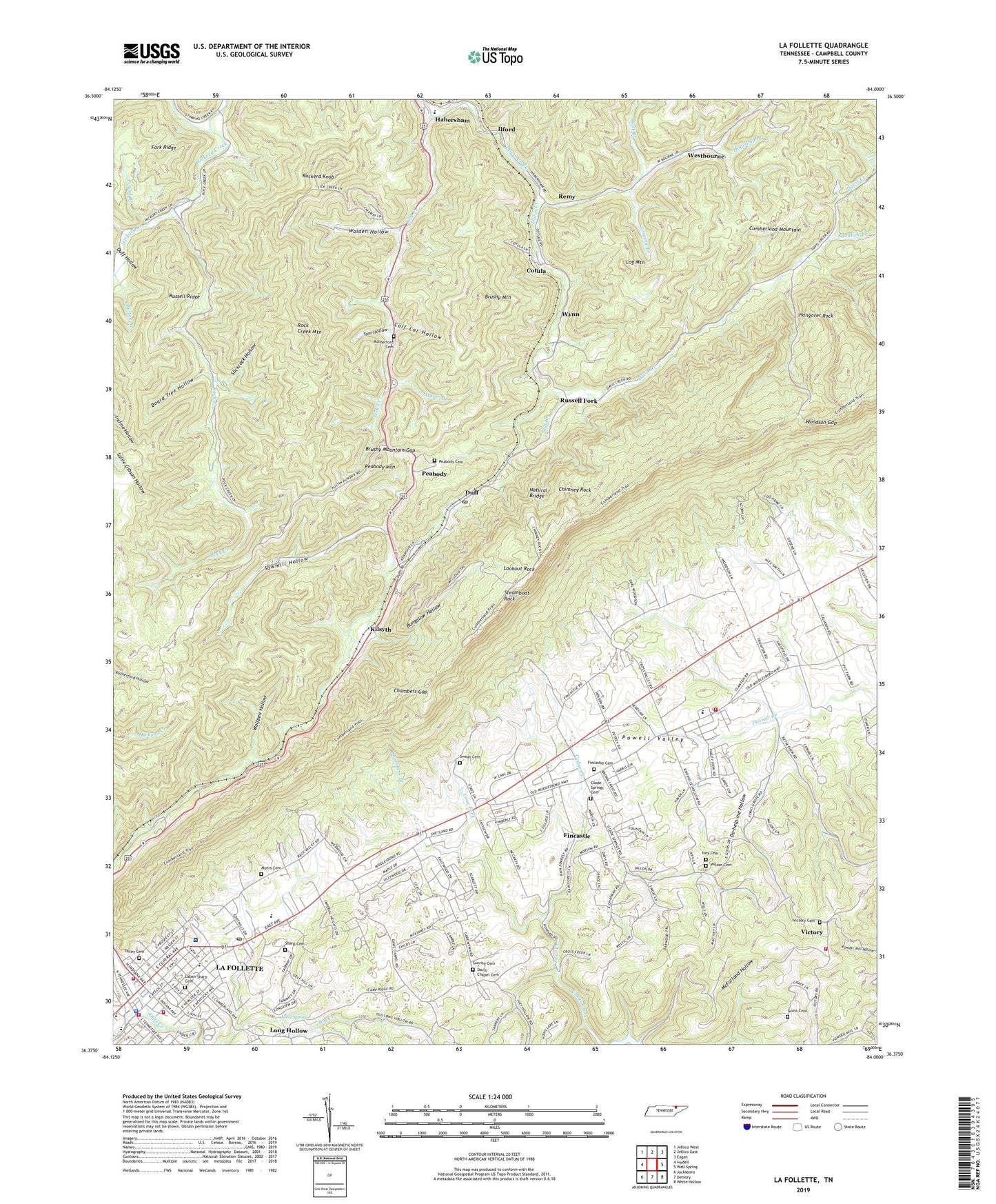
2022 topographic map quadrangle La Follette in the state of Tennessee. Scale: 1:24000. Based on the newly updated USGS 7.5' US Topo map series, this map is in the following counties: Campbell. The map contains contour data, water features, and other items you are used to seeing on USGS maps, but also has updated roads and other features. This is the next generation of topographic maps. Printed on high-quality waterproof paper with UV fade-resistant inks.
Quads adjacent to this one:
West: Ivydell
Northwest: Jellico West
North: Jellico East
Northeast: Eagan
East: Well Spring
Southeast: White Hollow
South: Demory
Southwest: Jacksboro
This map covers the same area as the classic USGS quad with code o36084d1.
Contains the following named places: Board Tree Hollow, Bolton Branch, Brushy Mountain, Brushy Mountain Gap, Bungalow Hollow, Calf Lot Hollow, Campbell County EMS, Campbell County Rural Fire Service Station 1 Headquarters, Campbell County Rural Fire Service Station 2, Cave Spring, Chambers Branch, Chambers Gap, Charity Worship Center, Chimney Rock, Commissioner District 2, Cotula, Cove Fork, Davis Chapel, Davis Chapel Baptist Church, Davis Chapel Cemetery, Davis Chapel Community Center, Davis Chapel School, Davis Creek, Davis Creek Church, Do-help-me Hollow, Duff, Duff Baptist Church, Duff Hollow, Duff Post Office, Duff School, East La Follette Baptist Church, Elm Grove Church, Fincastle, Fincastle Cemetery, Fincastle Census Designated Place, Fincastle Division, Fincastle Methodist Church, First Independent Missionary Baptist Church, First Presbyterian Church, Fork Ridge, Forks Grove Church, Glade Springs Baptist Church, Glade Springs Cemetery, Goins Cemetery, Granny Branch, Habersham, Hangover Rock, Hogcamp Branch, Ilford, Indiana Avenue Baptist Church, Ivey Cemetery, Ivey Hollow, James Mine, Jordan Hollow, Kilsyth, Kincaid Historical Monument, La Follette Church of Christ, La Follette Country Club, La Follette East Elementary School, La Follette High School, La Follette Post Office, La Follette United Methodist Church, La Follette West Elementary School, Laban Sharp Cemetery, LaFollette, LaFollette Fire Department Station 1, Lafollette Medical Center, LaFollette Police Department, Log Mountain, Long Hollow, Lookout Rock, Major Branch, Mill Branch, Myers Cemetery, Natural Bridge, New Hope Church, Peabody, Peabody Cemetery, Peabody Mountain, Peabody School, Pleasant Grove Baptist Church, Pound Branch, Remy, Rock Creek, Rock Creek Mountain, Ruckerd Knob, Russell Fork, Russell Ridge, Rutherford Cemetery, Sandlick Branch, Sawmill Hollow, Sharp Cemetery, Slickrock Hollow, Steamboat Rock, Stinking Creek, Sunrise Cemetery, Sweat Cemetery, Talley Cemetery, Tennessee Department of Agriculture Division of Forestry Campbell County, Tom Hollow, Valley View Elementary School, Victory, Victory Baptist Church, Victory Cemetery, Victory School, Vital Care Transportation Ambulance Service, Walden Hollow, Westbourne, Wilson Cemetery, Wolf Branch, Wolfpen Hollow, Woodson Gap, Woodson Gap Baptist Church, WTNQ-FM (La Follette), Wynn, Wynn-Habersham High School, ZIP Code: 37766