MyTopo
Daniels Landing Tennessee US Topo Map
Couldn't load pickup availability
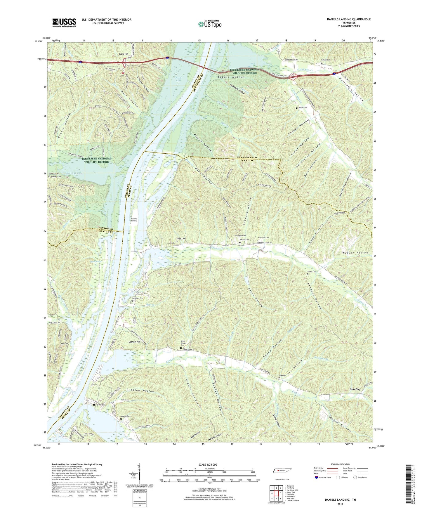
2022 topographic map quadrangle Daniels Landing in the state of Tennessee. Scale: 1:24000. Based on the newly updated USGS 7.5' US Topo map series, this map is in the following counties: Perry, Humphreys, Benton, Decatur. The map contains contour data, water features, and other items you are used to seeing on USGS maps, but also has updated roads and other features. This is the next generation of topographic maps. Printed on high-quality waterproof paper with UV fade-resistant inks.
Quads adjacent to this one:
West: Sugar Tree
Northwest: Rockport
North: Hustburg
Northeast: Hurricane Mills
East: Lobelville
Southeast: Chestnut Grove
South: Pine View
Southwest: Jeannette
This map covers the same area as the classic USGS quad with code o35087g8.
Contains the following named places: Barnett Hollow, Barnett Landing, Batten Road Hollow, Beach Creek, Beat Creek, Beech Hollow, Bell Hollow, Blue Creek Church, Blue Creek School, Blue Sky, Bradley Cemetery, Brevards Landing, Britts Chapel Cemetery, Britts Landing, Burnt Honor Branch, Buzzard Branch, Camp Branch, Chance Hollow, Church Cemetery, Clear Creek, Cotham, Cotham Hill, Crooked Creek, Crooked Creek Boat Dock, Crooked Creek Church, Crooked Creek Marina, Cuba Landing Marina, Daniels Landing, Davidson Cemetery, Deer Creek, Deer Point Campground, Deer Pond, Denson Cemetery, Densons Landing, Dog Creek, Duncan Hollow, Earleys Landing, Fools Branch, Frog Alley, Grassy Hollow, Griggs Cemetery, Hayes Chapel, Hellsneck Hollow, Hensley Hollow, Hog Creek, Hog Creek School, Jack Branch, Lain Cemetery, Ledbetter Landing, Lunn Hollow, McGruder Hollow, McKeel Cemetery, Melton Branch, Morgan Creek, Negro Hollow, Nix Cemetery, Nix Hollow, Nix Landing, North Duncan Branch, North Fork Blue Creek, Northern Cemetery, Oakview School, Odle Hollow, O'Guin Hollow, Opossum Hollow, Patterson Hollow, Peoples Landing, Piedmont Landing, Pigpen Hollow, Pond Gut, Pond Hollow, Ponderosa Dock, Poplar Stump Landing, Rabbit Hollow, Raney Branch, Raney Cemetery, Raney Hollow, Roan Creek, Roane Creek School, Roberts Cemetery, Roberts Creek, Roberts Hollow, Saulpaws Landing, Shannon Branch, Shipps Landing, Smith Cemetery, South 40 Volunteer Fire Department, South Duncan Branch, South Fork Blue Creek, Stinson Hollow, Stout Hollow, Sugar Tree Marina, Toms Creek, Toms Creek Dock, Townsend Cemetery, Walker Hollow, Walkers Landing, Walkers Landing Ferry, Ward Hill, West Britts Landing, West Shipps Landing, White Hollow