MyTopo
Loretto Tennessee US Topo Map
Couldn't load pickup availability
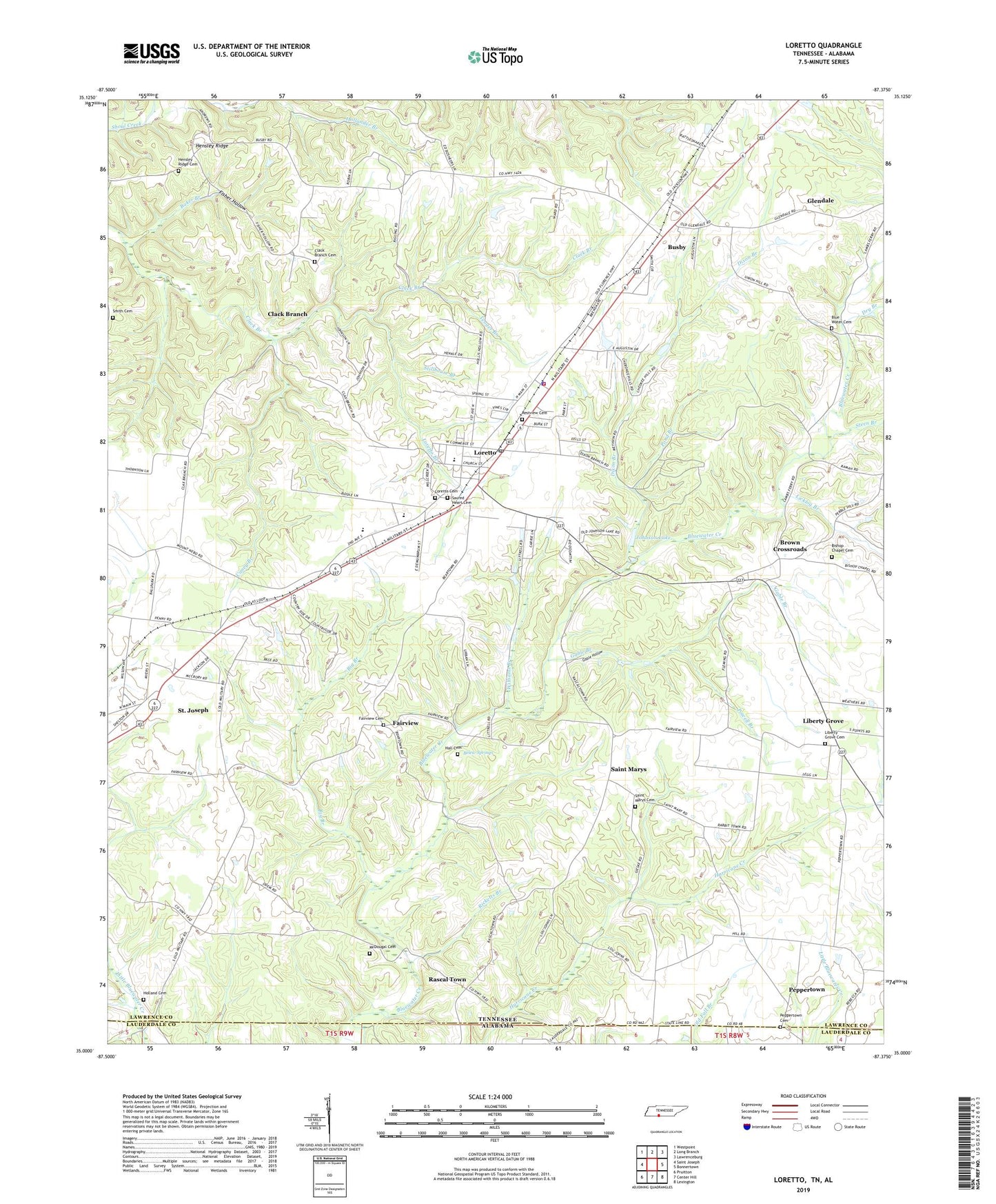
2022 topographic map quadrangle Loretto in the state of Tennessee. Scale: 1:24000. Based on the newly updated USGS 7.5' US Topo map series, this map is in the following counties: Lawrence, Lauderdale. The map contains contour data, water features, and other items you are used to seeing on USGS maps, but also has updated roads and other features. This is the next generation of topographic maps. Printed on high-quality waterproof paper with UV fade-resistant inks.
Quads adjacent to this one:
West: Saint Joseph
Northwest: Westpoint
North: Long Branch
Northeast: Lawrenceburg
East: Bonnertown
Southeast: Lexington
South: Center Hill
Southwest: Pruitton
This map covers the same area as the classic USGS quad with code o35087a4.
Contains the following named places: Baker Branch, Belew Springs, Berendsen School, Big Branch, Bishop Chapel, Bishop Chapel Cemetery, Blue Water Cemetery, Bluewater Church, Brown Crossroads, Burke Park, Busby, Caney Branch, City of Loretto, Clack Branch, Clack Branch Cemetery, Commissioner District 1, Commissioner District 2, Daisy Chapel, Dickson Lake Dam, Dixon Branch, Dry Branch, Fairview, Fairview Cemetery, Fairview First Congregational Methodist Church, Fairview School, First Baptist Church, Fisher Hollow, Gable Branch, Gable Hollow, Glendale, Glendale Church, Glendale School, Hall Cemetery, Hensley Ridge, Hensley Ridge Cemetery, Hensley Ridge School, Hill Poultry Farm, Holland Cemetery, Holland Stand, Johnson Lake, Liberty Grove, Liberty Grove Cemetery, Liberty Grove Church, Liberty Grove School, Licklog Branch, Loretto, Loretto Branch, Loretto Cemetery, Loretto Church of Christ, Loretto City Hall, Loretto Division, Loretto Elementary School, Loretto High School, Loretto Police Department, Loretto Post Office, Loretto United Methodist Church, Loretto Volunteer Fire Department, McDougal Cemetery, Odems Chapel, Old State House, Pebble Hill School, Peppertown, Peppertown Cemetery, Peppertown Church, Peppertown School, Pond Branch, Powell Branch, Rascal Town, Restview Cemetery, Ricketts Branch, Sacred Heart Catholic Church, Sacred Heart Catholic School, Sacred Heart Cemetery, Saint Marys, Saint Marys Catholic Church, Saint Marys Cemetery, Saint Marys School, Smith Cemetery, South Lawrence Elementary School, Steen Branch, Stillhouse Branch, Weathers Hospital, Williams Branch, Yeager Branch, ZIP Codes: 38469, 38481