MyTopo
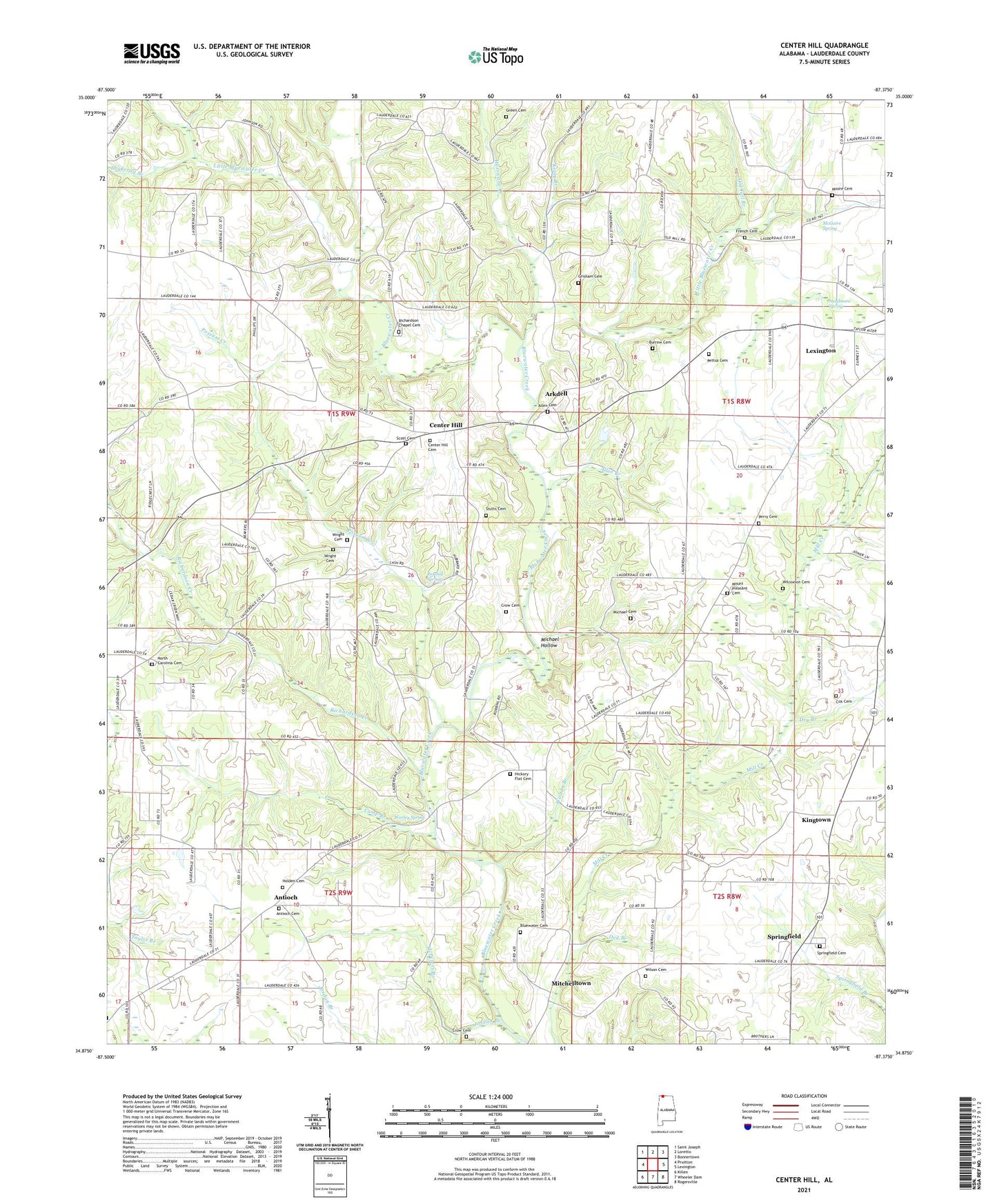
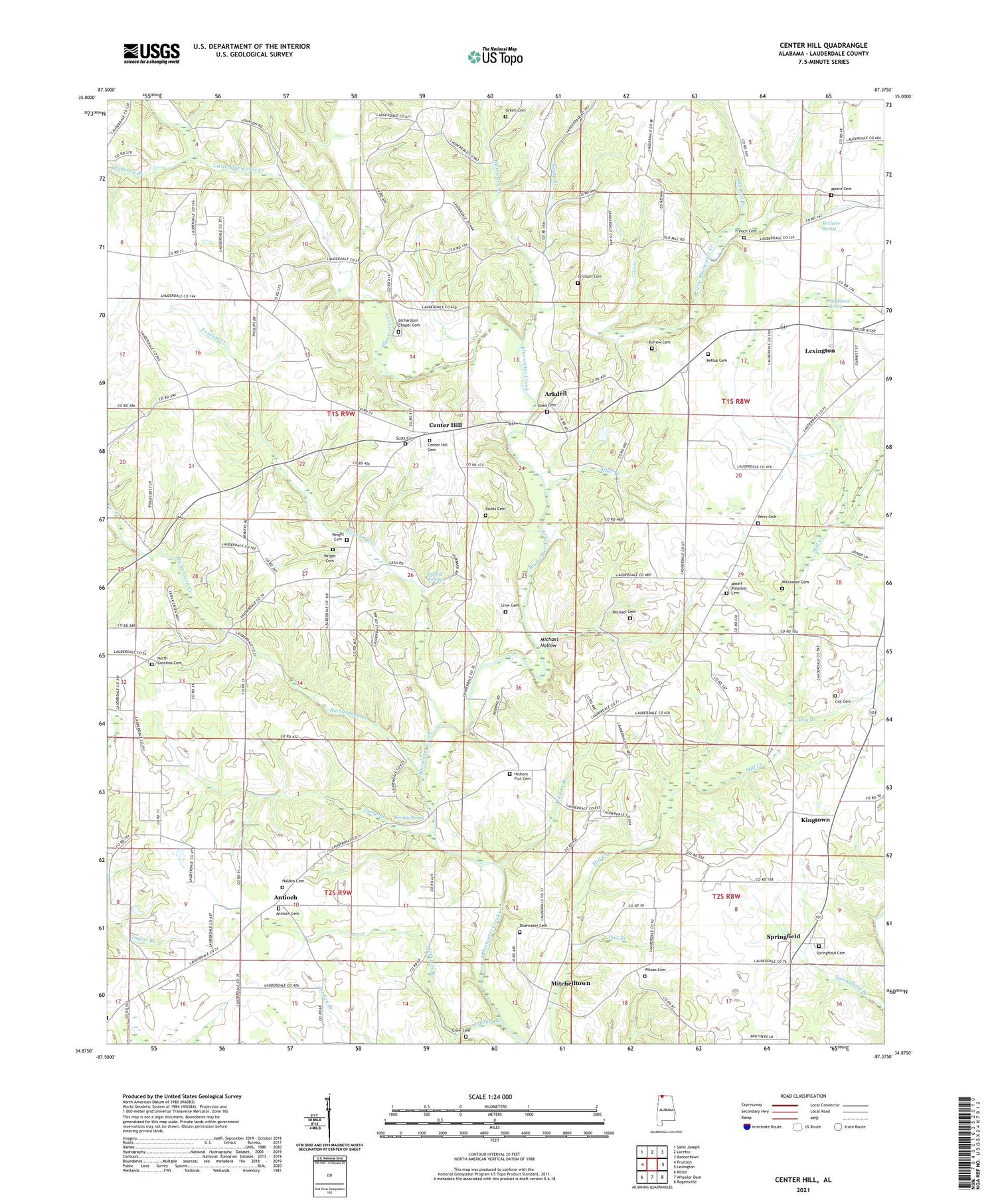
Center Hill Alabama US Topo Map
Couldn't load pickup availability
2024 topographic map quadrangle Center Hill in the state of Alabama. Scale: 1:24000. Based on the newly updated USGS 7.5' US Topo map series, this map is in the following counties: Lauderdale. The map contains contour data, water features, and other items you are used to seeing on USGS maps, but also has updated roads and other features. This is the next generation of topographic maps. Printed on high-quality waterproof paper with UV fade-resistant inks.
Quads adjacent to this one:
West: Pruitton
Northwest: Saint Joseph
North: Loretto
Northeast: Bonnertown
East: Lexington
Southeast: Rogersville
South: Wheeler Dam
Southwest: Killen
This map covers the same area as the classic USGS quad with code o34087h4.
Contains the following named places: Allen Branch, Allen Cemetery, Allen Park, Antioch, Antioch Church of Christ, Antioch School, Arkdell, Arkdell Post Office, Arkdell School, Baileys African Methodist Episcopal Chapel, Belew, Belew Post Office, Bethel African Methodist Episcopal Church, Bluewater Cemetery, Bluewater Primitive Baptist Church, Camp Branch, Center Hill, Center Hill Church, Comer, Comer Post Office, Cox Cemetery, Crow Cemetery, Dog Branch, Dry Branch, Ebenezer Church, Ebenezer School, Green Cemetery, Greens Chapel Methodist Church, Grisham Cemetery, Hickory Flat Freewill Baptist Church, Holden Cemetery, Hurricane Creek, Jordan Branch, Keaty Branch, Kingtown, Lexington Church, Lexington Division, Little Bluewater Creek, Marys Chapel Church of the Nazarene, McGuire Spring, McPeters Branch, Michael Cemetery, Michael Hollow, Mitchelltown, Moore Cemetery, Mount Pleasant Baptist Church, Needmore Spring, New Hope School, North Carolina, North Carolina Church of Christ, North Carolina School, Old Fall Branch, Olive Hill School, Palestine, Palestine School, Perry Cemetery, Pettus Cemetery, Posehill Springs, Posey, Possum Creek, Richardson Chapel, Richardson Chapel Cemetery, Richardson Creek, Salem School, Scott Cemetery, Shakerag Branch, Slabtown, Springfield, Springfield Church, Springfield School, Stutts Cemetery, Sweet Gum, Sweet Gum Flat Primitive Baptist Church, Sweet Gum School, Taylor Branch, Walton Branch, Williams School, Wilson Cemetery, Worley Spring, Wright Cemetery, ZIP Code: 35648