MyTopo
Ovilla Tennessee US Topo Map
Couldn't load pickup availability
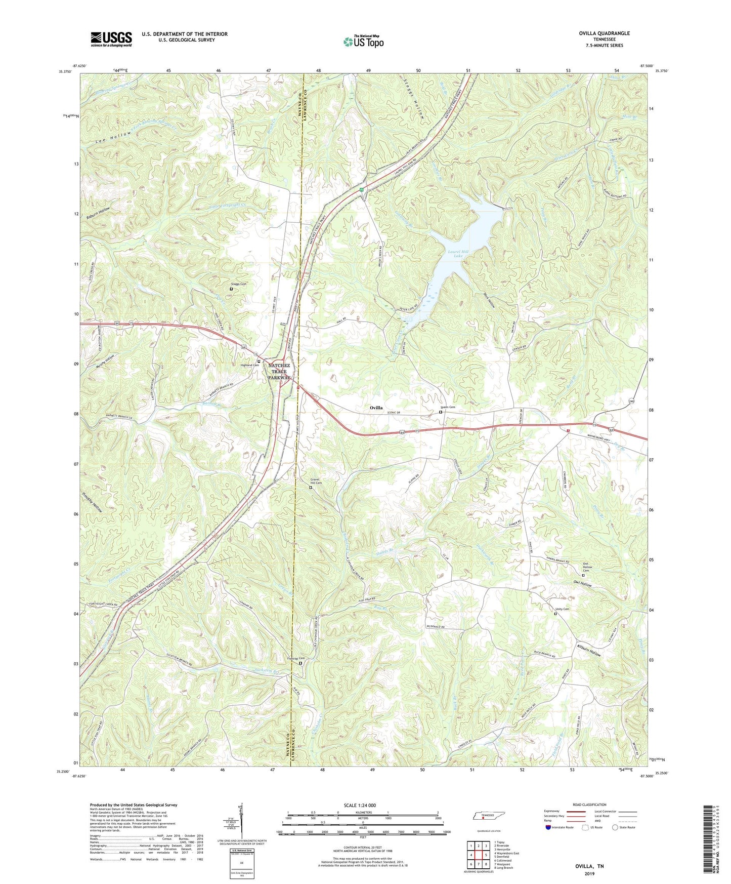
2019 topographic map quadrangle Ovilla in the state of Tennessee. Scale: 1:24000. Based on the newly updated USGS 7.5' US Topo map series, this map is in the following counties: Lawrence, Wayne. The map contains contour data, water features, and other items you are used to seeing on USGS maps, but also has updated roads and other features. This is the next generation of topographic maps. Printed on high-quality waterproof paper with UV fade-resistant inks.
Quads adjacent to this one:
West: Waynesboro East
Northwest: Topsy
North: Riverside
Northeast: Henryville
East: Deerfield
Southeast: Long Branch
South: Westpoint
Southwest: Collinwood
Contains the following named places: Bird, Buck Branch, Canaan Freewill Baptist Church, Commissioner District 13, County Line Church, County Line School, Dock Hollow, Dog Creek, Dogwood Mudhole, Duckworth Branch, Field Pond Branch, Fishtrap Cemetery, Fishtrap School, Galloway Branch, Gower, Gravel Hill Cemetery, Grews Branch, Ham Branch, Highland, Highland Cemetery, Highland Methodist Church, Highland School, Laurel Hill Lake, Laurel Hill Lake Dam, Laurel Hill Wildlife Management Area, Mine Branch, New Haven, New Haven Church, Ovilla, Ovilla Lookout Tower, Ovilla Volunteer Fire Department, Owl Hollow, Owl Hollow Cemetery, Peter Cave Creek, Piney School, Poag Branch, Ray Branch, Reed Branch, Short Branch, Spann Cemetery, Staggs Branch, Staggs Cemetery, Suckstem Branch, Taylor Branch, Unity Cemetery, Unity Church of God, Voorhies Branch, Weaver Branch, West End Volunteer Fire Department