MyTopo
Topsy Tennessee US Topo Map
Couldn't load pickup availability
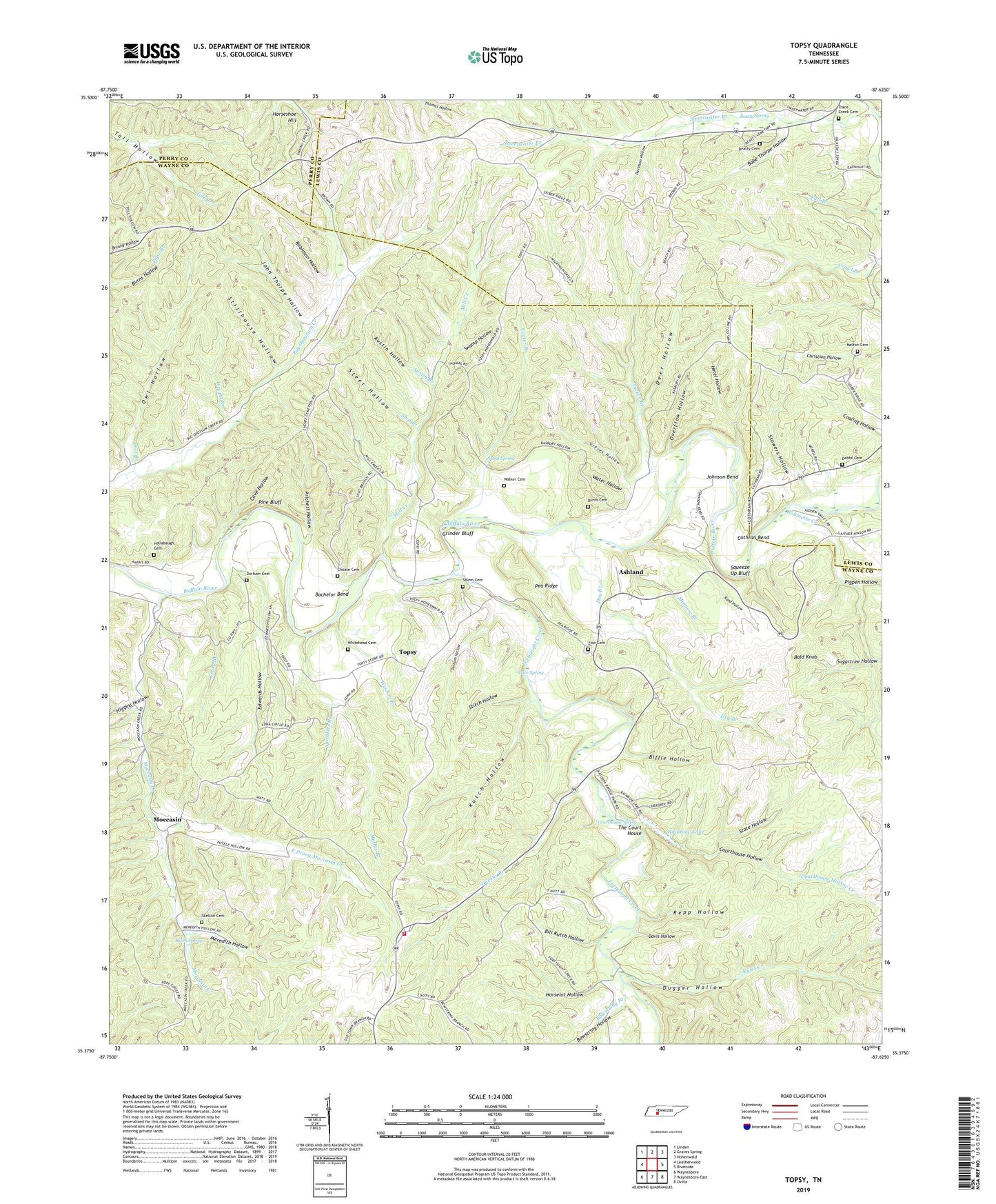
2022 topographic map quadrangle Topsy in the state of Tennessee. Scale: 1:24000. Based on the newly updated USGS 7.5' US Topo map series, this map is in the following counties: Wayne, Lewis, Perry. The map contains contour data, water features, and other items you are used to seeing on USGS maps, but also has updated roads and other features. This is the next generation of topographic maps. Printed on high-quality waterproof paper with UV fade-resistant inks.
Quads adjacent to this one:
West: Leatherwood
Northwest: Linden
North: Graves Spring
Northeast: Hohenwald
East: Riverside
Southeast: Ovilla
South: Waynesboro East
Southwest: Waynesboro
This map covers the same area as the classic USGS quad with code o35087d6.
Contains the following named places: Ashland, Ashland Ford, Austin Branch, Austin Hollow, Babe Thorpe Hollow, Bachelor Bend, Bald Knob, Bates School, Beatty Cemetery, Beatty Spring, Beech Spring, Biffle Hollow, Bill Kutch Hollow, Bowstring Branch, Bowstring Hollow, Buffalo River Volunteer Fire Department, Burns Cemetery, Carey Ford, Carter Branch, Cave Hollow, Cave Spring, Chapel School, Choate Cemetery, Churchwell Spring Branch, Commissioner District 4, Cothran Bend, Courthouse Hollow, Courthouse Hollow Creek, Courthouse Spring, Dabbs Cemetery, Davidson Hollow, Davis Hollow, Deer Hollow, Dry Branch, Dugger Hollow, Dugger Hollow Prospects, Durham Cemetery, Durham Hollow, East Prong Moccasin Creek, Edwards Hollow, Fall Branch, Fortyeight Creek, Graves Hollow, Grinder Bluff, Haley Chapel, Higgins Hollow, Hollabaugh Cemetery, Horselot Hollow, Horseshoe Hill, Hotel Hollow, John Thorpe Hollow, Johnson Bend, Keazy Branch, Kelly Ford, Kellys Chapel Church, Kutch Hollow, Kyles Creek, Matheny Camp, Mathis Branch, Melton Cemetery, Meredith Ford, Meredith Hollow, Mill Creek, Minnow Branch, Moccasin, Moccasin Creek, Morrow Valley School, Natural Bridge, Overflow Hollow, Owl Branch, Owl Hollow, Pea Ridge, Phillips Church, Pigpen Hollow, Pine Bluff, Prichett Hollow, Queens Branch, Rainbow Lake, Rand Hollow, Rasbury School, Repp Hollow, Robinette Creek, Robinson Hollow, Salem Cemetery, Salem Church, Seiber Chapel, Shot Branch, Skelton Cemetery, Slickrock Ford, Spout Spring, Sprinkles Branch, Squeeze Up Bluff, State Hollow, Steer Hollow, Stillhouse Hollow, Stitch Hollow, Stockard Ford, Stowers Hollow, Sugartree Hollow, Swamp Hollow, Sweetwater, Sweetwater Branch, Sweetwater School, The Court House, Topsey School, Topsy, Trace Creek Cemetery, Tucker Branch, Walker Cemetery, Walker School, Water Hollow, Whitehead Cemetery, Wisdom Branch, Wright Branch, Zion Cemetery