MyTopo
Pillowville Tennessee US Topo Map
Couldn't load pickup availability
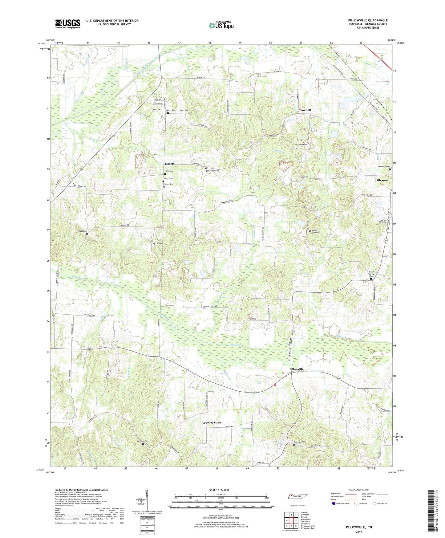
2022 topographic map quadrangle Pillowville in the state of Tennessee. Scale: 1:24000. Based on the newly updated USGS 7.5' US Topo map series, this map is in the following counties: Weakley. The map contains contour data, water features, and other items you are used to seeing on USGS maps, but also has updated roads and other features. This is the next generation of topographic maps. Printed on high-quality waterproof paper with UV fade-resistant inks.
Quads adjacent to this one:
West: Greenfield
Northwest: Martin
North: Dresden
Northeast: Como
East: McKenzie
Southeast: Trezevant East
South: Trezevant West
Southwest: Bradford
This map covers the same area as the classic USGS quad with code o36088b6.
Contains the following named places: Beech Springs Cemetery, Beech Springs Church, Cane Creek, Center Point School, Coats School, Cotton Creek, Cox Cemetery, Crowley Store, Dunlap School, Edmonston Cemetery, Garner Branch, Gearins Chapel, Gleason Clay Pit Number 3, Higgs Cemetery, Hopewell Cemetery, Liberty, Liberty Apostolic Pentecostsal Church, Liberty Baptist Church, Liberty Cemetery, Liberty Methodist Church, Manus Creek, Meridian Cemetery, Meridian Church, Meridian School, Mount Olive Church, Mount Olive School, Mount Zion Cemetery, Mount Zion Church, Nailing Branch, Parks Cemetery, Parks School, Pence Branch, Pillowville, Pillowville Volunteer Fire Department, Sandhill, Sandhill Cemetery, Sandhill Church, Seminary Cemetery, Seminary Church, Simms Cemetery, Smith Chapel School, Spears School, Todd Branch, Wards Chapel School