MyTopo
Martin Tennessee US Topo Map
Couldn't load pickup availability
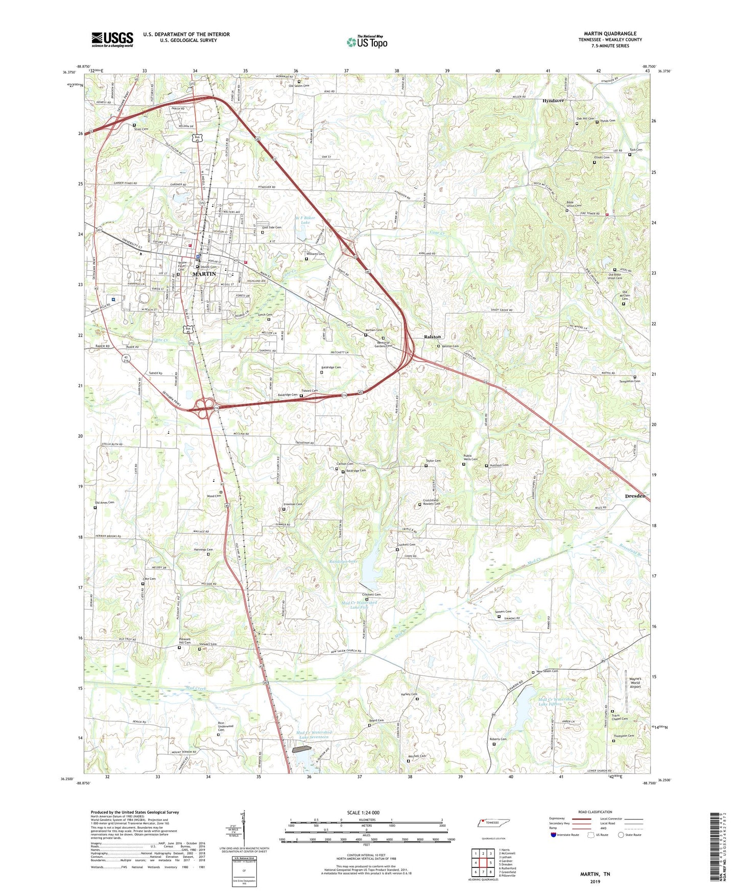
2022 topographic map quadrangle Martin in the state of Tennessee. Scale: 1:24000. Based on the newly updated USGS 7.5' US Topo map series, this map is in the following counties: Weakley. The map contains contour data, water features, and other items you are used to seeing on USGS maps, but also has updated roads and other features. This is the next generation of topographic maps. Printed on high-quality waterproof paper with UV fade-resistant inks.
Quads adjacent to this one:
West: Gardner
Northwest: Harris
North: McConnell
Northeast: Latham
East: Dresden
Southeast: Pillowville
South: Greenfield
Southwest: Rutherford
This map covers the same area as the classic USGS quad with code o36088c7.
Contains the following named places: Adams Chapel, Adams Chapel School, Andy Holt Humanities Building, Atrium Residence Hall, Austin Peay Residence Hall, Baldridge Cemetery, Beard Cemetery, Bethany Church, Bible Union Cemetery, Bible Union Church, Brassfield Branch, Brehm Hall, Browning Hall, Buford Ellington Residence Hall, C E Weldon Library, Carlton Cemetery, Cate Cemetery, Cecil M and Boyce Gooch Hall, Central Baptist Church, Chestnut Branch, City of Martin, Commissioner District 5, Commissioner District 6, Cooper Hall, Crockett Cemetery, Crutchfield-Rowlett Cemetery, Dibrell Cemetery, East Side Cemetery, Eastside Baptist Church, Elliott Cemetery, Frank Clement Residence Hall, Freeman Cemetery, Freemans Chapel, G-H Residence Hall, Hall-Moody Administration Building, Hannings Cemetery, Harkey Cemetery, Harmon Field, HealthSouth Cane Creek Rehabilitation Hospital, Hutchins Cemetery, Hynds Cemetery, Hyndsver, Hyndsver Post Office, Hyndsver School, Jim McCord Residence Hall, Kilgore School, Lynch Cemetery, Martin, Martin Church of Christ, Martin City Hall, Martin Division, Martin Elementary School, Martin Fire Department Station 1, Martin Fire Department Station 2, Martin Industrial Park, Martin Junior High School, Martin Memorial Gardens, Martin Police Department, Martin Post Office, Martin Primary School, McFerrin College, Miles Chapel Christian Methodist Episcopal Church, Mitchell Cemetery, Mud Creek Watershed Dam Fifteen, Mud Creek Watershed Dam Five, Mud Creek Watershed Dam Number Seventeen, Mud Creek Watershed Lake Fifteen, Mud Creek Watershed Lake Five, Mud Creek Watershed Lake Number Seventeen, New Salem Cemetery, New Salem Church, Northwest Tennessee Mental Health Center, Oak Grove Church, Oak Hill Cemetery, Oak Hill Church, Old Ames Cemetery, Old Bible Union Cemetery, Old McClain Cemetery, Old Salem Cemetery, Old Salem Church, Pacer Stadium, Parham Cemetery, Paul Meek Library, Pleasant Hill Cemetery, Pleasant Hill Church, Public Wells Cemetery, Public Wells Church, Ralston, Ralston Cemetery, Ralston School, Randolph Dam, Randolph Lake, Rice-Underwood Cemetery, Roberts Cemetery, Rotary Field, Salem School, Scott Family Cemetery, Shady Grove Church, Somers Cemetery, Stewart Cemetery, Taylor Cemetery, Templeton Cemetery, Tennessee Department of Agriculture Division of Forestry Weakley County, Thompson Cemetery, Tidwell Cemetery, Travis Chapel, Travis Chapel Cemetery, Tuck Cemetery, Union High School, University Center, University of Tennessee, Vincent Grove School, Virginia Weldon Park, Volunteer Martin Hospital, W F Baker Lake, W F Baker Lake Dam, Wayne's World Airport, WCMT-AM (Martin), WCMT-FM (Martin), Weakley County Farm, Weakley County Training School, Westview High School, Williams Cemetery, Wood Cemetery, WUTM-FM (Martin), Yellow Fever Cemetery, ZIP Code: 38237


