MyTopo
Trezevant East Tennessee US Topo Map
Couldn't load pickup availability
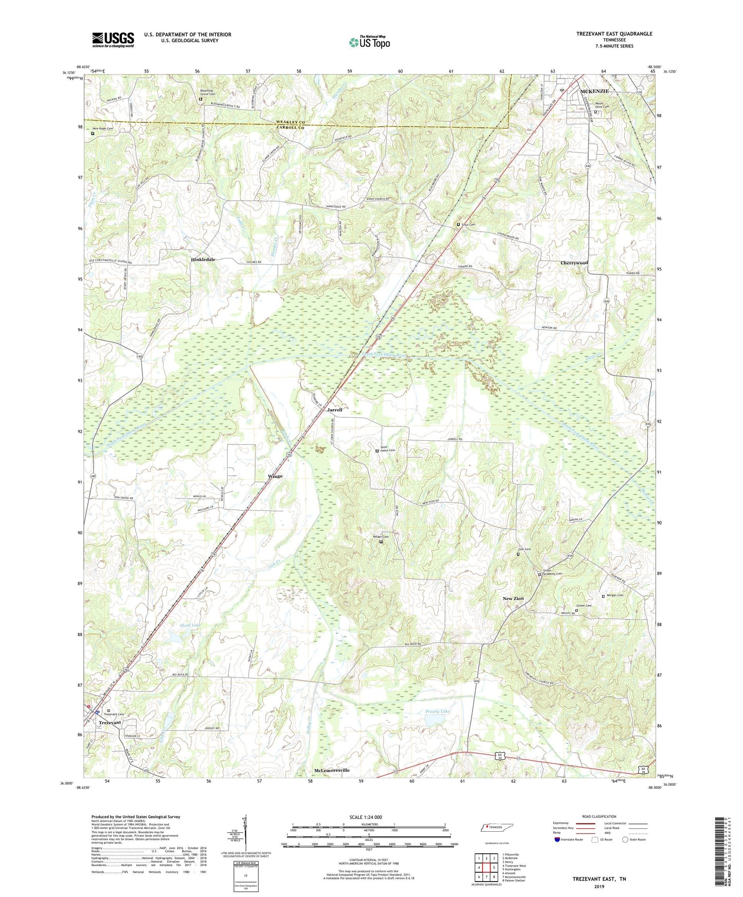
2022 topographic map quadrangle Trezevant East in the state of Tennessee. Scale: 1:24000. Based on the newly updated USGS 7.5' US Topo map series, this map is in the following counties: Carroll, Weakley. The map contains contour data, water features, and other items you are used to seeing on USGS maps, but also has updated roads and other features. This is the next generation of topographic maps. Printed on high-quality waterproof paper with UV fade-resistant inks.
Quads adjacent to this one:
West: Trezevant West
Northwest: Pillowville
North: McKenzie
Northeast: Henry
East: Huntingdon
Southeast: Palmer Shelter
South: McLemoresville
Southwest: Atwood
This map covers the same area as the classic USGS quad with code o36088a5.
Contains the following named places: Beaver Creek, Blooming Grove, Blooming Grove Cemetery, Blooming Grove Church, Bowden Church, Bowden School, Carroll County Rural Fire Department District 16 Trezevant, Cherrywood, Cherrywood Community Center, Clear Creek, Commissioner District 2, Commissioner District 8, Concord Baptist Church, Crooked Creek, District 19, District 22, Elender Creek, Enon, Enon Baptist Church, Enon Cemetery, Green Cemetery, Halley Creek, Hinkledale, Jarrell, Liberty Hill Baptist Church, Lick Creek, McKenzie Post Office, Morgan Cemetery, Mount Olivet Cemetery, New Bethel Church, New Hope Cemetery, New Hope Church, New Zion, Presely Lake, Presley Dam, Reedy Creek, Saint Johns Cemetery, Saint Johns Church, Shoof Lake, Shoof Lake Dam, Spring Hill Church, Todd Creek, Town of Trezevant, Trezevant, Trezevant Cemetery, Trezevant First Baptist Church, Trezevant High School, Trezevant Police Department, Trezevant Post Office, Turner Academy, Union Academy, Union Academy Baptist Church, Union Academy Cemetery, White Creek, Wilder Cemetery, Wingo, Wingo Church, Zion Church, Zion Church Cemetery, ZIP Codes: 38201, 38258